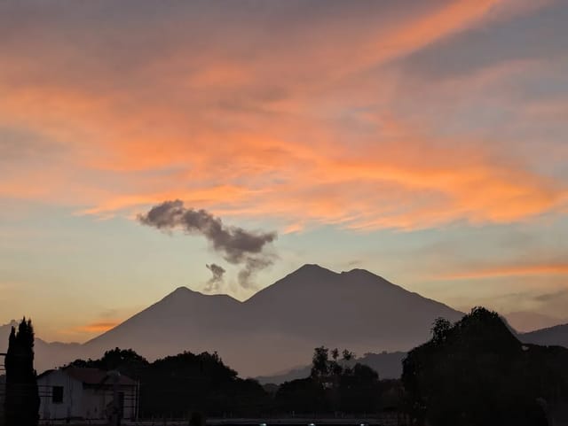
Guatemala burns between January and May, and almost all of it is people: agricultural burning that gets away, a cleared slope, a campfire. Four NASA satellites pass overhead every day and flag the hot pixels. This page reads those flags, clips them to Guatemala, and subtracts the two volcanoes that would otherwise dominate the count.
Detections in the last 24 hours, by department
24 wildfire detections across 8 departamentos in the last 24 hours, plus 18 volcanic thermal detections held out. Acquisitions dated 2026-09-19, 2026-09-20.
| Departamento | Detections (24 h) | Share | Hottest pixel (MW) |
|---|---|---|---|
| Petén | 9 | 12.84 | |
| El Progreso | 3 | 9.31 | |
| Jutiapa | 3 | 15.94 | |
| Santa Rosa | 2 | 7.82 | |
| Escuintla | 2 | 0.88 | |
| Chiquimula | 2 | 7.14 | |
| Quiché | 2 | 4.52 | |
| Zacapa | 1 | 2.44 |
A detection is the centre of a satellite pixel flagged as containing one or more fires or other thermal anomalies — not a fire count, not an area burned, and not an address. Fire radiative power (MW) is how brightly the pixel burned, which tracks intensity rather than size. We acknowledge the use of data and/or imagery from NASA's Fire Information for Resource Management System (FIRMS) (https://earthdata.nasa.gov/firms), part of NASA's Land, Atmosphere Near real-time Capability for Earth observations (LANCE) (https://earthdata.nasa.gov/lance) and NASA's Earth Science Data and Information System (ESDIS). Feed built 2026-09-20T17:01:08.815611Z.
The volcanoes in the fire data
This is the correction that matters most in Guatemala and that almost nobody applies. NASA’s own definition of a detection is the giveaway:
Each hotspot/active fire detection represents the center of a pixel flagged as containing one or more fires or other thermal anomalies (such as volcanoes). For MODIS the pixel is approximately 1 km and for VIIRS the pixel is approximately 375 m. The “location” is the center point of the pixel (not necessarily the coordinates of the actual fire). The actual pixel size varies with the scan and track
Fuego and Santiaguito are permanently hot. They light up the fire product every single day, season or no season:
| Volcano | Thermal detections held out |
|---|---|
| Fuego | 7 |
| Santiaguito | 11 |
18 of 42 detections over Guatemala in this window were within 6 km of an active volcano. They are subtracted from every wildfire figure on this page. Eruption status lives on the volcano pages, not here.
So a raw FIRMS map of Guatemala overstates wildfire activity by whatever the volcanoes are doing that day. Every wildfire figure on this page has that subtraction applied; eruption status itself belongs on the volcano pages and the ash advisories, not here.
How to read a detection honestly
One fire can raise several detections. NASA again:
Sometimes you will see several active fires in a line. This generally represents a fire front.
Three satellites passing at three different times over one burning hillside produce three rows. That is why the table’s column heading says detections, not fires, and why this page never converts a detection count into a fire count.
A detection is not an address.
We are not able to determine the exact location or size of the fire; what we do know is that at least one fire is located within the flagged pixel.
The point given is the pixel centre, and the fire is often smaller than the pixel, so no detection here is attached to a named farm, community or person.
The confidence field is weaker than it looks. NASA’s own caution:
The confidence field should be used with caution as it is likely that it will vary in terms of meaning in different parts of the world.
And a satellite is going away. NASA’s standing notice, as of 20 September 2026:
Delivery of Suomi National Polar-orbiting Partnership (Suomi NPP) satellite data products will cease on November 1, 2026. Data users should transition now to alternative products from NOAA-21 and NOAA-20.
One of the four feeds below disappears on that date. The count will step down slightly when it does, and that will be an instrument change, not a change on the ground.
The four satellite files read on each build
| Satellite product | Pixel size | Read this build | Detections in Guatemala |
|---|---|---|---|
| MODIS C6.1 (Terra/Aqua) | 1000 m | yes | 1 |
| VIIRS C2 (Suomi NPP) | 375 m | yes | 14 |
| VIIRS C2 (NOAA-20) | 375 m | yes | 14 |
| VIIRS C2 (NOAA-21) | 375 m | yes | 13 |
Each satellite passes at its own time, so the same fire can appear in more than one row. The counts are detections, not fires.
Fire radiative power, the MW column in the department table, is how brightly a pixel burned. It tracks intensity, not area — a small, very hot fire outranks a large smouldering one.
Guatemala’s own agencies use the same sensors
INSIVUMEH publishes a Guatemala hotspot map built from the identical instruments, describing it as a 24-hour heat-point map from VIIRS: NOAA-20, SUOMI, MODIS, with data courtesy of VIIRS and MODIS, plus a GOES-19 fire-temperature composite. Its output is a PNG, which is why this page reads the underlying files instead.
CONRED works from a different one — INAB’s GIS — and its wording is the careful version:
Para el monitoreo de estas emergencias, se cuenta con el apoyo del Sistema de Información Geográfica del INAB, que permite identificar puntos de calor asociados a posibles incendios, facilitando la coordinación de acciones en campo para el control y liquidación de los siniestros de manera oportuna.
Heat points associated with possible fires. That is the Guatemalan state describing the same limitation NASA describes, in one phrase.
The season, in CONRED’s own counts
Satellites tell you where. CONRED tells you how much, and only CONRED publishes hectares.
| CONRED bulletin | Date | Fires reported | Hectares reported |
|---|---|---|---|
| Boletín Informativo 107-2026 | 21 April 2026 | more than 1,040 | 13,237 |
| Nota de Prensa 108-2026 | 4 May 2026 | more than 1,280 | more than 19,650 |
| Nota de Prensa 240-2026 | 18 August 2026 | more than 1,800 | see note |
| — | full year 2025 | more than 1,700 | more than 40,000 |
On 21 April, CONRED also gave the live picture and the worst-hit department:
Al 21 de abril, se desarrollan acciones de supresión en los departamentos de Guatemala (2), Jutiapa (1), Petén (8) y Quiché (3), labores que son ejecutadas de manera articulada por las instituciones que integran el Sistema CONRED.
Durante la presente temporada, se han superado los 1,040 incendios controlados y liquidados a nivel nacional, registrando un total de 13,237 hectáreas afectadas. El departamento de Jutiapa continúa siendo el más impactado, con 1,821 hectáreas consumidas.
The note on the August figure. CONRED’s 18 August bulletin reads, verbatim: en este año 2026, se han liquidado más de 1,800 incendios a nivel nacional, con una afectación superior a 36,00 hectáreas. The hectare figure has a misplaced comma in CONRED’s own text. It could be 36,000 or 3,600 — 36,000 would be consistent with a season that had already passed 19,650 by early May, but consistency is not a source. We are leaving it as published and using the fire count from that bulletin instead of the area.
Who puts them out, and what the law says
CONRED names the whole chain in its 18 August 2026 bulletin — its own immediate-response brigades alongside Bomberos Voluntarios, Bomberos Municipales, ASONBOMD, INAB, CONAP, community development councils and municipalities — and gives its own head count:
Actualmente, la SE-CONRED cuenta con más de 450 brigadistas distribuidos estratégicamente en el territorio nacional.
Locally, municipalities can stand up a seasonal commission. INSIVUMEH’s northern regional office recorded one being activated in Petén in May 2026:
El personal de la Sede Regional del Norte del Instituto Nacional de Sismología, Vulcanología, Meteorología e Hidrología participó el pasado 19 de mayo de 2026 en la reunión convocada por la Municipalidad de San Andrés, Petén, con el propósito de activar la Alerta de la Comisión Municipal de Incendios Forestales.
The penalties
CONRED’s summary of Article 93 of the Ley Forestal, Decreto 101-96:
El Artículo 93 de la Ley Forestal, Decreto 101-96, establece prisión de 2 a 10 años y multa equivalente al valor del avalúo realizado por el Instituto Nacional de Bosques (INAB). En caso de reincidencia, la prisión aumenta de 4 a 12 años. Si el incendio ocurre en un área protegida, la pena es de 4 a 12 años, con reincidencia de 6 a 15 años, además de la multa correspondiente al avalúo del Consejo Nacional de Áreas Protegidas (CONAP). La ley establece que cada incendio debe ser investigado para determinar su origen y establecer responsabilidades.
That is CONRED’s restatement of the article, published on 18 August 2026 — not the statute’s own text. If you need the wording itself, read Decreto 101-96 directly.
Practical version, in CONRED’s words:
La mayoría de estos siniestros tiene relación con actividades humanas, por lo que la responsabilidad ciudadana es fundamental. Se recomienda evitar quemas o rozas, especialmente en áreas con pendiente; no dejar fogatas encendidas; no arrojar colillas ni materiales inflamables en zonas boscosas; y reportar inmediatamente cualquier incendio al 119 el número de emergencia nacional. No se debe intentar combatir un incendio sin capacitación ni equipo adecuado.
Reporting one, CONRED asks for the exact location:
La Secretaría Ejecutiva de la CONRED recomienda a la población no intentar combatir incendios si no cuenta con el equipo o la capacitación adecuada, y reportar de inmediato cualquier incidente al 119, indicando la ubicación exacta.
Regionally, Guatemala, El Salvador and Honduras are working to a shared framework — the Estrategia Regional para Manejo de los Incendios Forestales 2025–2030, socialised through CEPREDENAC and FAO in August 2026, on the stated grounds that:
Centroamérica y República Dominicana enfrentan temporadas de incendios cada vez más intensas, complejas y prolongadas, debido, entre otros factores, a los efectos del cambio climático, la presión sobre los recursos naturales y las condiciones de vulnerabilidad territorial.
What this page will not tell you
- How much burned. Detections are not hectares. Only CONRED publishes area, and only in dated bulletins.
- Whose land it is, or who lit it. A pixel centre is not an address, and CONRED goes no further than saying most fires relate to human activity.
- What the smoke is doing to you. That is air quality, which carries the EPA and WHO bands and the rain-removes-particulates mechanism. Hotspots lead the air by a day; the air-quality page is where the health answer lives.
- Whether a volcano is erupting. Volcanoes and volcanic ash. This page only subtracts them.
- Whether an alert has been declared. Emergency alerts and weather alerts.
The dry, clear, windy air that carries a fire season is the same air that drops highland temperatures overnight — see frost alerts. Petén, which usually leads the detection count, has its own page: Petén, as does the department CONRED named worst-hit in 2026, Jutiapa.
How this page is built and when it updates
- Source: NASA FIRMS Central America 24-hour active-fire CSV exports — MODIS C6.1 (Terra/Aqua, 1 km) and VIIRS C2 on Suomi NPP, NOAA-20 and NOAA-21 (375 m). Public, and no API key is required for these regional files.
- Guatemala clipping is geometric, not a bounding box. Every detection is tested point-in-polygon against GADM department boundaries, so nothing from Chiapas, Belize or Honduras can leak into a Guatemalan count, and each row gets its departamento from the polygon it falls in.
- Volcano hold-out: any detection within 6 km of Fuego, Santiaguito or Pacaya is removed from the wildfire counts and reported separately, using the same summit coordinates this site already uses for its ash tracker.
- Detections only. No hectares are ever derived from satellite data; hectares are quoted from CONRED with their bulletin number and date.
- A failed fetch never overwrites good data. If all four files fail, the previous reading is kept whole and the table shows a stale badge — a zeroed fire feed in March would be the worst possible failure mode.
- Cadence: re-read on each daily data run. FIRMS publishes globally within three hours of the satellite pass.
- Attribution. We acknowledge the use of data and/or imagery from NASA’s Fire Information for Resource Management System (FIRMS), part of NASA’s Land, Atmosphere Near real-time Capability for Earth observations (LANCE) and NASA’s Earth Science Data and Information System (ESDIS). FIRMS data are provided as-is; users bear responsibility for their use.
- Sources and captures for every quotation on this page:
content/research/wildfire-hotspots-2026-09-20.md.
Frequently Asked Questions
Where can I see fires burning in Guatemala right now?
NASA FIRMS publishes active-fire detections globally within three hours of the satellite pass, and its Central America 24-hour CSV exports are public and need no API key. This page reads four of them — MODIS on Terra and Aqua at 1 km, and VIIRS on Suomi NPP, NOAA-20 and NOAA-21 at 375 m — clips them to Guatemala’s department boundaries and groups them by departamento. Guatemala’s own weather service publishes a hotspot map from exactly the same sensors, but as an image rather than as data.
Does a hotspot mean there is a fire there?
Not exactly, and NASA is explicit about it. Each detection represents the centre of a pixel flagged as containing one or more fires or other thermal anomalies such as volcanoes, and the location is the centre point of the pixel, not necessarily the coordinates of the actual fire. The pixel is about 1 km for MODIS and about 375 m for VIIRS, and the fire is often smaller than the pixel. CONRED’s own wording is equally careful — it calls them heat points associated with possible fires.
Why are Fuego and Santiaguito showing up in fire data?
Because a lava flow is a thermal anomaly, and the satellites cannot tell it from a burning hillside. In the 24-hour window read on 20 September 2026, 18 of the 42 detections inside Guatemala — 43% — sat within 6 km of Fuego or Santiaguito. This page holds those out of every wildfire figure and reports them separately, which is why its count is lower than a raw FIRMS map of the same window. Anyone reading FIRMS over Guatemala without that filter is counting volcanoes as wildfires.
How many fires did Guatemala have in 2026?
CONRED’s dated figures are the only ground-truth counts. On 21 April 2026 it reported more than 1,040 fires controlled and extinguished nationally and 13,237 hectares affected, with Jutiapa worst hit at 1,821 hectares. On 4 May it reported more than 1,280 and over 19,650 hectares. On 18 August it reported more than 1,800 fires nationally, against more than 1,700 fires and more than 40,000 hectares in 2025. The hectare figure in that August bulletin is printed as ‘36,00 hectáreas’, which is a typo in CONRED’s own text and which we are not going to silently repair into either 3,600 or 36,000.
When is Guatemala's wildfire season?
The dry months. CONRED reported the 2026 season beginning on 1 January, and the figures above show it running hard through April and May. By September detections drop to a handful a day. The season is why this page will look almost empty in October and crowded in March — a low count here in September is a real reading, not a broken feed.
Who fights forest fires in Guatemala?
CONRED coordinates, and it names its partners: its own Brigadas de Respuesta Inmediata — more than 450 brigadistas nationally as of August 2026 — alongside Bomberos Voluntarios, Bomberos Municipales, the departmental municipal fire service association ASONBOMD, the national forest institute INAB, the protected-areas council CONAP, community development councils and municipalities. Some municipalities also stand up a Comisión Municipal de Incendios Forestales for the season. The number to report a fire is 119.
What is the penalty for starting a forest fire in Guatemala?
Serious, and CONRED publishes the summary. In its bulletin of 18 August 2026 it states that Article 93 of the Ley Forestal, Decreto 101-96, sets two to ten years in prison plus a fine equal to the valuation carried out by INAB; on a repeat offence the prison term rises to four to twelve years; inside a protected area the penalty is four to twelve years, rising to six to fifteen on a repeat offence, with the fine set by CONAP’s valuation instead. CONRED adds that the law requires every fire to be investigated to establish its origin and responsibility. That is CONRED’s summary of the article, not the statute’s own wording.
Does a hotspot count predict bad air?
It leads it, because the smoke arrives after the detection does. Our air-quality page covers the health side, the EPA and WHO bands, and the fact that INSIVUMEH names precipitation as the main removal process for PM10 — which is why air degrades through exactly the dry months that carry the fires. Use this page for where the smoke is coming from and the air-quality page for what it is doing.