Lake Izabal is Guatemala’s largest lake: INSIVUMEH, the national seismology, volcanology, meteorology and hydrology institute, lists it at 589.6 km², more than four times the 130.1 km² it gives Lake Atitlán. Petén Itzá comes third at 99.0 km², and INE’s 2014 Compendio Estadístico Ambiental confirms that order, calling Petén Itzá the third largest natural lake after Izabal and Atitlán. Atitlán is far deeper: INE gives it a mean depth of 203.9 m, and the lake authority AMSCLAE reports soundings past 350 m.
In short: By area: Izabal 589.6 km², Atitlán 130.1 km² (125.4 km² in INE’s 2014 figures), Petén Itzá 99 km², El Golfete 62 km², Amatitlán 15.2 km² (14.86 km² in INE). By depth, Atitlán leads (203.9 m mean), and Petén Itzá’s maximum is 160 m. Izabal sits 0.9 m above sea level, Atitlán about 1,560 m. Güija is shared with El Salvador and left out of INSIVUMEH’s table.
The lakes ranked by surface area
INSIVUMEH (Instituto Nacional de Sismología, Vulcanología, Meteorología e Hidrología) published a table of the country’s most important lakes on its hydrology pages. INSIVUMEH no longer serves that page at its old address (checked 13 November 2026); the figures below are from the copy kept by the Internet Archive, dated 11 December 2008. The INE column is from the 2014 edition of its environmental compendium.
| Rank | Lake | Area, INSIVUMEH (km²) | Area, INE 2014 (km²) | Elevation (m above sea level) | Depth published |
|---|---|---|---|---|---|
| 1 | Izabal | 589.6 | not printed | 0.9 (INSIVUMEH) | not published by either source |
| 2 | Atitlán | 130.1 | 125.4 (water surface) | 1,562.0 (INSIVUMEH); 1,560 (AMSCLAE) | 203.9 m mean (INE); soundings past 350 m (AMSCLAE) |
| 3 | Petén Itzá | 99.0 | 99 | 110 (both) | 160 m maximum (INE) |
| 4 | El Golfete | 62.0 | not printed | 0.0 (INSIVUMEH) | not published by either source |
| 5 | Amatitlán | 15.2 | 14.86 | 1,186 (INSIVUMEH) | not published by either source |
The ranks follow INSIVUMEH’s areas. INE does not print an area for Izabal in its lake passages, but its Petén Itzá entry puts Izabal first and Atitlán second, so the two publications agree on the top three. INSIVUMEH leaves out smaller lakes such as El Pino and Calderas, and the border lake Güija.
Lake Izabal: the largest, and almost at sea level
INSIVUMEH lists Izabal at 589.6 km² and 0.9 m above sea level; of the five lakes in its table only El Golfete, at 0.0 m, sits lower. INE’s 2014 compendium names Izabal and Güija as the lakes that stand out among the country’s many, and notes that the Polochic River empties into Lake Izabal. Neither INSIVUMEH nor INE publishes a depth for Izabal in these pages.
For the towns around the lake, see the Izabal department guide.
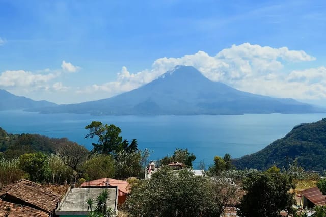
Lake Atitlán: second by area, deepest by far
INE’s 2014 compendium gives Atitlán a water surface of 125.4 km², a mean depth of 203.9 m and a basin of 546 km², and says the lake is surrounded by 15 municipalities. The basin figure is the land that drains into the lake, not the lake itself, so do not compare 546 km² with Izabal’s 589.6 km².
AMSCLAE (Autoridad para el Manejo Sustentable de la Cuenca y Lago de Atitlán y su Entorno, the body INE names as the basin’s administrator) describes the lake as 1,560 m above sea level and 18 km long. On depth it is careful: the depth varies at many points and is unknown, but “se han sondeado más de 350 m de profundidad” (soundings of more than 350 m have been made). That is a sounding, not a measured maximum, and it is a different quantity from INE’s 203.9 m average. AMSCLAE also says the lake has no visible outlet, and gives two explanations of its origin: an old dead crater, or volcanoes that cut off three rivers flowing from the north.
The three volcanoes on its shore, per AMSCLAE: Atitlán (3,537 m), Tolimán (3,158 m) and San Pedro (3,020 m).
For the water itself, see whether you can swim in Lake Atitlán; for how it compares with two famous foreign lakes, see Lake Atitlán vs Lake Tahoe and Lake Como.
Lake Petén Itzá: third largest, 160 m deep
INE’s 2014 compendium places Petén Itzá in El Petén, northern Guatemala, with an area of 99 km², a maximum depth of 160 m and an elevation of 110 m above sea level. INSIVUMEH’s figures match: 99.0 km² and 110.0 m. INE lists the shore communities El Remate, Jobompiche, San José, San Pedro, San Miguel and Santa Elena, and the municipalities of San Benito, Flores and San Andrés.
Water quality is a separate question, covered in can you swim in Lake Petén Itzá.
Lake Amatitlán: the small lake next to the capital
INE’s 2014 compendium calls Amatitlán one of the country’s main lakes, with a surface of 14.86 km², and says its basin is administered by AMSA (Autoridad para el Manejo Sustentable de la cuenca y lago de Amatitlán). INSIVUMEH lists it at 15.2 km² and 1,186 m above sea level, in the department of Guatemala and the municipality of Amatitlán. Neither source gives a depth. How to visit is on the Lake Amatitlán day-trip page.
How many lakes Guatemala has
The answer depends on what counts as a lake:
- INSIVUMEH: 23 lakes and lagoons plus 119 smaller lagoons, covering about 950 km². Its list of lagos names five: Amatitlán, Atitlán, Güija, Izabal and Petén Itzá.
- INE 2014, citing César Castañeda (1990): about 1,151 lake systems, made up of 7 lakes, 365 lagoons and 779 small lagoons, with 1,207 km² of water surface in total. Castañeda puts 80% of these water bodies between 0 and 200 m above sea level and 54% in the department of Petén.
- INE 2014, in a chart sourced to Universidad Rafael Landívar’s 2006 Perfil Ambiental: 92,000 hectares in lakes, 23,188 hectares in lagoons and 2,174 hectares in small lagoons nationwide. The Atlantic slope holds the most lake surface, 59,000 hectares, followed by the Pacific slope with 25,420.
On origins, INE quotes Castañeda: lake systems above 1,000 m are generally tectonic-volcanic, while the rest come from the gradual uplift of the marine platform, or from rivers that changed course or flooded.
Lake Güija: shared with El Salvador
INE’s 2014 compendium says Güija is shared with El Salvador. INSIVUMEH lists it among the country’s lagos, under Jutiapa and the municipality of Asunción Mita, but leaves it out of its size table as a border lake, so this page gives it no rank.
Where to stay near the three biggest lakes
The three largest lakes are in three different departments: INSIVUMEH places Izabal in Izabal, Atitlán in Sololá and Petén Itzá in El Petén, where Flores is one of the lakeshore municipalities INE lists. For Atitlán, see where to stay at Lake Atitlán.
Where to stay in Río Dulce
Compare Booking.com, Airbnb and hotels on one map. Drag the map and set your dates to see live availability and real prices.
Affiliate links — if you book, we earn a small commission at no extra cost to you.
Where to stay in Panajachel
Compare Booking.com, Airbnb and hotels on one map. Drag the map and set your dates to see live availability and real prices.
Affiliate links — if you book, we earn a small commission at no extra cost to you.
Where to stay in Flores
Compare Booking.com, Airbnb and hotels on one map. Drag the map and set your dates to see live availability and real prices.
Affiliate links — if you book, we earn a small commission at no extra cost to you.
Sources
- INSIVUMEH, Lagos de Guatemala (Índice de lagos), Internet Archive copy of 11 December 2008: http://web.archive.org/web/20081211062931/http://www.insivumeh.gob.gt/hidrologia/lagos.htm (read 13 November 2026; the original address now returns a not-found page)
- INE, Compendio Estadístico Ambiental de Guatemala 2014, PDF pages 26, 27, 29 and 61-63: https://www.ine.gob.gt/sistema/uploads/2021/04/23/20210423175428xOByTYH2jynYNQxyzSLcDspydEB4NIbU.pdf (read 13 November 2026)
- AMSCLAE, Lago de Atitlán: https://www.amsclae.gob.gt/2013/09/03/lago-de-atitlan/ (read 13 November 2026)
Frequently Asked Questions
Which are Guatemala's biggest lakes, and how big and deep are they?
INSIVUMEH’s lake index lists Izabal at 589.6 km², Atitlán at 130.1 km², Petén Itzá at 99.0 km², El Golfete at 62.0 km² and Amatitlán at 15.2 km². INE’s 2014 environmental compendium gives the same order for the top three, prints 125.4 km² for Atitlán, and gives Atitlán a mean depth of 203.9 m and Petén Itzá a maximum depth of 160 m.
What is the largest lake in Guatemala?
Lake Izabal, in the department of Izabal. INSIVUMEH lists it at 589.6 km² and 0.9 m above sea level, and INE’s 2014 compendium calls Petén Itzá the third largest natural lake after Izabal and Atitlán.
How deep is Lake Atitlán?
INE’s 2014 compendium gives a mean depth of 203.9 m. AMSCLAE, the lake’s management authority, says the depth varies from point to point and is unknown, but that soundings have gone past 350 m. These are two different measures and neither is a published maximum.
Why do the figures for Atitlán's area differ?
They come from different publications. INSIVUMEH’s lake index lists 130.1 km²; INE’s 2014 compendium prints a water surface of 125.4 km². INE also gives the Atitlán basin as 546 km², which is the drainage area, not the lake.
How many lakes does Guatemala have?
It depends on the count. INSIVUMEH says there are 23 lakes and lagoons plus 119 smaller lagoons covering about 950 km². INE’s 2014 compendium cites César Castañeda (1990): about 1,151 water bodies, of which 7 are lakes, 365 lagoons and 779 small lagoons, totalling 1,207 km².
Is Lake Güija in Guatemala?
Partly. INE’s 2014 compendium says Güija is shared with El Salvador, and INSIVUMEH lists Güija under Jutiapa, Asunción Mita, but leaves it out of its size table because it is a border lake.