Lake Tahoe is the deepest and highest of the three: 1,645 feet deep at 6,223 feet (USGS and EPA), against Atitlán’s 327.56 m at 1,562 m (AMSCLAE) and Como’s 410 m at 199 m (Como basin authority). What differs most for a visitor is who decides whether the water is fit to swim in, and how.
In short: Atitlán sits in a volcanic basin with no visible outlet and a four-level cyanobacteria alert run by AMSCLAE. Tahoe is a granite-graben lake whose clarity EPA says fell by about 30% between 1968 and 1997. Como is a glacial lake in Lombardy; Italian rules, as an Insubria health-agency page summarises them, run a 1 May to end-September bathing season with municipal bans after a bad result. Each figure below keeps the publishing agency’s own unit.
The three lakes side by side
| Lake Atitlán (Guatemala) | Lake Tahoe (USA) | Lake Como (Italy) | |
|---|---|---|---|
| Elevation | 1,562 msnm (AMSCLAE 2025 report) | 6,223 ft., natural rim (EPA) | 199 m s.l.m. (Como basin authority) |
| Maximum depth | 327.56 m (AMSCLAE 2025 report, citing Reyes et al., 2017) | 1,645 feet (USGS Hydro Mapper; EPA) | 410 m (basin authority; ARPA Lombardia report) |
| Average depth | not given in the AMSCLAE pages used here | 1,000 feet (USGS Hydro Mapper); 333 m (USGS CalVal) | not given by the basin authority |
| Surface area | 130 km2 (AMSCLAE 2025 report) | 192 sq. miles (EPA); about 490 km2 (USGS CalVal) | 145 km2 (basin authority); 145 Kmq (ARPA) |
| Length | 18 km (AMSCLAE) | 35 km, 19 km wide (USGS CalVal) | 46 km, 650 m to 4.3 km wide (basin authority) |
| Volume | 25.46 km3, estimated (AMSCLAE 2025 report) | about 156 km3 (USGS CalVal, citing Wang et al., 2020) | not given by the basin authority |
| Origin | two opinions: an old extinct crater, or volcanoes blocking three rivers (AMSCLAE) | within a granite graben near the Sierra Nevada crest (USGS CalVal) | natural lake of glacial origin (basin authority) |
| Rivers in and out | no visible outlet (AMSCLAE) | 63 streams in, one out: the Truckee River (EPA) | main inflows: the Adda and Mera rivers, into the northern basin (ARPA report) |
| Who sets swimming advice | AMSCLAE cyanobacteria alert | park operator at each beach (Sand Harbor: Nevada State Parks) | Italian system: health-agency sampling, municipal bans (ATS Insubria page) |
All figures read 10 November 2026. The Tahoe surface figures from EPA and USGS are two different agencies’ numbers and are not converted into each other here.
Why Atitlán has two depth figures
AMSCLAE publishes two descriptions of the lake. Its older lake page says the lake sits at 1.560 metres above sea level, that its depth varies and is unknown, and that soundings of more than 350 m have been made. Its 2025 report on the lake’s littoral zones gives 1,562 msnm, a maximum depth of 327.56 m and an estimated volume of 25.46 km3, citing Reyes et al. (2017). The table uses the 2025 report; the older page’s 350 m is a sounding statement, not a measured maximum.
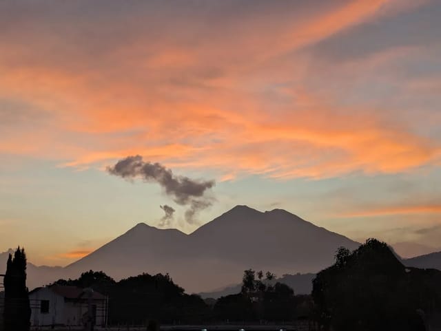
The 2025 report also gives the shoreline an oval shape of 21 x 18 km with two bays running south, and names the three volcanoes on its shores: Atitlán (3,537 msnm), Tolimán (3,158 msnm) and San Pedro (3,020 msnm).
Three different kinds of basin
AMSCLAE’s lake page does not commit to one origin story. It sets out two opinions: that the lake is an old extinct crater, or that the rise of the volcanoes cut off three rivers coming from the north, whose waters collected and formed the lake. It adds that the lake has no visible outlet.
Tahoe is described by the USGS CalVal page as a large, deep lake within a granite graben near the crest of the Sierra Nevada, straddling the California-Nevada border, and the second deepest lake in the United States. EPA’s lake facts add an age of 2 million years and name Oregon’s Crater Lake as the only deeper US lake.
Como’s basin authority describes it as a natural lake of glacial origin in the provinces of Como and Lecco, Italy’s third largest lake by surface and the first by length of shoreline, at 170 km. The ARPA Lombardia study (dated April 2004) calls it a deep subalpine lake of natural type, artificially regulated.
Water quality: what each authority publishes
Atitlán. AMSCLAE’s alert system has four levels, set out in an AGN (Agencia Guatemalteca de Noticias) article of 25 November 2024. At the lowest, the water is described as clean and transparent and fit for recreational use; at the highest, a dense, pasty yellowish or brown mass, the advice is “no bañarse con agua del lago, no sacar la cianobacteria” (do not bathe with lake water, do not remove the cyanobacteria). The full colour table, the 2026 alert history and what happened to swimmers is on our page can you swim in Lake Atitlán.
Tahoe. EPA says monitoring shows declining water quality in both the deep-water and the nearshore zones. Deep-water clarity fell by approximately 30% between 1968 and 1997, from 100 to 64 feet, and has since averaged 65.2 feet (2016-2020). EPA attributes the loss to fine sediment and phytoplankton, lists the lake as impaired under Clean Water Act Section 303(d) for nitrogen, phosphorus and sediment, and gives a target of 29.7 metres (97.4 feet) annual average Secchi depth by 2076. The nearshore zone has degraded because of algae and aquatic invasive species, particularly in urbanised areas.
Como. Neither the Como basin authority’s lake page nor the 2004 ARPA study says anything about bathing water. The Italian system is described by ATS Insubria, a health agency headquartered in Varese, on its lake-bathing page (which does not list the individual lakes or shores it covers): the agency samples water near the most frequented areas in its stretches of lake and sends the results to Italy’s Ministry of Health for publication on the Portale Acque. Under D.Lgs. 116/2008 and the Ministerial Decree of 30 March 2010, as that page summarises them, the bathing season runs from 1 May to the end of September. If a result is unfavourable, ATS asks the mayor of the comune to issue a bathing ban; beaches can be closed for pathogenic micro-organisms, potentially toxic algae or harmful chemicals, and the ban is lifted after a first favourable result.
Swimming access: rules you can check before you go
| Lake | Published rule or arrangement | Publisher |
|---|---|---|
| Atitlán | Four alert levels; at the highest, do not bathe with lake water | AMSCLAE, via AGN, 25 November 2024 |
| Tahoe, Sand Harbor | Beach Patrol on duty Memorial Day through Labor Day; no glass bottles in waterfront areas; pets only 15 October to 15 April, on a leash of no more than six feet | Nevada State Parks |
| Tahoe, Sand Harbor | Day use $10.00 per vehicle ($15.00 non-Nevada vehicles); day-use reservations required for vehicle entry 15 May to 30 September, 8:00 to 10:00 a.m. in the fee section and 8:00 to 10:30 a.m. in another section of the same page, so confirm the cutoff with the park; parking on Hwy 28 outside designated parking is prohibited | Nevada State Parks |
| Italian lakes (as summarised by ATS Insubria) | Season 1 May to end of September; sampling points near bathing areas; municipal bans after an unfavourable result | ATS Insubria (Varese) |
ATS Insubria also advises bathing in lakes only if you swim well and are well trained, and discourages high dives. Nevada State Parks warns that Sand Harbor sees high visitation between Memorial Day and Labor Day and that visitors should be ready for park closures.
What the comparison means for an Atitlán trip
At Sand Harbor the beach is run by a park operator, Nevada State Parks, with its own Beach Patrol and rules; under the Italian bathing rules as ATS Insubria describes them, an unfavourable test result during the season leads to a request that the town’s mayor order a bathing ban. At Atitlán the published instrument is a lake-wide alert level from AMSCLAE, so the thing to check before swimming is the current level, not the lake’s depth or its reputation. The lake’s towns differ in where you can get into the water; see Lake Atitlán towns, where to stay at Lake Atitlán and the Lake Atitlán overview.
Sources
- AMSCLAE: Conservación y manejo de las zonas litorales del Lago Atitlán, 2025 (PDF) — read 10 November 2026.
- AMSCLAE: Lago de Atitlán — read 10 November 2026.
- AGN: cianosemáforo del lago de Atitlán, 25 November 2024 — read 10 November 2026.
- USGS CalVal: Lake Tahoe — read 10 November 2026.
- USGS: Lake Tahoe Hydro Mapper — read 10 November 2026.
- EPA: About Lake Tahoe — read 10 November 2026.
- Nevada State Parks: Sand Harbor — read 10 November 2026.
- Autorità di Bacino del Lario e dei Laghi Minori: Lago Lario — read 10 November 2026.
- ARPA Lombardia hydrological study, April 2004 (PDF) — read 10 November 2026.
- ATS Insubria: balneabilità dei laghi — read 10 November 2026.
Frequently Asked Questions
Lake Atitlán vs Lake Tahoe: which is deeper and higher?
Tahoe is both. USGS and EPA give Tahoe a maximum depth of 1,645 feet and EPA an elevation of 6,223 ft. at the natural rim. AMSCLAE, the Atitlán basin authority, gives Atitlán a maximum depth of 327.56 m and an elevation of 1,562 msnm in its 2025 littoral-zone report. The figures are kept in each agency’s own units.
How big is Lake Atitlán compared with Tahoe and Como?
AMSCLAE gives Atitlán a surface of 130 km2 and a length of 18 km. EPA gives Tahoe a surface of 192 sq. miles, and the USGS CalVal page about 490 km2 and a length of 35 km. Lake Como’s basin authority gives 145 km2 and a length of 46 km.
How did each lake form?
AMSCLAE’s own lake page says there are two schools of opinion on Atitlán: an old extinct crater, or volcanoes that blocked three rivers from the north. USGS describes Tahoe as lying within a granite graben in the Sierra Nevada. Como’s basin authority calls it a natural lake of glacial origin.
Who decides whether you can swim in each lake?
At Atitlán, AMSCLAE runs a four-level cyanobacteria alert; at its highest level the advice is not to bathe with lake water. For Italian lakes, the health agency ATS Insubria describes sampling during a season of 1 May to the end of September and, after an unfavourable result, a request to the mayor to order a bathing ban; its page does not name the lakes it covers. At Tahoe’s Sand Harbor, Nevada State Parks runs the beach, with Beach Patrol from Memorial Day through Labor Day.
Does Atitlán have an outlet like Tahoe's Truckee River?
AMSCLAE’s lake page says Atitlán has no visible outlet. EPA says 63 streams feed Lake Tahoe and only one, the Truckee River, flows out, and that water entering Tahoe takes about 650 years to reach the outlet.