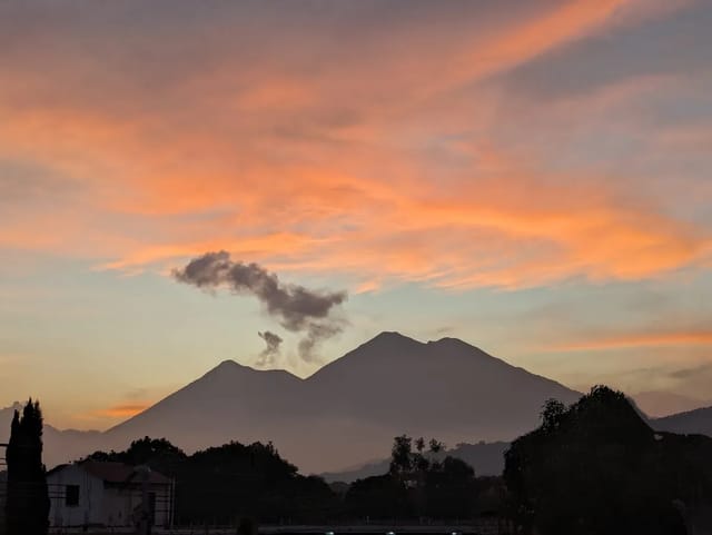
Rey Tepepul (officially Parque Regional Municipal El Mirador Rey Tepepul) is a municipal regional park in Santiago Atitlán, Sololá; CONAP lists the Municipality of Santiago Atitlán as its contact institution. CONAP, Guatemala’s protected-areas council, describes cloud forest and an impressive view of the lake, with views over the lake basin, the volcanoes and the south coast; it covers 3,509.91 hectares, sits at 1,822 m and was declared in 2017. CONAP plans 4 to 8 hours for a visit, lists access as open, publishes no fee, and tells visitors to bring a heavy jacket or raincoat, field boots, and a wool cap and gloves.
This page is for a visitor at Lake Atitlán weighing a day in Santiago Atitlán’s cloud-forest park: what the park is, what you might see, how to get there and what to wear. It uses CONAP’s tourism page for the park as archived on 10 March 2026 and a 26 November 2024 report by AGN, the government news agency, both read on 1 November 2026.
Quick summary
| Item | Detail (source) |
|---|---|
| Official name | Parque Regional Municipal El Mirador Rey Tepepul (CONAP) |
| Where | Santiago Atitlán, Sololá, inside the RUMCLA reserve of the Lake Atitlán basin (CONAP) |
| Contact institution | Municipality of Santiago Atitlán, (+502) 7721-7150 (CONAP) |
| Area | 3,509.91 hectares (CONAP) |
| Altitude | 1,822 m (CONAP) |
| Declared | 2017 (CONAP) |
| Hours | Acceso libre, open access (CONAP) |
| Fee | Not published on the CONAP page |
| Time to allow | 4 to 8 hours (CONAP) |
| Birds named | Quetzal, cayaya (CONAP); quetzal (AGN) |
| From Guatemala City | 147 km, about 4 hours via the CA-1 (CONAP) |
What you can see
CONAP’s one-line answer to what to expect is cloud forest and an impressive view of Lake Atitlán. Its longer description adds views over the lake basin, the volcanoes and the south coast, and a mix of forest types: high-altitude conifer forest, broadleaf forest running from the bocacosta to the slopes of the Atitlán volcano, and scattered mixed forest. It names the Quetzal and the cayaya (Penelopina nigra) as examples of the endangered species found there, and says some of the species are endemic.
AGN’s 2024 report adds that the park contains two volcanic cones, among them Cerro Paquisís, which it calls one of the oldest in the region; cypress forest in recovery; and agroforestry plots of maxán, a leaf used in local cooking. It says the quetzal makes the park a key destination for birdwatching, and that the park matters for water recharge, supplying spring water to farms on the south coast that grow export crops such as coffee, avocado and macadamia.
CONAP also describes sacred sites and trails woven into the Tz’utujil culture of the area’s people, and calls the park a destination for nature and mountain tourism.
Getting there
CONAP gives three ways in:
| Route | What CONAP says |
|---|---|
| From Guatemala City by the CA-1 (main access) | 147 km, about 4 hours: the Inter-American Highway to km 116, Las Trampas, toward Godínez and San Lucas Tolimán, then past San Lucas Tolimán to Santiago Atitlán |
| From the south coast by the CA-2 | To the village of Cocales, Suchitepéquez, then toward Patulul and San Lucas Tolimán |
| By lake | By boat from Panajachel or San Pedro La Laguna |
The CONAP page locates the park in the municipality of Santiago Atitlán but does not give the distance or route from Santiago’s town centre to the trails, or say whether a guide is required. Ask the Municipality of Santiago Atitlán, (+502) 7721-7150, before you go. If you are coming across the lake, our Panajachel to Santiago Atitlán page and our lancha routes guide cover the boats.
What to bring and wear
CONAP’s recommendations are specific:
- A heavy jacket (chumpa gruesa) or raincoat
- Field boots
- A wool cap and wool gloves
- A change of clothes
- No denim trousers (pantalón de lona)
It estimates 4 to 8 hours to visit the park’s attractions, so allow most of a day. CONAP’s page lists opening hours only as acceso libre and publishes no entrance fee.
Combining it with the rest of Santiago and the lake
In Santiago itself, our Maximón page covers a visit to Maximón. For other walks around the lake see our Lake Atitlán hikes, and for birding sites elsewhere in the country, our Guatemala birding guide.
Sources
- CONAP, Turismo SIGAP, Parque Regional Municipal El Mirador Rey Tepepul, https://turismo-sigap.conap.gob.gt/rutas-turisticas/ruta-de-volcanes-paisaje-y-cultura-altiplano/parque-regional-municipal-el-mirador-rey-tepepul/ — Wayback Machine copy of 10 March 2026, read 1 November 2026
- Agencia Guatemalteca de Noticias (AGN), Conservación y biodiversidad en el parque regional municipal Mirador Rey Tepepul (26 November 2024), https://agn.gt/conservacion-y-biodiversidad-en-el-parque-regional-municipal-mirador-rey-tepepul — read 1 November 2026
Frequently Asked Questions
What is Rey Tepepul?
Parque Regional Municipal El Mirador Rey Tepepul is a municipal regional park in Santiago Atitlán, Sololá; CONAP lists the Municipality of Santiago Atitlán as its contact institution. CONAP’s tourism page (archived 10 March 2026) describes cloud forest and an impressive view of Lake Atitlán, gives an altitude of 1,822 m and an area of 3,509.91 hectares, and says it was declared in 2017, inside the Lake Atitlán basin multiple-use reserve (RUMCLA).
Can you see quetzals at Rey Tepepul?
CONAP names the Quetzal and the cayaya (Penelopina nigra) as examples of the endangered species in the park (CONAP says some of the park’s species are endemic), and AGN, the government news agency, reported in November 2024 that the quetzal makes the park a key destination for birdwatching. Neither source gives sighting rates or a season.
How long does a visit to Rey Tepepul take?
CONAP estimates 4 to 8 hours to visit the park’s attractions. It lists the opening hours simply as acceso libre (open access) and publishes no entrance fee; the contact it gives is the Municipality of Santiago Atitlán, (+502) 7721-7150.
What should I wear to Rey Tepepul?
CONAP recommends a heavy jacket or raincoat, field boots, a wool cap and gloves, and a change of clothes, and advises against wearing denim (pantalón de lona).
How do you get to Rey Tepepul?
The park is in the municipality of Santiago Atitlán. CONAP says it is 147 km and about 4 hours from Guatemala City by the CA-1: to km 116 at Las Trampas, toward Godínez and San Lucas Tolimán, then through San Lucas Tolimán to Santiago Atitlán. You can also come up from the CA-2 on the south coast via Cocales, Patulul and San Lucas Tolimán, or by boat from Panajachel or San Pedro La Laguna. CONAP does not give the distance from Santiago’s town centre to the park.