- Fuego alert level: Orange — Elevated eruptive activity. See INSIVUMEH's latest daily and BEFGO special bulletins for current explosion rates and ash-column heights. Washington VAAC ash advisories are in effect.
- Pacaya alert level: Yellow
- Santiaguito alert level: Yellow
- Ash advisory (Washington VAAC, Fuego): ACTIVE ADVISORY (4 in 24h) — plume ~4572 m (17 Sep 2026 1628 UTC)
- Latest CONRED bulletin: Desgasificación como parte de la actividad del volcán Santiaguito (2026-09-08)
Sources: INSIVUMEH · Washington VAAC · CONRED · updated: 9/17/2026, 11:47:23 AM
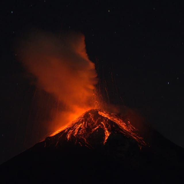
If you searched “guatemala volcano eruption today”, here is the honest answer up front: Volcán de Fuego is erupting today — and it has been erupting continuously since 2002. Explosions every 15-90 minutes are its normal state, not a news event. What matters is whether today’s activity is routine or a paroxysm (a strong eruptive phase) — and that’s what the live box above tells you, straight from INSIVUMEH, the Washington VAAC and CONRED.
The pattern, and where the August 2026 phase left things. INSIVUMEH ended the August 3-5, 2026 eruptive phase at 1:50 PM on August 5 after 50 hours and put Fuego back at 4-6 weak-to-moderate explosions per hour — its baseline. Two things routinely lag the end of a phase: lahar risk in the ravines while it rains, and park access, which is decided separately from the eruption — the Acatenango municipal park reopened on August 7, 2026 on previously approved routes only, with direct Fuego-crater access still prohibited. For today’s level, read the live status box above.
- The eruptive phase has ended. INSIVUMEH's special bulletin BEFGO-066-2026 — headline "Finaliza la erupción del volcán de Fuego" — reports that after 50 hours the volcano returned to its normal parameters: weak-to-moderate explosions, 4 to 6 per hour. That is Fuego's baseline behaviour, the state it has been in almost continuously since 2002. No lava fountains, no eruptive column, no pyroclastic flows.
- ⚠️ The danger changed shape rather than ending — lahars are now the live hazard. The phase left fresh ash and pyroclastic deposits sitting in the ravines, and rain is forecast for the coming days. CONRED warns that lahars may descend the ravines and affect roads, bridges and nearby communities, and explicitly asks people "no bajar la guardia" — don't drop your guard: keep evacuation routes identified and clear, keep the 72-hour bag ready, and be prepared to self-evacuate if conditions require it. Never cross a Fuego ravine during or right after rain. Emergency line: 119.
- The Acatenango municipal park REOPENED on August 7 — but check which authority applies to you. The Municipalidad de Acatenango restored access to the Parque Regional Municipal Astillero Volcán Acatenango on Friday August 7, 2026; hiking is allowed only on previously approved routes and direct access to the Fuego crater stays prohibited (Infobae, Aug 9). That is the municipality’s call on its own park; INGUAT has published no notice lifting its own August 5 restriction (press page checked Aug 10), so confirm with your operator. The August 5 position, for context: On August 5, after INSIVUMEH declared the eruption finished, INGUAT's position was that the ascent of Acatenango and Fuego "continúa restringido" — still restricted, temporarily and preventively, with no reopening date announced. Other tourist destinations in Sacatepéquez and the rest of the country are operating normally. CONRED had posted personnel at the Acatenango entrance on August 4. If you have a booking, contact your operator — they reschedule.
- Ashfall: the communities worst affected sit on the west and southwest flank, principally San Pedro Yepocapa, Chimaltenango (INSIVUMEH/CONRED, August 5).
- Shelters: the peak figure was 1,522 people in five shelters — Salón Municipal, Alotenango, Sacatepéquez (299) · Polideportivo, Santa Lucía Cotzumalguapa, Escuintla (339) · Gimnasio Abner Casasola, Escuintla (343) · Escuela Rural Mixta Colonia El Quetzal, Escuintla (233) · Escuela Urbana Mixta José Francisco Azurdia, Escuintla (207) — recorded by CONRED on August 4 (Nota de Prensa 212-2026). On the morning of August 5, sheltered families in Escuintla and Sacatepéquez began collecting their belongings to return home (Prensa Libre live coverage, 11:30). CONRED has not published a return count or a shelter-closure bulletin as of this update, so we are not quoting a current shelter population — the 1,522 above is the August 4 peak, not today's number.
- What the "Orange Alert" actually means — and where it stands: CONRED declared Alerta Anaranjada Institucional on August 3 (Boletín Informativo 238-2026). Institutional is the load-bearing word: it raises the readiness and coordination posture of the CONRED system itself. It was never a territorial alert or a general evacuation order for the public. No bulletin lifting or downgrading it had been published when this update was written; CONRED says it is maintaining permanent monitoring of the volcano and coordination with local authorities.
- The record of the phase — how it escalated hour by hour, from the first lava on the crater rim to pyroclastic flows in five ravines and an ash plume tracked 270 km over the Pacific — is in the trajectory table below.
Sources: INSIVUMEH BEFGO-055/056/059/061/066-2026 · CONRED "Tras 50 horas de actividad, volcán de Fuego retorna a sus parámetros normales" (5 Aug, 14:39) · CONRED Boletín Informativo 238-2026 · CONRED Nota de Prensa 212-2026 (shelter figures, 4 Aug) · INGUAT statement on volcano access (5 Aug) · Washington VAAC. Checked against conred.gob.gt on 5 August 2026. Between our updates, the live box above and INSIVUMEH's X account (@insivumehgt) carry the newest numbers.
Watch the eruption live (webcams)
Reading about an eruption is one thing — seeing it is another. Two verified live views of Fuego right now:
- INSIVUMEH surveillance cameras — the official monitoring stations for Fuego and Santiaguito, images updating every minute. Scientific stills, not cinematic, but this is the same view the volcanologists watch.
- AfarTV 24/7 live stream — a 4K cinematic stream from the southeast flank, running day and night. During a paroxysm this is the best free seat in the house; night incandescence (glowing material on the cone) shows best after dark.
Rainy-season reality: clouds regularly white-out one flank while another stays clear — if a camera shows nothing but grey, it’s usually weather, not calm. Cross-check with the ash advisory in the live box above.
How the eruption escalated — the trajectory
| When (local) | What happened | Source |
|---|---|---|
| Jul 23-29 (baseline) | 5-11 explosions/hour; plumes to ~1.1 km above the summit; ash drifting up to 40 km SW/W/NW | INSIVUMEH via Smithsonian GVP weekly report |
| Aug 3, 12:30 AM | Constant lava emission piling up on the west crater rim; no eruptive column yet | INSIVUMEH BEFGO-055-2026 |
| Aug 3, 8:30 AM | Eruption begins — new eruptive phase declared | INSIVUMEH BEFGO-056-2026 |
| Aug 3, afternoon | Columns 4,000-5,000 m asl; ash ~60 km west, airspace of Chimaltenango and Suchitepéquez affected | CONRED Boletín 237-2026 |
| Aug 3, 8:00 PM | Still intensifying; pyroclastic flows in Seca and Ceniza ravines; columns 5,000-6,000 m asl; park access to Acatenango and Fuego closed | INSIVUMEH BEFGO-059-2026 |
| Aug 3, 9:15 PM | Ash cloud ~130 km southwest, over Chimaltenango, Suchitepéquez and Retalhuleu; conditions forecast to hold 24h | INSIVUMEH ash-dispersion map |
| Aug 4, overnight | Ash plume tracked ~270 km WSW over the open Pacific; 5 VAAC advisories in 24 hours | Washington VAAC 03:28 UTC |
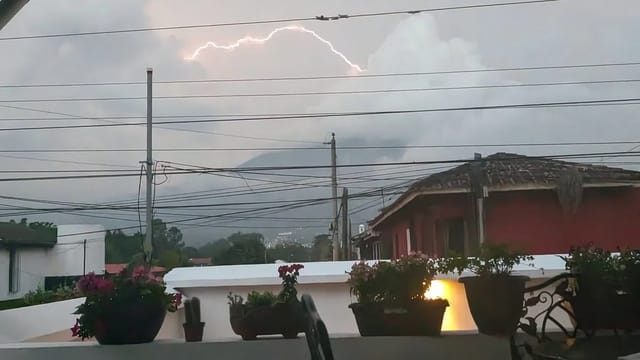
| Aug 4, morning | Day 2 — most intense stage so far: pyroclastic flows in five ravines (Seca, Taniluyá, Ceniza + Las Lajas and Honda); continuous strong emissions with lightning in the plume | INSIVUMEH BEFGO-061-2026 via CONRED · VAAC 09:19 UTC |
| Aug 4, 7:35 AM | Columns 5,000-7,000 m asl; ash ~120 km W/NW over Chimaltenango, Suchitepéquez and Sololá airspace; models project up to 150 km, reaching Quetzaltenango; emissions expected up to 24 more hours | INSIVUMEH dispersion map (@insivumehgt) |
| Aug 4, 3:30 PM | 1,522 people in five shelters (Alotenango, Santa Lucía Cotzumalguapa, Escuintla ×3); food, health care, psychosocial support under Function 13 of the National Response Plan | CONRED Nota de Prensa 212-2026 |
| Aug 5, 10:27 AM | Progressive reduction after more than 40 hours of activity | CONRED bulletin |
| Aug 5, 11:30 AM | Sheltered families in Escuintla and Sacatepéquez begin collecting belongings to return home | Prensa Libre live coverage |
| Aug 5, 11:31 AM | Ash dispersion now projected to reach up to 50 km (down from 100 km on Aug 3) | CONRED bulletin |
| Aug 5, 1:50 PM | ERUPTION ENDS — 50 hours. Volcano returns to normal parameters: 4-6 weak-to-moderate explosions per hour. Lahar risk continues with forecast rain | INSIVUMEH BEFGO-066-2026 |
| Aug 5, afternoon | Ascent of Acatenango and Fuego remains restricted — temporary and preventive, no reopening date | INGUAT |
| Aug 7 (Fri) | Municipal park REOPENS. Municipalidad de Acatenango restores access to the Parque Regional Municipal Astillero Volcán Acatenango; hiking on pre-approved routes only, Fuego crater access still prohibited. No INGUAT notice lifting its own restriction has been published | Municipalidad de Acatenango (via Infobae, Aug 9) |
Total duration: 50 hours, from 8:30 AM on August 3 to 1:50 PM on August 5.
For comparison: a typical Fuego paroxysm lasts hours to a couple of days. The June 3, 2018 disaster is the reason every escalation like this one is watched closely — but note that ~95% of paroxysms end without damage beyond ashfall.
Normal vs. Dangerous
| Behavior | Normal? | What to do |
|---|---|---|
| Explosions every 15-90 min, rumbling, night glow | ✅ Yes — baseline since 2002 | Nothing. It’s the show you watch from Antigua and Acatenango |
| Fine ashfall in nearby villages | ✅ Frequent | Cover water and food, sweep roofs when it accumulates |
| Paroxysm: lava fountains, 5-7 km ash column, pyroclastic flows | ⚠️ 2-10 times a year | Follow INSIVUMEH’s BEFGO bulletins and CONRED; evacuate only if instructed |
| Lahars (mudflows) in the ravines when it rains | ⚠️ Near-daily in rainy season | NEVER cross a Fuego ravine during or right after rain |
The key distinction: “Fuego is erupting” is the permanent condition. The news is a paroxysm — that’s what the special bulletins and the live box above are for.
The three active volcanoes at a glance
- Fuego (3,763 m, ~16-18 km from Antigua): Guatemala’s most active volcano and one of the most active in the Americas. Continuous Strombolian eruption since 2002; 2-10 paroxysms per year. Today’s alert level, explosion count, plume height and the risk-radius map for this volcano alone: Volcán de Fuego live tracker.
- Pacaya (2,552 m, ~30 km from Guatemala City): active periods with lava flows and ash; the “easy” volcano hike when calm — access is managed by the national park according to activity.
- Santiaguito (~2,500 m, near Quetzaltenango): a lava-dome complex growing in the 1902 crater of Santa María, active since 1922, with regular dome collapses and ash explosions.
Live levels for all three are in the box above; deeper data, maps and the activity timeline live on the volcanoes hub.
The precedent: June 3, 2018
The June 3, 2018 paroxysm sent pyroclastic flows down the Las Lajas ravine in minutes and buried San Miguel Los Lotes: more than 200 confirmed dead and hundreds more missing — commonly cited as 400+ dead and missing, Guatemala’s worst volcanic disaster since the 1902 Santa María eruption. The lessons changed the monitoring: BEFGO bulletins now escalate faster, CONRED runs evacuation drills in flank communities, and ground zero remains uninhabited. It is also why “elevated activity” notices are taken seriously even though ~95% of paroxysms end without damage.
What today’s activity means for you
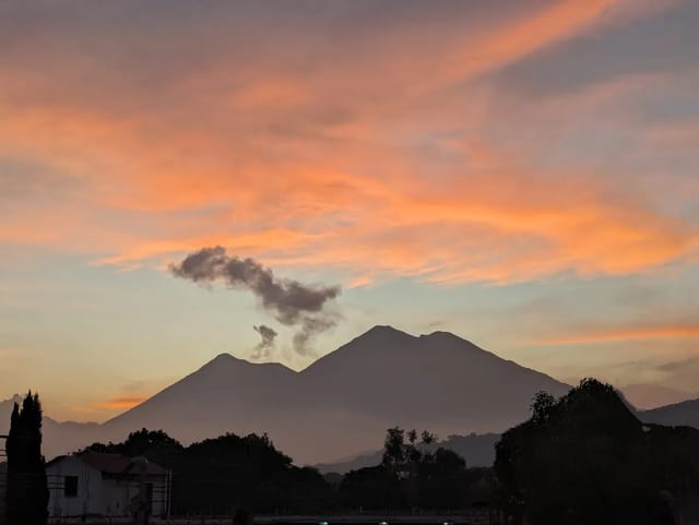
- In Antigua (16-18 km): occasional fine ash and spectacular views. No direct flow risk. Air quality dips slightly during paroxysms — see weather and air quality.
- Acatenango overnight hike: suspended August 3, 2026; the Municipalidad de Acatenango reopened its Parque Regional Municipal Astillero Volcán Acatenango on Friday August 7, hiking on previously approved routes only, with direct Fuego-crater access still prohibited. INGUAT has published no notice lifting the separate restriction it stated on August 5, so confirm with your operator. Don’t read “the eruption ended” as “the hike reopened”: the park authorities and INGUAT lift restrictions, INSIVUMEH doesn’t — and they don’t all move on the same day. Outside eruptive phases, operators also suspend departures whenever a strong BEFGO is active; the operator makes that call, don’t argue with it. Route and prep: hiking Guatemala’s volcanoes.
- Flights at La Aurora: temporary closures are possible when wind pushes ash toward the capital during a paroxysm. Closures usually last hours. Confirm with your airline.
- RN-14 (Antigua–Escuintla road): cut by lahars at the Las Lajas bridge regularly in rainy season. Alternate: CA-9 via Palín.
- Flank communities (Escuintla, Sacatepéquez, Chimaltenango): follow CONRED instructions and local drills; know your evacuation route.
After the eruptive phase: the lahar weeks — this is where we are now
This is the standard aftermath of a Fuego eruptive phase, and it is what the August 3-5, 2026 phase left behind. Once the explosions stop, the danger changes shape rather than ending. The phase left fresh ash and pyroclastic deposits sitting in the same ravines the flows descended — and it is the middle of the rainy season. Rain remobilizes that loose material into lahars (hot mudflows carrying boulders and tree trunks) down Seca, Taniluyá, Ceniza, Las Lajas and Honda. CONRED’s own end-of-eruption bulletin leads with exactly this: rain is forecast for the coming days, lahars may descend the ravines and affect roads, bridges and nearby communities, and the public should not drop its guard. This is the documented post-2018 pattern: the Las Lajas deposit produced lahars for years afterward, and RN-14 at the Las Lajas bridge is the road that gets cut.
What that means practically for the coming weeks:
- INSIVUMEH issues lahar special bulletins most rainy-season afternoons when rain hits the upper slopes — they appear on insivumeh.gob.gt and @insivumehgt alongside the BEFGO stream.
- Never cross a Fuego ravine during or right after rain — lahars arrive with little warning and carry multi-meter boulders.
- Driving Antigua–Escuintla: expect RN-14 interruptions at Las Lajas on heavy-rain afternoons; the alternate is CA-9 via Palín.
Official monitoring
- INSIVUMEH — daily volcanological bulletin + special BEFGO bulletins
- @insivumehgt on X and @ConredGuatemala — during an eruptive phase, bulletins and dispersion maps usually land here first, minutes before the websites
- CONRED — alerts, evacuations and guidance (emergency line 119)
- Washington VAAC — aviation ash advisories
- Volcanoes hub — all 3 active volcanoes with live data and timelines
- Fuego eruption safety explainer — the deeper visitor-safety guide
- Live earthquake tracker — recent quakes are tectonic, not volcanic (see FAQ), but both are spiking in searches this week
- En español: Volcán de Fuego hoy
This page is informational. In a volcanic emergency, follow CONRED instructions (line 119).
Frequently Asked Questions
Is a volcano erupting in Guatemala today?
Almost certainly yes — and that is normal. Volcán de Fuego has been in continuous eruption since 2002: Strombolian explosions several times per hour are its baseline, not an emergency. The real question is whether there is a PAROXYSM (a strong eruptive phase) — that shows up in the Washington VAAC ash advisory in this page’s live box, in INSIVUMEH’s special BEFGO bulletins, and in CONRED bulletins. If the live box shows quiet status, activity is routine. After the August 3-5, 2026 eruptive phase, INSIVUMEH put the volcano back at 4 to 6 weak-to-moderate explosions per hour — baseline behaviour, not a news event. For today’s level, read the live box above.
Which volcanoes are active in Guatemala right now?
Three: Fuego (continuous Strombolian eruption since 2002, near Antigua), Pacaya (active periods with lava flows, near Guatemala City) and Santiaguito (active lava-dome complex since 1922, near Quetzaltenango). The live box on this page shows each one’s current alert level from INSIVUMEH data.
How often does Fuego have big eruptions (paroxysms)?
Historically 2 to 10 paroxysms per year — phases lasting hours to days with lava fountains, ash columns of 4,500-7,000+ meters and sometimes pyroclastic flows. Between paroxysms it keeps moderate explosions every 15-90 minutes. The June 3, 2018 paroxysm was its deadliest in recent history: it left more than 200 confirmed dead and hundreds more missing — commonly cited as 400+ dead and missing — most in San Miguel Los Lotes.
Does volcanic ash close La Aurora airport?
Sometimes, but less often than people assume. Only two Fuego ash closures of La Aurora are sourced: 3-4 June 2018 and 11 December 2022, the second lasting ‘algunas horas’ per DGAC. No closure is sourced for 2023 or 2024, and during the March 2025 and August 2026 Fuego activity officials said operations were not affected. Most historic ash closures were Pacaya, not Fuego. The full ledger is on our volcanic ash page. If you fly during a paroxysm, confirm your flight with the airline.
Is it safe to visit Antigua with Fuego active?
Yes. Antigua sits ~16-18 km from the crater, outside the pyroclastic-flow and lahar hazard zones. What Antigua gets is occasional fine ashfall (annoying, not dangerous) and spectacular night views of the glow — part of the attraction. The real risk is in communities on the south and southwest flanks (Escuintla) and inside the ravines. The Acatenango overnight hike is suspended during strong eruptive phases — as on August 3, 2026, when the national park restricted access to both Acatenango and Fuego.
Is the Acatenango overnight hike open right now?
Updated August 10, 2026 — PARTLY, and which answer applies to you depends on which authority you mean. The Municipalidad de Acatenango restored access to the Parque Regional Municipal Astillero Volcán Acatenango on Friday August 7, 2026: hiking is allowed again, but only on previously approved routes, and direct access to the Fuego crater remains prohibited. That is the municipality’s decision about its own park. INGUAT has published no notice of its own lifting the restriction it stated on August 5 — its press page, checked August 11, still carries nothing on the subject. It did, however, take part in the reopening decision: press reporting on August 10 (Agencia Ocote) states CONRED authorised the municipality to reopen the park on a technical opinion from INGUAT and INSIVUMEH, under conditions. So the reopening was not the municipality acting alone. Confirm with your operator before you travel. Background, and the part people get wrong: INSIVUMEH declared Fuego’s eruption OVER on the afternoon of August 5 (BEFGO-066-2026), but the eruption ending and the hike reopening were two separate decisions by two different authorities. INGUAT’s position on August 5, after the eruption was declared finished, was that access to Acatenango and Fuego ‘continúa restringido’ — still restricted, temporarily and preventively, with no reopening date announced. The restriction was originally relayed in BEFGO-059-2026 by Volcán de Acatenango National Park, which asked INGUAT and the Municipality of San Juan Alotenango to notify agencies and guides; CONRED posted personnel at the Acatenango entrance on August 4. Operators reschedule rather than refuse refunds — contact yours before showing up. When the park reopens, this answer will be updated.
Are the recent earthquakes in Guatemala related to Fuego's eruption?
No official source links them. The earthquakes Guatemala has felt through 2026 (CONRED counted 4,200+ nationwide by late July, including 60 in a single 24-hour stretch) are tectonic — the Cocos-Caribbean plate boundary and local faults. Fuego’s eruption is magmatic, tracked on its own seismic network (the RSAM signal in INSIVUMEH bulletins). INSIVUMEH reports the two phenomena separately. Track quakes on our live earthquake page.
Where do I see the official volcano bulletins?
INSIVUMEH publishes the daily volcanological bulletin and special BEFGO bulletins during elevated activity (insivumeh.gob.gt). CONRED publishes alerts and evacuation guidance (conred.gob.gt). The Washington VAAC issues aviation ash advisories. This page’s live box summarizes all three.