As of 12 September 2026. Every number below comes from AMSCLAE — the Autoridad para el Manejo Sustentable de la Cuenca del Lago de Atitlán y su Entorno — or from our own pull of AMSCLAE’s public limnimetric series. There is no live gauge feed for Lake Atitlán. The readings that exist are dated, and this page says when each one was taken.
Quick summary
- About 2 cm. The vertical fall AMSCLAE recorded between January and August 2026, reported by Agencia Ocote on 28 August 2026.
- 3.00 m. AMSCLAE’s stated change in lake level from May 2014 to October 2025.
- Not 10, 12 or 25 metres. Those figures circulated in August 2026 and AMSCLAE contradicted them directly.
- The public daily series stops on 31 December 2023 — roughly 2.7 years stale as of this writing.
- One station of four publishes anything. Capitania (Panajachel) has a series; Jardines del Lago, Tiosh Abaj and Yach Club return no data for any year offered.
A retreating beach and a falling level are two different measurements
This is the whole misunderstanding. In late August 2026, photographs of exposed lakebed at San Lucas Tolimán spread with the claim that the lake had dropped between 10 and 12 metres. One outlet, Publinews, went further on 26 August with a headline about a critical drop of up to 25 metres. Agencia Ocote also recorded the claim circulating in the form that the lake had lost between 20 and 25 metres of level over four years, stated without documentary backing.
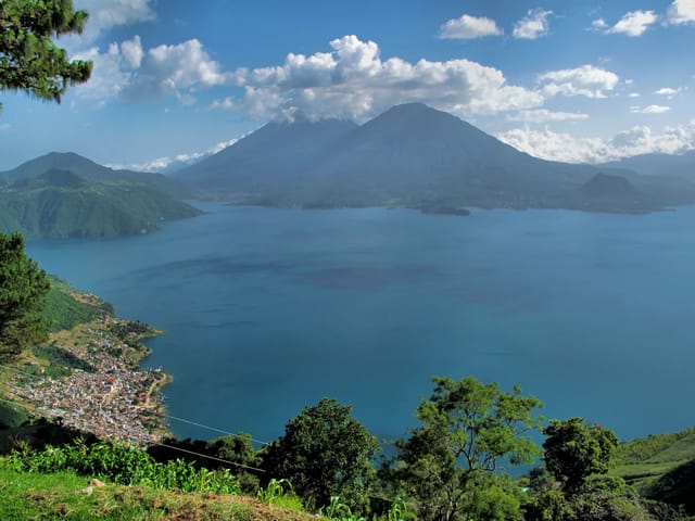
AMSCLAE’s answer was that the photographs show a horizontal retreat of the shoreline at San Lucas Tolimán and not a vertical fall of 10 to 12 metres in the lake level. The agency’s explanation of the difference: the lake level is measured vertically — how much the water surface rose or fell relative to a fixed point — whereas what a person standing on the beach sees is a horizontal distance, how far the line where the water ends has moved. The head of AMSCLAE’s Department of Environmental Research and Quality summarised it in four words: “Son dos medidas diferentes” — they are two different measurements.
What the gauge has actually recorded
The instrument is a limnimetric scale installed in 2014 on the Panajachel beach, at the Capitanía del Puerto Lacustre Atitlán. AMSCLAE describes it this way: measurements are taken every day at 07:00 and 16:00, they began in May 2014 and have continued through 2025, and the scale’s geographic position was validated by the Instituto Geográfico Nacional (IGN) and integrated into the national geodetic network.
The table below is our own pull of AMSCLAE’s published series for that station — 3,280 daily points, every year the tool offers. Values are in msnm (metres above sea level) as the scale reports them.
| Year | Readings | First reading | Last reading | Min | Max | Net |
|---|---|---|---|---|---|---|
| 2014 | 237 | 1556.571 (7 May) | 1557.051 | 1556.571 | 1557.351 | +0.480 |
| 2015 | 365 | 1557.051 | 1556.851 | 1556.531 | 1557.151 | -0.200 |
| 2016 | 366 | 1556.951 | 1556.251 | 1554.171 | 1557.151 | -0.700 |
| 2017 | 365 | 1556.251 | 1556.201 | 1555.551 | 1556.341 | -0.050 |
| 2018 | 365 | 1556.171 | 1555.501 | 1555.351 | 1556.181 | -0.670 |
| 2019 | 151 (incomplete) | 1555.551 | 1554.400 | 1554.370 | 1555.551 | -1.151 |
| 2020 | 366 | 1554.450 | 1553.860 | 1553.830 | 1554.450 | -0.590 |
| 2021 | 335 (incomplete) | 1553.950 | 1554.350 | 1553.200 | 1554.550 | +0.400 |
| 2022 | 365 | 1554.150 | 1554.250 | 1553.650 | 1554.500 | +0.100 |
| 2023 | 365 | 1554.300 | 1553.850 | 1553.750 | 1554.350 | -0.450 |
2019 and 2021 have gaps — 151 and 335 published readings respectively — so those two rows are not complete years, and their annual net should not be read as a full-year figure.
- Highest reading in the series: 1557.351 msnm on 1 November 2014
- Lowest reading in the series: 1553.200 msnm on 31 January 2021
- Net change, 7 May 2014 to 31 December 2023: -2.721 m
Requests for 2024, 2025 and 2026 return zero points. The published series ends on 31 December 2023.
AMSCLAE’s 2025 report contradicts itself
The same AMSCLAE document gives two incompatible accounts of 2025:
| Where in the report | What it says | Implied net |
|---|---|---|
| Results section | “From January to October 2025 there was a total fall in the lake level of 0.30 m” | -0.30 m |
| Conclusions section | The level fell 0.30 m January to April, then rose 0.22 m May to October | -0.08 m |
Both cannot be right. Agencia Ocote prints both figures side by side without reconciling them. We are not averaging them and not picking one silently — the contradiction sits inside the source document.
Why the level moves
AMSCLAE names four predominant factors: precipitation, solar radiation, tributaries (rivers and streams), and groundwater. It also singles out extraction — over-exploitation of groundwater and surface water inside the basin impacts the lake negatively, because excessive pumping lowers aquifer pressure and reduces the amount of water feeding it.
There is a lag, and it explains why one good rainy season does not reset the lake. AMSCLAE cites work (Chura-Cruz et al., 2013) showing that long-term changes in a lake’s level are significantly associated only after roughly two years — on an annual scale, rainy years determine the lake level up to two years later, while in the short term the influence runs over two to three months.
Inside a single year the shape is seasonal: the level falls through the dry months and, in AMSCLAE’s words, from May to October an increase in the lake level is seen, typical of the rainy season.
What a lower lake changes on the ground
AMSCLAE’s report is direct about the consequences. A one-metre fall in water level reduces the surface area where aquatic macrophytes can establish and develop, principally tul (reed). Across 2014 to 2025 it says the decline has impacted the lake’s ecosystems through change in land use, erosion of the littoral zone, and loss of habitat for fish, birds and plants — affecting the trophic chain and potentially leading to the extinction of local species.
It is also an infrastructure question. AMSCLAE states that the monitoring exists in part to allow the planning of lakeshore infrastructure such as docks and water-pumping systems for human consumption — which is where this stops being abstract for anyone using the lancha routes between villages, or living on the shoreline in Panajachel, where the gauge itself sits.
How this page is sourced and when it updates
- Primary source: AMSCLAE’s lake-level monitoring report, Monitoreo de nivel del lago Atitlán, and its nivel del lago monitoring page. Both retrieved 12 September 2026. The monitoring is run by AMSCLAE’s Department of Environmental Research and Quality, Environmental Monitoring Unit.
- The decade table is our own pull of AMSCLAE’s published series for the Capitania station, covering every year the tool offers. We did not interpolate or smooth anything; every value shown is a published reading.
- The 2026 figure is not ours and is not a gauge value. It exists as AMSCLAE speaking to Agencia Ocote on 28 August 2026. There is no 2026 series to check it against.
- On elevation: the numbers above are dated limnimetric-scale readings at the Panajachel Capitanía, not a nominal elevation for the lake. AMSCLAE publishes a nominal figure too — 1,560 m on its own site and 1,562 msnm at the lakeshore in its microbasin-prioritisation study — and those are the figures our Lake Atitlán guide and Panajachel pages carry. Both kinds of number are defensible; they are not the same measurement, and a lake surface that has ranged about 9 metres since 1904 has no single true elevation.
- Update cadence: the 2025 report covers January to October 2025 and sits under AMSCLAE’s January 2026 upload path, so the lag between the end of the reported period and publication runs to about three months. That is one report, not an announced schedule. We re-check the interactive series and the report archive quarterly and restamp this page when either moves, including on the day 2024 onward starts returning data.
Frequently Asked Questions
Did Lake Atitlán really drop 10 to 12 metres?
No. The figure AMSCLAE recorded for 2026 is roughly 2 centimetres of vertical fall between January and August, reported by Agencia Ocote on 28 August 2026. AMSCLAE’s response to the viral claim was that the photographs circulating showed a horizontal retreat of the shoreline at San Lucas Tolimán and not a vertical fall of 10 to 12 metres in the lake level. A separate outlet, Publinews, ran a headline on 26 August 2026 describing a critical drop of up to 25 metres — that is the circulating claim, not a measurement, and AMSCLAE’s own numbers contradict it.
How much has Lake Atitlán fallen since the gauge was installed?
AMSCLAE’s own monitoring report states that the change in the lake level from May 2014 to October 2025 has been 3.00 m. Our pull of AMSCLAE’s published daily series from the Capitania station gives a net change of -2.721 m between the first reading on 7 May 2014 and the last published reading on 31 December 2023. The two figures cover different end dates, which is why they differ; both are stated here rather than blended.
What is Lake Atitlán's water level right now?
Nobody publishes it. AMSCLAE takes readings twice a day, at 07:00 and 16:00, but its public interactive series stops on 31 December 2023 — requests for 2024, 2025 and 2026 return no data points. The most recent official figures are the annual and period figures quoted on this page, not a live gauge value. Any page or app showing a live Lake Atitlán level is not getting it from AMSCLAE’s published series.
How much did the lake fall in 2025?
AMSCLAE’s report gives two different answers and this page does not pick one for you. Its results section says that from January to October 2025 there was a total fall in the lake level of 0.30 m. Its conclusions section says the level fell 0.30 m between January and April 2025 and then rose 0.22 m between May and October — which nets to -0.08 m, not -0.30 m. Agencia Ocote reports both figures side by side and does not reconcile them either. The discrepancy is inside the source document and has not been resolved by AMSCLAE.
Why do AMSCLAE's readings say about 1,553 m when other sources say 1,560 or 1,562 m?
Because a lake surface is not a fixed elevation, and the two kinds of number are measuring different things. AMSCLAE itself publishes both: its website describes the lake as situated at 1,560 metres above sea level, and its Priorización de Microcuencas study puts the basin altitude at 1,562 msnm at the lakeshore rising to 3,535 msnm at the summit of Volcán Atitlán. Those are nominal figures for the place. The 1,553 to 1,557 msnm range is something narrower: dated readings off the limnimetric scale on the Panajachel beach at the Capitanía del Puerto Lacustre Atitlán, whose position was validated by the Instituto Geográfico Nacional and integrated into the national geodetic network. The surface has always moved. A USAC study citing INDE and INSIVUMEH records gives the lake level at 1,565.1 msnm in 1904, 1,555.7 m in 1927, 1,560.9 m in 1949 and 1,563.51 m in 1961 — a range of about 9 metres inside one century. So a nominal elevation and a dated gauge reading can differ by several metres without either being wrong.