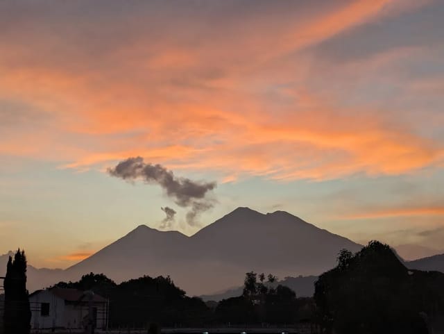
Sierra de las Minas is a mountain range in north-eastern Guatemala, protected as a biosphere reserve by Decreto 49-90 and part of UNESCO’s biosphere network since 1992, which UNESCO says holds about 60 per cent of the country’s remaining cloud forest. UNESCO’s page names two visitor sites: the Salto de Chilascó near Salamá, where the Ministry of Culture’s SIC lists Q35 for foreigners, and the Angel Stone at Los Albores, which UNESCO calls one of the most visited sites in the reserve.
In short: Biosphere reserve, Decreto 49-90 (SIC); UNESCO MAB nomination 1992. Area 240,537 ha (UNESCO) / 240,536.82 ha (CONAP registry). Five departments: Alta Verapaz, Baja Verapaz, El Progreso, Zacapa, Izabal. Administrator: Junta Directiva Sierra de las Minas. Visitor sites named by UNESCO: Salto de Chilascó (over 130 m, Salamá) and Albores (Angel Stone, 2,400 m). Chilascó entry: Q25 nationals / Q35 foreigners / Q10 children (SIC Salto de Chilascó listing, March 2026).
The Sierra is a mountain range, not a single site. UNESCO describes it as one of the truly wild places in Guatemala; the Ministerio de Cultura y Deportes’s cultural information system (SIC) gives it about 130 km of length and a climb from sea level to 3,015 metres. What you can do depends on which of its visitor sites you head for.
Key facts and where they come from
| Fact | Value | Source |
|---|---|---|
| Category | Reserva de la Biosfera | CONAP protected-area registry (read 9 November 2026) |
| Legal instrument | Decreto Número 49-90 del Congreso de la República | SIC listing |
| UNESCO biosphere nomination | 1992 | UNESCO Man and the Biosphere Programme |
| Area | 240,537.00 ha | UNESCO MAB |
| Area | 240,536.82 ha | CONAP registry |
| Area | 242,642 ha | CONAP article of 18 July 2022 |
| Departments | Alta Verapaz, Baja Verapaz, El Progreso, Zacapa, Izabal | SIC listing; CONAP 2022 article |
| Size of the range | About 130 km long, 10-30 km wide, sea level to 3,015 m | SIC listing |
| Administrator | Junta Directiva Sierra de las Minas | CONAP registry; SIC listing |
| World Heritage | Tentative List only, submitted 23 September 2002 | UNESCO World Heritage Centre |
| Reserve-wide entry fee | None given | UNESCO MAB page (read 9 November 2026); the SIC Chilascó listing prices only that visit |
The three area figures are not reconciled by any of the sources, so each is printed with its source. UNESCO’s and CONAP’s registry figures differ by less than one hectare; the 2022 CONAP article is about 2,100 ha higher.
The two visitor sites UNESCO names
Salto de Chilascó. UNESCO calls it one of the highest waterfalls in Central America, over 130 metres, in the community of Santa Cruz, Chilascó, Salamá, Baja Verapaz. The Ministry of Culture’s SIC listing for the waterfall (modified 26 March 2026; its source is the treasurer of the Asociación de Chilasco) places it in Aldea San Rafael Chilasco, off the CA-14 toward Cobán at about km 144, then 12 km of dirt road to the community. It names ASOTUCHI, the local tourism association, as the body that runs the site. For the walk and the fees side by side, see our Salto de Chilascó guide. The town is Salamá.
Albores and the Piedra del Ángel. UNESCO calls the Angel Stone, in the community of Los Albores, one of the most visited sites in the reserve, surrounded by cloud forest at 2,400 metres, where the quetzal, the horned turkey (pavo de cacho in the SIC listing) and other large mammals can be seen. UNESCO’s page (read 9 November 2026) and the SIC Salto de Chilascó listing give no route, hours, fees or contact for Albores, so ask locally before you go.
Fees and hours
The Ministry of Culture’s SIC listing Salto de Chilasco (modified 26 March 2026) gives these figures for the waterfall visit:
| Item | Price | Source |
|---|---|---|
| Guatemalans | Q25.00 | SIC Salto de Chilasco listing |
| Foreigners | Q35.00 | Same |
| Children | Q10.00 | Same |
| Hours | Monday to Sunday, 7:00 am to 4:00 pm | Same |
These are for the Chilascó visit, not a reserve-wide ticket. The listing also names horse rides, forest rangers, food, lodging and camping among the services, without prices. UNESCO’s page (read 9 November 2026) gives no fee for Albores or for the reserve as a whole.
What the reserve protects
- Cloud forest. UNESCO says the range contains an estimated 60 per cent of Guatemala’s remaining cloud forest.
- Species. UNESCO counts at least 885 species of birds, mammals, amphibians and reptiles, and more than 17 evergreen tree species endemic to the area. The SIC listing says the Sierra protects 70% of the fauna species reported for Guatemala and Belize, and lists 44 endemic and 20 threatened species registered with CONAP.
- Water. Per the SIC, 63 rivers rise in the range, in 52 sub-basins, and supply industries, towns and farms in the Polochic, San Jerónimo and Salamá valleys. Rainfall in the high parts ranges from 700 to 3,000 mm a year.
- Genetic isolation. Guatemala’s World Heritage tentative submission describes habitats equivalent to islands of genetic evolution, with high endemism. UNESCO’s biosphere page calls the region an irreplaceable seed resource for reforestation and agroforestry throughout the tropics.
The name. UNESCO explains that the heart of the mountains is jade and marble, mined for centuries, hence the “mountain range of the mines”.
Threats
UNESCO names land-use change for new cultivation as a high threat, mainly to the warm tropical forest and the coniferous and mixed forests of the southern slope, along with harmful farming techniques and forest burning. The SIC listing adds landslides on the steep terrain, illegal hunting, invasions, the pine weevil, solid and liquid waste, deforestation, disorderly water use and forest fires.
Safety
None of the reserve’s five departments is on the do-not-travel list of the State Department’s 12 March 2026 advisory (Level 3 for Guatemala overall). It advises hiking only with a qualified local guide; at Chilascó, ask ASOTUCHI, and for Albores ask locally.
Related
- Salto de Chilascó waterfall, one of the two visitor sites UNESCO names
- Guatemala’s national parks and protected areas
- Biotopo del Quetzal, cloud forest on the same CA-14 corridor
- Salamá, Baja Verapaz and Zacapa
- How CONAP administers Guatemala’s protected areas
Where to stay in Salamá
Compare Booking.com, Airbnb and hotels on one map. Drag the map and set your dates to see live availability and real prices.
Affiliate links — if you book, we earn a small commission at no extra cost to you.
Sources
- UNESCO Man and the Biosphere Programme, Sierra de las Minas (read 9 November 2026)
- UNESCO World Heritage Centre, Tentative List: Sierra De Las Minas Biosphere Reservation (read 9 November 2026)
- Ministerio de Cultura y Deportes, SIC listing, Reserva Biósfera Sierra de Las Minas, Salto de Chilascó (modified 13 February 2025; credits CONAP’s SIGAP tourism routes; read 9 November 2026). Used for registry and natural-history facts only.
- Ministerio de Cultura y Deportes, SIC listing, Salto de Chilasco (modified 26 March 2026; source: treasurer of the Asociación de Chilasco; read 1 November 2026)
- CONAP, protected-area registry, Reserva de la Biosfera Sierra de las Minas (read 9 November 2026)
- CONAP, Reserva de la Biosfera Sierra de las Minas (RBSM) (article dated 18 July 2022; read 9 November 2026)
- U.S. Department of State, Guatemala Travel Advisory, issued 12 March 2026
Affiliate links — if you book, we earn a commission at no extra cost to you.
Before you pay, check each plan's medical-evacuation limit and its rules for hiking and adventure activities. Three options, as each company describes them on its own site:
- Genki Traveler: a monthly subscription for up to 12 months that covers up to €1,000,000 for unexpected medical care while traveling abroad, at public and private doctors and hospitals.
- SafetyWing Nomad Insurance: the Essential plan is travel medical insurance paid every 4 weeks; the Complete plan is full health insurance with extra travel protections.
- Faye: single-trip plans sold to residents of U.S. states (not U.S. territories); its FAQ lists emergency medical cover of up to $250K and emergency medical evacuation of up to $500K, and adventure and extreme activities need a paid add-on for medical cover.
Limits, prices and the altitude rules side by side: travel insurance for Guatemala · insurance for volcano hikes
Affiliate links: we earn a commission if you buy, at no extra cost to you. Plan descriptions come from each insurer's own site, read September 22-25, 2026; Genki's limit is in euros, Faye's in U.S. dollars; this is not insurance advice. Disclosure
Frequently Asked Questions
How do you visit the Sierra de las Minas Biosphere Reserve?
By heading for one of its visitor sites. UNESCO’s page names two: the Salto de Chilascó waterfall in Santa Cruz, Chilascó, Salamá (Baja Verapaz), and the Angel Stone in the community of Los Albores. For Chilascó, the Ministry of Culture’s SIC listing for the waterfall (modified 26 March 2026) gives the way in: the CA-14 toward Cobán, at about km 144, then 12 km of dirt road to the community of Chilascó.
How much is the entrance fee to Sierra de las Minas?
The SIC listing for the Salto de Chilascó (modified 26 March 2026) gives Q25 for Guatemalans, Q35 for foreigners and Q10 for children, Monday to Sunday, 7:00 am to 4:00 pm. Those prices are for the Chilascó visit. UNESCO’s page (read 9 November 2026) gives no fee, for the reserve as a whole or for Albores.
Where is Sierra de las Minas?
In north-eastern Guatemala, between the Polochic and Motagua valleys. The SIC listing says the range spans five departments (Alta Verapaz, Baja Verapaz, El Progreso, Zacapa and Izabal), runs about 130 km east to west, is 10 to 30 km wide and rises from sea level to 3,015 metres.
Why is Sierra de las Minas important?
UNESCO says it contains an estimated 60 per cent of Guatemala’s remaining cloud forest and at least 885 species of birds, mammals, amphibians and reptiles, with more than 17 endemic evergreen tree species. The SIC listing says 63 rivers rise in the range, in 52 sub-basins, supplying farms and towns in the surrounding valleys.
Who manages Sierra de las Minas?
CONAP’s protected-area registry and the SIC listing both name the Junta Directiva Sierra de las Minas as administrator. The reserve was declared by Decreto Número 49-90 of the Congress, per the SIC, and UNESCO lists 1992 as its year of nomination to the Man and the Biosphere network.
Is Sierra de las Minas a World Heritage Site?
No. Guatemala’s Ministry of Culture and Sports submitted it to UNESCO’s World Heritage Tentative List on 23 September 2002 under natural criteria (vii) to (x). A tentative listing is not an inscription. Its UNESCO status is biosphere reserve, nominated in 1992.