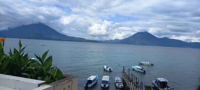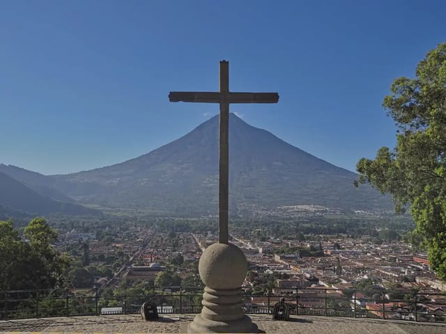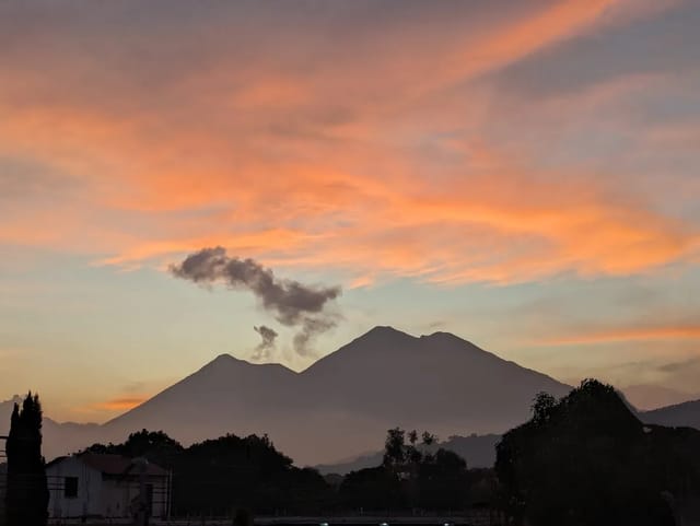
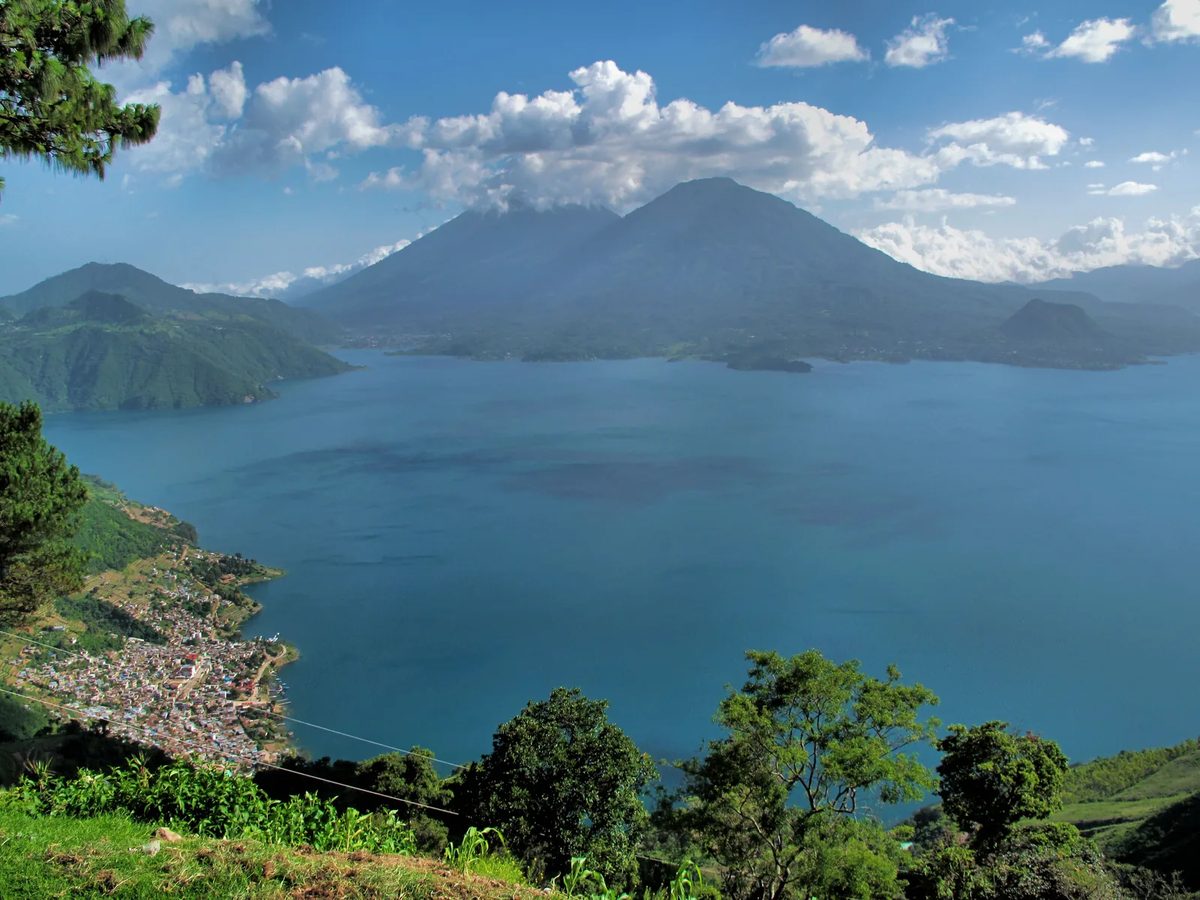
Indian Nose – known locally as Rostro Maya – is the viewpoint of San Juan La Laguna, at the highest point above the town, and the municipality describes the mountain as the face of a person lying on its back, looking at the sky. From the summit you can see Lake Atitlán and the San Pedro, Tolimán and Atitlán volcanoes, and the peaks of Acatenango and Fuego.
The usual plan is to climb before dawn and watch the sun come up over the lake.
Quick Facts
| Detail | Info |
|---|---|
| Elevation | 2,200 m (7,218 ft), per the San Juan La Laguna municipality |
| Duration | 30-45 minutes up from Santa Clara La Laguna; about 2 hours from San Juan town |
| Difficulty | Short but steep |
| Community Fee | Not on the municipal page; ask locally |
| Guide Fee | The municipality recommends a local guide; ask for a written price |
| Tour Package | Ask operators for a written quote |
| Best Time | Before dawn, for the sunrise |
| Nearest Towns | San Juan La Laguna, Santa Clara La Laguna |
What You’ll See
From the summit, the San Juan La Laguna municipality lists this view:
- Lake Atitlan below
- Volcan San Pedro (3,020 m)
- Volcan Toliman (3,158 m)
- Volcan Atitlan (3,537 m), the tallest of the three
- The peaks of Acatenango and Fuego, further away
Volcano heights are from AMSCLAE, the Lake Atitlán basin authority, which puts the lake at 1,560 metres above sea level.
How to Get There
The San Juan La Laguna municipality gives two ways to reach San Juan: by road, turning off the Interamericana at kilometre 148 at the sign for Santa Clara La Laguna and descending through Santa Clara and San Pablo La Laguna; or by lancha from Panajachel.
From Panajachel (Most Common)
By road: follow the kilometre-148 turnoff to Santa Clara La Laguna, where the sunrise route starts.
By boat: the Asociación de Lancheros San Juan Bautista runs Panajachel to San Juan from 07:00 to 19:00, about every 20 minutes, and San Juan to Panajachel from 06:00 to 17:30; the fare to any town on that route is Q25 (San Juan La Laguna municipality, read 8 October 2026). The San Juan Bautista association’s first boat from Panajachel leaves at 07:00, so for sunrise you need to sleep near the trailhead or arrange private transport the night before.
From San Juan La Laguna (Closest)
San Juan is the lakeside town below the viewpoint. The municipality puts the walk from town to the summit at about 2 hours; a tuk-tuk to the Santa Clara trailhead shortens it, so agree the price before you get in.
From San Pedro La Laguna
The Santa Clara trailhead is a short tuk-tuk ride from San Pedro or San Juan (AtitlanVida). Tour agencies in San Pedro sell sunrise trips; ask for a written quote that says what it includes.
Where to stay near the trailhead: because the hike starts before dawn, base yourself in San Juan or San Pedro La Laguna the night before and arrange the pre-dawn pickup with your hostel.
Where to stay in San Juan La Laguna
Compare Booking.com, Airbnb and hotels on one map. Drag the map and set your dates to see live availability and real prices.
Affiliate links — if you book, we earn a small commission at no extra cost to you.
Indian Nose from San Marcos
Tours with Vick’s private Indian Nose hike itinerary names San Juan and San Marcos as meeting places and lists a van journey of 35 minutes each way (read 25 October 2026). Its pickup description says the guide and driver meet near the hotel or on the closest main street; the precise meeting arrangement needs operator confirmation.
For the 26 October 2026 departure at 04:00, its booking calendar displayed Adult:2 x $52.00 and a total of $104.00. This was a quote for that date and party, rather than an undated rate. The product includes the entrance fee and coffee and/or tea; breakfast and meals are excluded.
For comparison, Indian Nose Hike lists round-trip transportation, a local guide and entrance fees for its hikes from San Pedro, San Juan or Panajachel (read 25 October 2026). Those named starting points do not include San Marcos.
The Trail
On the Santa Clara route, the ascent is steep but brief: most fit hikers reach the summit platform in 30 to 45 minutes (AtitlanVida, read 8 October 2026). The longer option starts in San Juan town and takes about 2 hours, through nature and, as the municipality puts it, the stories of the place. You can also camp on the hill, Cerro K’istalin, and be at the top for first light.
Timing
- Before dawn: the municipality suggests starting the climb in the early morning to watch the sunrise over the lake.
- Boats: the San Juan Bautista association’s first boat from Panajachel leaves at 07:00, so plan road transport or sleep on the San Juan side.
- Light: bring a headlamp for the approach in the dark – you want both hands free.
What to Bring
The San Juan La Laguna municipality recommends:
- Water and a snack – fruit bars or light bread for breakfast at the viewpoint
- Camera
- A warm layer (abrigo)
- Shoes for climbing
- Sunscreen
- A local guide
Add a headlamp for the pre-dawn approach and cash in quetzales for the community fee and transport.
Costs Breakdown
| Item | GTQ | USD (approx) |
|---|---|---|
| Lancha Panajachel to San Juan (any stop on the route) | Q25 | $3.27 |
| Community entry fee | Ask locally | – |
| Local guide | Ask for a written price | – |
Lancha fare from the San Juan La Laguna municipality, read 8 October 2026; USD at the Banguat reference rate of Q7.64157 for 10 October 2026. See current exchange rates for up-to-date conversion.
After the Hike
Artisan cooperatives: the municipality describes San Juan La Laguna as a quiet town with rich craftwork and its women weavers.
Explore the lake: from San Juan, lanchas run back to Panajachel, stopping at San Pablo, San Marcos, Tzununá, Jaibalito and Santa Cruz, for Q25 (San Juan La Laguna municipality).
Tips
- Hire a local guide. The San Juan La Laguna municipality recommends one and lists a contact for local guides on its Rostro Maya page.
- Cloud cover happens. Check the forecast the night before.
- Bring cash. Have small bills for the community fee and transport.
See also: Things to Do in San Pedro La Laguna, Priced.
Sources
Tours with Vick private Indian Nose hike and embedded booking calendar, read 25 October 2026.
Indian Nose Hike tour catalogue, read 25 October 2026.
San Juan La Laguna municipality, Rostro Maya en San Juan (read 8 October 2026) and lake transport recommendations (read 8 October 2026).
AMSCLAE, Lago de Atitlán (volcano heights and lake elevation, read 12 September 2026).
AtitlanVida, Indian Nose sunrise hike guide (Santa Clara route duration, read 8 October 2026).
For more Lake Atitlan hiking, see the San Pedro Volcano climb. Browse all trails in our hiking directory or check current exchange rates for cost planning.
Frequently Asked Questions
How long is the Indian Nose hike?
On the Santa Clara La Laguna route, most fit hikers reach the summit platform in 30 to 45 minutes; the ascent is steep but brief (AtitlanVida, read 8 October 2026). Walking from the town of San Juan La Laguna takes about 2 hours, per the municipality’s own page.
What time should I start the Indian Nose hike?
Start before dawn: the San Juan La Laguna municipality suggests climbing in the early morning to watch the sunrise over the lake, or camping on the hill. The San Juan Bautista association’s first boat from Panajachel leaves at 07:00, so stay in San Juan or San Pedro the night before or book a pre-dawn pickup. Bring a headlamp for the walk in the dark.
How much does Indian Nose cost?
The San Juan La Laguna municipality’s Rostro Maya page, read 8 October 2026, lists no entry fee or guide price. Ask your guide or hostel for the current community fee and carry cash. The public lancha from Panajachel to San Juan costs Q25, per the municipality.
Can I start an Indian Nose hike from San Marcos?
Tours with Vick names San Juan and San Marcos as meeting places for its private Indian Nose hike and lists a van journey of 35 minutes each way. The product includes the entrance fee and coffee and/or tea, with breakfast and meals excluded (read 25 October 2026).