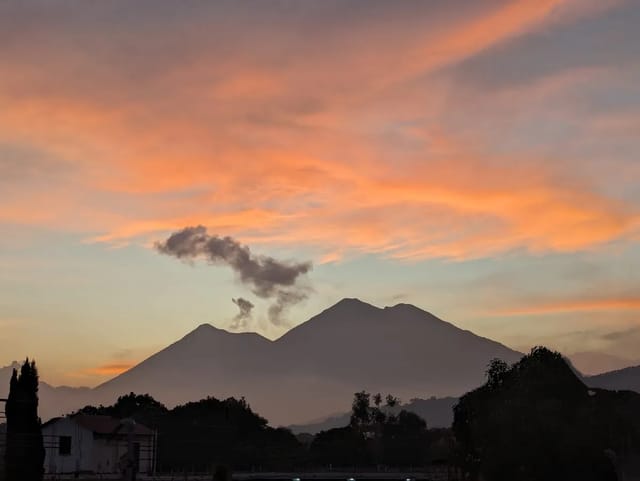
Bocas del Polochic is the wetland where the Río Polochic meets Lake Izabal, in El Estor, Izabal: a wildlife refuge declared by Decreto 38-96 and listed as Ramsar site no. 813. CONAP lists it open Monday to Sunday, 07:00 to 17:00. CONAP, the Ministry of Culture and the decree publish no entry fee; Adrenalina Tours sells a US$125-per-adult day tour from Río Dulce that excludes entrance fees.
Quick summary: About 20,760 hectares under Decreto 38-96 (14,360 ha land, 6,400 ha water); 21,227 ha in the Ramsar register. Hours Monday to Sunday 07:00-17:00 (CONAP). Two roads: via El Estor (43 km from the Río Dulce bridge turn-off, 30 km of it dirt) or via Mariscos to the Selempín scientific station. Administrator: Fundación Defensores de la Naturaleza, (+502) 7949-7130 / 7237. No entry fee published by CONAP. Adrenalina Tours: US$125 per adult from Río Dulce, about 10 hours, entrance fees not included.
CONAP lists the refuge as habitat of the manatee and counts more than 250 bird species in it. This page sets out what the decree, CONAP, the Ministerio de Cultura’s cultural information system (SIC) and the Ramsar register actually say, and marks clearly what none of them publish.
Key facts and where they come from
| Fact | What the source says | Source |
|---|---|---|
| Legal status | Protected area, managed under the category of refugio de vida silvestre | Decreto 38-96, Articles 1 and 2 |
| Date of the decree | 11 June 1996; not repealed per the UNEP LEAP / FAOLEX record | Decreto 38-96; UNEP LEAP |
| Location | Municipality of El Estor, department of Izabal | Decreto 38-96; CONAP |
| Area (decree) | About 20,760 ha: 14,360 ha land, 6,400 ha water | Decreto 38-96, Article 1; CONAP lists 20,760 ha |
| Area (Ramsar) | 21,227 ha | Ramsar Sites Information Service, site 813 |
| Ramsar designation | 20 March 1996, site no. 813 | Ramsar Sites Information Service |
| Administration | CONAP, which may delegate to Fundación Defensores de la Naturaleza | Decreto 38-96, Article 5 |
| Listed administrator | Fundación Defensores de la Naturaleza | CONAP tourism portal; SIC lists CONAP / FDN |
| Hours | Monday to Sunday, 07:00 to 17:00 | CONAP tourism portal |
| Entry fee | None published | CONAP, SIC and the decree give no amount |
Why two different areas?
The two figures come from two different documents. The Congress decree, and CONAP’s tourism page after it, give an approximate 20,760 hectares, split into 14,360 ha of land and 6,400 ha covered by water. The Ramsar Convention’s site record gives 21,227 ha, and notes that its most recent information sheet dates from 1996. Neither source explains the gap of roughly 470 ha, so we print both and do not merge them. The Ramsar designation (20 March 1996) also came before the Congress decree (11 June 1996). The decree’s preamble notes that the Ley de Áreas Protegidas, Decreto 4-89, had already named Bocas del Polochic an area of special protection in its article 90, and that Guatemala ratified its adhesion to the Ramsar Convention by Decreto 4-88.
Entry fee: none published
CONAP’s tourism page publishes hours, size, access and contact details but no price. The Ministerio de Cultura’s SIC listing gives none either, and Decreto 38-96 sets no amount.
What the decree does say, in Article 7(c), is that the refuge’s budget includes the proceeds of activities organised by its administration, for which the administering entity will set a charge per visit, a research fee or a charge for any other activity in the master plan. In other words, the manager is allowed to charge, and a fee may be collected on the day, but CONAP, the SIC listing and the decree do not publish its amount.
Two further signals point the same way. Adrenalina Tours lists “Entrance fees, food and gratuities” as not included in its tour. The private directory Guatevalley says “Los precios pueden variar dependiendo las fechas y la Administración de Bocas del Polochic” (prices may vary by date and the refuge administration). Ask the administrator for the current charge before you travel, and carry cash in quetzales.
Hours and contact
CONAP’s tourism portal lists the hours as “Lunes a Domingo 07:00 a 17:00 horas” (Monday to Sunday, 7 a.m. to 5 p.m.). It recommends: “Contactar a la administración del área y a las comunidades locales que prestan los servicios, previo a su visita” (contact the area’s administration and the local communities that provide the services before your visit).
The administrator contact, exactly as CONAP prints it:
- Administrator: Fundación Defensores de la Naturaleza
- Telephone: (+502) 7949-7130 / 7237
- Email: info@defensores.org.gt and asisbocas@defensores.org.gt
Getting there: two roads from the CA-9
CONAP names the CA-9 Norte (the highway to the Atlantic) as the main access road and gives an estimated arrival time of 6 hours, without saying from where. It lists two routes.
| Route | Directions (CONAP) | Road surface | Ends at |
|---|---|---|---|
| Via El Estor | CA-9 to km 245, then the CA-13 toward Río Dulce; after crossing the Río Dulce bridge, take the turn-off to El Estor, 43 km away | 30 of the 43 km are dirt road, passable all year | The municipal centre of El Estor |
| Via Mariscos | CA-9 to the Trincheras junction at km 218, which leads to Mariscos; then the dirt road parallel to the Lake Izabal shore | Dirt road | The Selempín scientific station |
The Ministerio de Cultura’s SIC listing gives the same two roads with distances from Guatemala City: about 320 km via the CA-13 junction at aldea La Ruidosa (km 245), and about 230 km to the Trincheras junction for Mariscos. It adds a third approach, from Cobán in Alta Verapaz along road 7-E to El Estor, and says that on the water you take a community or private boat (lancha comunitaria o particular).
For the drive from the capital to the CA-13 junction and the bridge, see our Guatemala City to Río Dulce driving guide, or the bus and shuttle options to Río Dulce. Adrenalina Tours puts El Estor 45 km and about 1 hour from Río Dulce; Guatevalley gives 43 km and about 1 hour.
Wildlife: what the official sources list
CONAP describes the refuge as a wetland formed where the Río Polochic flows into Lake Izabal, a mix of tropical rainforest, floodplains and rivers. It credits the area with:
- More than 250 bird species
- Important populations of howler monkeys (Alouatta pigra) and otters (Lutra longicaudis)
- A wide variety of mammals, reptiles, amphibians and fish, which CONAP says earned it the nickname nido de la vida (nest of life)
- The manatee (Trichechus manatus), which CONAP calls a species in grave danger of extinction
The Ministerio de Cultura’s SIC listing says the wetland’s fauna is abundant and mostly birds. By their Spanish names, it lists garzas (herons), garza real, garzón gris, garza verde, cormorán (cormorant), gavilán caracolero, martín pescador de collar, el amazonas and el pigmeo. Harder to observe, it says, are the avetorito americano, gavilán pecho naranja, paloma escamosa and loro cabeza blanca. Among mammals, it calls the manatee the wetland’s emblematic species and says Bocas del Polochic is a key feeding and resting place for it, with a large presence of calves. It also lists the black howler monkey, otter, jaguar, puma, ocelot, margay, jaguarundi and tapir.
AGN, the government news agency, reported on 3 February 2023, citing CONAP, that El Estor has the largest number of manatees in Guatemala and that the refuge holds close to 400 plant species and more than 250 bird species. AGN quotes CONAP: “Es la zona reproductiva más importante para el manatí en el Atlántico de Guatemala” (it is the most important breeding zone for the manatee on Guatemala’s Atlantic side). AGN also reported, from Defensores’ website, that about 5,500 people, most of them Maya, live in the communities around the protected area.
The Ramsar record describes seasonal wetland habitats with diverse aquatic plants and lowland broad-leaved forest, and says the site works as a biological corridor for large mammals from nearby ecosystems.
Neither CONAP nor the SIC listing publishes a manatee sighting rate or a best season. Treat a manatee as a possibility, not a promise. Species counts also differ between sources (FLAAR Mesoamerica, citing Defensores in 2022, gives 341 flora and 500 fauna species), so we quote each figure with its source rather than combining them.
Threats
The SIC listing says the Río Polochic carries suspended sediment from soil erosion in its basin, along with fertilisers and pesticides that have altered the water quality of Lake Izabal. The Ramsar record lists subsistence fishing, hunting, firewood cutting, agriculture and cattle ranching among the human activities at the site.
Visiting: services and community tourism
The SIC listing (undated) lists these services: rustic lodging, a rest and camping area, trails, changing rooms, telephone, local guides, food, handicraft sales and toilets. It names no lodge and gives no prices. CONAP’s page mentions the Selempín scientific station only as the end of the Mariscos road and publishes no rates for staying there.
On the El Estor side, boat trips run through community tourism. In February 2014 Prensa Libre reported a community-run tourist site in the Q’eqchi’ village of Chapín Abajo, El Estor, offering boat trips for birdwatching, with manatees sometimes seen, and bungalows with electricity and piped water. That article is more than ten years old. Adrenalina Tours’ tour page (read 9 November 2026) names the Chapín Abajo community, linked to Defensores de la Naturaleza, as its boat partner.
Tours from Río Dulce
| Operator | Price | From | Duration | Included | Not included |
|---|---|---|---|---|---|
| Adrenalina Tours | US$125 per adult | Your hotel in Río Dulce | About 10 hours | Ground transport, boat from El Estor (about 3 hours), bilingual guide/driver, El Paraíso waterfall | Entrance fees, food, tips |
| Anywhere.com | From US$290 | Río Dulce | 9 hours | Boat transport, life jackets; a local guide on request | Meals and admission fees |
Prices as listed on each operator’s page, read 9 November 2026 (UTC).
Adrenalina Tours runs the trip every day. Its page says it drives you from your hotel in Río Dulce to El Estor, where you board a boat with the Chapín Abajo community, and ends with a visit to the El Paraíso waterfall; see our Finca El Paraíso hot waterfall guide. The page gives more than one start time (a 06:00 departure, advice to leave at 5 a.m. before breakfast, and an 08:00 option in the booking form), so confirm the pickup time when you book. Its child price is also listed inconsistently across two pages, so ask for it directly.
Anywhere.com sells a broader day from Río Dulce, at 7 a.m. every day, in English and Spanish, that also includes the Cañón del Boquerón and Finca El Paraíso, so it is not a refuge-only trip. Its page does not say whether the US$290 is per person or per booking.
The Río Dulce directory inriodulce.net advises spending the night in El Estor because its tours leave early to see the animals.
Where to stay
Sleep in El Estor to be at the boat early, or in Río Dulce if you are taking Adrenalina’s tour with hotel pickup. Live availability around El Estor:
Where to stay in El Estor
Compare Booking.com, Airbnb and hotels on one map. Drag the map and set your dates to see live availability and real prices.
Affiliate links — if you book, we earn a small commission at no extra cost to you.
Related
- El Estor municipality and the Izabal department page
- Things to do in Río Dulce and Castillo de San Felipe
- Río Dulce to Livingston by boat and Livingston
- Laguna Lachuá, a rainforest lake in Alta Verapaz
- How CONAP administers Guatemala’s protected areas
- All Guatemala activities
Sources
- Decreto 38-96 del Congreso de la República, full text on FAOLEX; catalogue record on UNEP LEAP
- CONAP tourism portal (SIGAP), Refugio de Vida Silvestre Bocas de Polochic
- Ministerio de Cultura y Deportes, SIC listing for Bocas del Polochic
- Ramsar Sites Information Service, site 813
- AGN, Bocas del Polochic, hogar de manatíes en el Atlántico (3 February 2023)
- Operator pages: Adrenalina Tours (Bocas de Polochic tour), Anywhere.com (Bocas de Polochic Tour), inriodulce.net tour list
- Secondary: Prensa Libre (23 February 2014) on Chapín Abajo; FLAAR Mesoamerica (13 June 2022); Guatevalley directory
All sources read 9 November 2026 (UTC). Nothing on this page comes directly from Defensores de la Naturaleza’s website.
Affiliate links — if you book, we earn a commission at no extra cost to you.
Before you pay, check each plan's medical-evacuation limit and its rules for hiking and adventure activities. Three options, as each company describes them on its own site:
- Genki Traveler: a monthly subscription for up to 12 months that covers up to €1,000,000 for unexpected medical care while traveling abroad, at public and private doctors and hospitals.
- SafetyWing Nomad Insurance: the Essential plan is travel medical insurance paid every 4 weeks; the Complete plan is full health insurance with extra travel protections.
- Faye: single-trip plans sold to residents of U.S. states (not U.S. territories); its FAQ lists emergency medical cover of up to $250K and emergency medical evacuation of up to $500K, and adventure and extreme activities need a paid add-on for medical cover.
Limits, prices and the altitude rules side by side: travel insurance for Guatemala · insurance for volcano hikes
Affiliate links: we earn a commission if you buy, at no extra cost to you. Plan descriptions come from each insurer's own site, read September 22-25, 2026; Genki's limit is in euros, Faye's in U.S. dollars; this is not insurance advice. Disclosure
Frequently Asked Questions
What is Bocas del Polochic?
A wildlife refuge (refugio de vida silvestre) in the municipality of El Estor, Izabal, where the Río Polochic flows into Lake Izabal. Congress declared it a protected area by Decreto 38-96, dated 11 June 1996, with an approximate area of 20,760 hectares: 14,360 ha of land and 6,400 ha covered by water. It is also Ramsar site no. 813, designated on 20 March 1996, which the Ramsar register records at 21,227 ha.
How much is the entrance fee to Bocas del Polochic?
CONAP’s tourism page, the Ministerio de Cultura’s SIC listing and the decree itself give no amount (all read 9 November 2026 UTC). Article 7(c) of Decreto 38-96 lets the administering entity set a charge per visit, so a fee may apply on the day. Adrenalina Tours’ package from Río Dulce lists entrance fees as not included. Ask the administrator before you go and carry cash.
What are the opening hours of Bocas del Polochic?
CONAP’s tourism portal lists Monday to Sunday, 07:00 to 17:00. CONAP also recommends contacting the area’s administration and the local communities that provide services before your visit.
How do you get to Bocas del Polochic?
CONAP lists two roads, both off the CA-9. Via El Estor: at km 245 take the CA-13 toward Río Dulce, cross the Río Dulce bridge and take the turn-off to El Estor, 43 km away, 30 km of it dirt road passable all year. Via Mariscos: take the CA-9 to the Trincheras junction at km 218, which leads to Mariscos, then the dirt road along the Lake Izabal shore to the Selempín scientific station. CONAP gives an estimated travel time of 6 hours without naming the starting point.
Is there a tour to Bocas del Polochic from Río Dulce?
Yes. Adrenalina Tours sells a Bocas de Polochic tour from Río Dulce at US$125 per adult: ground transport to El Estor (about 1 hour), a boat trip from El Estor with the Chapín Abajo community (about 3 hours), a bilingual guide/driver and a visit to El Paraíso waterfall, about 10 hours in total. Entrance fees, food and tips are not included.
Can you see manatees at Bocas del Polochic?
It is possible but not guaranteed. CONAP says the refuge is habitat of the manatee (Trichechus manatus), a species in grave danger of extinction. A February 2023 AGN report, citing CONAP, called El Estor the area with the most manatees in Guatemala and the refuge the most important breeding zone for the manatee on Guatemala’s Atlantic side. Neither CONAP nor the SIC listing publishes a sighting rate or best season.
Who manages Bocas del Polochic and how do I contact them?
Decreto 38-96 puts the refuge under CONAP, which may delegate its administration to the Fundación Defensores de la Naturaleza. CONAP’s tourism page lists Defensores as administrator, with telephone (+502) 7949-7130 / 7237 and the emails info@defensores.org.gt and asisbocas@defensores.org.gt.