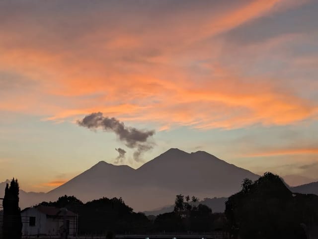
This page does one thing the national earthquake tracker does not: it filters the same USGS feed to the 50 km around Antigua Guatemala and sets those events against the city’s own record, which runs from the 1541 disaster at Ciudad Vieja through 1773 to 1976. Distances are measured from Antigua’s central point (14.5586, -90.7295) to each epicentre.
Quick summary:
- Live list: the first table reads the site’s USGS feed (the most recent events, up to 50, from the last 30 days; M2.5 and above inside Guatemala) and keeps only epicentres within 50 km of Antigua. The time the feed was pulled and the dates of the events it holds are printed above the table.
- 2016 to October 9, 2026: USGS lists 24 earthquakes of M4.5 or more within 50 km of Antigua between January 1, 2016 and October 9, 2026. The largest values were M5.7, on July 8, 2025 near Amatitlán and on June 17, 2018 near Guanagazapa.
- History: USGS Professional Paper 1002 records damage to Antigua in 1565, 1577, 1586, 1607, 1651, 1689, 1717, 1751, 1773, 1830 and 1874, among others; UNESCO ties the 1773 Santa Marta earthquakes to the move of the capital.
- If it shakes: CONRED’s emergency number is 119.
Earthquakes within 50 km of Antigua, from the live feed
Pulled Oct 9, 2026 at 18:42 Guatemala time from USGS Earthquake Hazards Program.
The feed holds 12 events, from 2026-09-10 07:29 GT to 2026-10-07 01:43 GT.
1 of them within 50 km of Antigua.
| Date and time (Guatemala) | Magnitude | USGS location | Depth | Distance from Antigua |
|---|---|---|---|---|
| 2026-10-02 05:35 GT | M4.2 mb | 9 km SSW of Yepocapa, Guatemala | 115 km | 31 km |
Nearest event to Antigua anywhere in the feed: M4.2, 9 km SSW of Yepocapa, Guatemala, 2026-10-02 05:35 GT, 31 km away.
Straight-line distance from 14.5586, -90.7295 to the epicentre, computed from the latitude and longitude USGS publishes. The feed keeps the most recent events, up to 50, from a query of the last 30 days: M2.5 and above inside Guatemala and M4.5 and above in the border zone; in a busy month it spans less than 30 days, which is why its dates are printed above. Depth and magnitude are USGS's; INSIVUMEH keeps its own records.
The table comes from the same USGS file that drives the national earthquake tracker, which also explains how INSIVUMEH’s magnitudes differ from USGS’s and lists the feed’s events nationwide. An empty table means no epicentre among the events the feed holds fell inside the 50 km circle; it does not mean nothing was felt, because the feed stops at M2.5 inside Guatemala.
2016 to October 9, 2026: every M4.5 or larger within 50 km
USGS catalogue query for M4.5 and above within 50 km of Antigua, January 1, 2016 to October 9, 2026, captured October 9, 2026. Times converted to Guatemala time (UTC-6). Distance computed from the USGS epicentre.
| Date and time (Guatemala) | Magnitude | USGS location | Depth | Distance from Antigua |
|---|---|---|---|---|
| 2025-10-21 17:06 | M4.7 mb | 2 km SSE of Fraijanes | 178 km | 34 km |
| 2025-08-19 02:05 | M4.6 mb | 9 km ESE of San Vicente Pacaya | 188 km | 27 km |
| 2025-07-08 15:54 | M4.8 mb | 6 km SW of Santa María de Jesús | 5 km | 12 km |
| 2025-07-08 15:41 | M5.7 mww | 3 km SSW of Amatitlán | 10 km | 15 km |
| 2025-07-08 15:11 | M4.8 mww | 4 km WSW of Amatitlán | 10 km | 13 km |
| 2025-01-22 19:56 | M4.8 mb | 2 km WSW of Villa Canales | 188 km | 21 km |
| 2024-11-19 08:56 | M4.7 mb | 1 km SSW of Antigua Guatemala | 179 km | 1 km |
| 2024-06-11 20:55 | M4.9 mww | 5 km N of San Pedro Ayampuc | 15 km | 42 km |
| 2023-06-01 04:02 | M4.6 mb | Guatemala (no nearer place given) | 212 km | 12 km |
| 2022-06-26 01:05 | M4.6 mb | 2 km NE of San Andrés Itzapa | 196 km | 14 km |
| 2021-12-14 15:22 | M4.5 mb | 7 km NNE of Guanagazapa | 191 km | 33 km |
| 2020-09-27 03:40 | M5.3 mww | 6 km E of Masagua | 110 km | 40 km |
| 2020-09-14 08:29 | M4.6 mb | 6 km ESE of Patulul | 137 km | 43 km |
| 2020-08-18 04:01 | M4.8 mb | 5 km S of Santa Lucía Cotzumalguapa | 96 km | 44 km |
| 2019-11-09 02:32 | M5.5 mww | 9 km WSW of Mataquescuintla | 200 km | 49 km |
| 2019-06-12 21:31 | M4.7 mb | 7 km E of Fraijanes | 208 km | 39 km |
| 2019-04-15 22:04 | M4.5 mb | 5 km NW of Palín | 79 km | 13 km |
| 2018-06-17 20:32 | M5.7 mww | 12 km SW of Guanagazapa | 99 km | 47 km |
| 2017-09-19 20:37 | M4.9 mb | 4 km ENE of Acatenango | 179 km | 19 km |
| 2017-07-19 05:26 | M4.8 mb | 3 km WSW of Fraijanes | 195 km | 30 km |
| 2017-06-04 17:57 | M4.8 mb | 0 km SW of Amatitlán | 184 km | 14 km |
| 2017-02-16 07:33 | M4.8 mb | 2 km S of Petapa | 202 km | 20 km |
| 2016-11-25 09:08 | M4.7 mb | 2 km ESE of Santa Apolonia | 195 km | 34 km |
| 2016-05-08 01:52 | M4.7 mb | 7 km SSE of Patulul | 114 km | 49 km |
Two things stand out in the record. Depth varies widely: 14 of the 24 epicentres sit 150 km or more below the surface, including the M4.7 of November 19, 2024 that USGS places 1 km SSW of Antigua at 179 km depth, while the July 8, 2025 events were at 5 to 10 km. The July 8, 2025 sequence put three M4.8 to M5.7 shocks within 43 minutes, all between 12 and 15 km from Antigua.
A lower threshold gives more events: a separate USGS query for M3 and above within 50 km from October 1, 2025 returned 6 events, the largest the M4.7 near Fraijanes on October 21, 2025.
The July 17, 2026 M7.3 and Antigua
The M7.3 of July 17, 2026 (08:48 Guatemala time) was centred 60 km WSW of Puerto Madero, Mexico, at 22 km depth, about 240 km from Antigua; an M6.4 followed at 09:20, about 263 km away. Neither falls inside the 50 km circle. The national earthquake tracker covers that sequence.
Antigua’s earthquake history, as USGS and UNESCO record it
The table below is from the chronological historical record in USGS Professional Paper 1002 (the preliminary report on the 1976 earthquake): every entry that names Antigua or Ciudad Vieja. The report itself warns that primary sources had not been checked for every entry, so the list may have omissions or errors.
| Date (as listed) | What USGS PP 1002 records for Antigua |
|---|---|
| 1526 July 19 or 20 | A damaging earthquake caused the Spanish settlement to be moved to Ciudad Vieja |
| 1541 September 10 | Two destructive earthquakes at Ciudad Vieja killed about 150 Spaniards and at least 600 others; the main Spanish settlement then moved to Antigua |
| 1565 February | A series of violent earthquakes caused extensive damage in and near Antigua |
| 1575 | Several large shocks caused damage in San Salvador and also in Antigua |
| 1577 November 30 | Swarm; the largest shock caused much damage in Antigua |
| 1586 December 23 | Long sequence from January 16, 1585, with an eruption of Fuego; Antigua destroyed, many deaths |
| 1607 April | Many buildings collapsed in Antigua, killing a number of people |
| 1651 February 18 | Extensive damage in Antigua |
| 1681 July 22 | A swarm of earthquakes caused extensive damage in Antigua |
| 1684 August | Earthquake swarm caused notable damage in the Antigua area |
| 1689 February 12 | Swarm with extensive damage and loss of life in the Antigua area, stronger than 1651 |
| 1702 August 4 | Extensive damage in Antigua |
| 1717 September 29-30 | Antigua damaged on the 29th and destroyed on the 30th; extensive loss of life; violent eruptions of Fuego |
| 1751 March 4 | Antigua damaged; Cathedral dome destroyed |
| 1773 July 29 | Main shock of a swarm from May to December; Antigua completely destroyed, many deaths; capital moved to Guatemala City |
| 1830 April 1 | Swarm similar to 1773 destroyed many buildings in Antigua |
| 1853 February 9 | Major earthquake caused great alarm in Quetzaltenango; also strongly felt in Antigua and Amatitlán |
| 1862 December 19 | Antigua, Amatitlán, Escuintla, Tecpán and neighbouring towns severely damaged |
| 1874 September | Antigua, Chimaltenango and Patzicía destroyed; 200 people killed |
The same report sums it up: Antigua was extensively damaged by earthquakes 11 times between 1565 and 1773, and accounts say it was destroyed in 1586, 1717, 1773 and 1874. Its map of historical seismicity notes that the zone near Antigua apparently has particularly high seismicity.
1773: the Santa Marta earthquakes and the move of the capital
UNESCO’s World Heritage listing for Antigua (inscribed 1979) gives the sequence: the city was founded in 1524 as Santiago de Guatemala, re-established in 1527, buried by earthquakes and an avalanche in 1541, and inaugurated at its third site, the Valley of Panchoy, in March 1543. It stood there for 230 years until the 1773 Santa Marta earthquakes destroyed much of the town, and the authorities ordered the capital moved to what became Guatemala City. UNESCO adds that the partial abandonment of the city in 1776, together with rules prohibiting repair and new construction, is why the grid and the Baroque buildings and ruins survive. It describes the local style, Barroco antigueño, as an adaptation of the Baroque built to withstand the region’s earthquakes, with massive buildings and low bell towers.
USGS PP 1002 adds that the 1773 shocks were felt even more strongly in Chimaltenango and Quetzaltenango, nearer the Motagua fault, and that the fault may have been their source.
1976: the February 4 earthquake
| Detail | Value | Source |
|---|---|---|
| Date and time | February 4, 1976, 09:01 UTC (03:01 Guatemala time) | USGS event usp0000ex3 |
| Magnitude | M7.5 (Mw) | USGS event usp0000ex3 |
| Epicentre | 7 km N of Los Amates, Guatemala; about 195 km from Antigua (computed) | USGS event usp0000ex3 |
| Deaths nationwide | More than 23,000 | USGS impact summary |
| Antigua | Figure 69 of PP 1002 shows massive destruction of some adobe houses near the centre of town | USGS PP 1002 |
| Intensity | Isoseismal VIII and higher across Sacatepéquez, Chimaltenango, Guatemala and southern Quiché | USGS PP 1002 |
USGS’s summary calls it the most destructive earthquake in Guatemala since 1917, with most adobe structures in the outlying areas of Guatemala City destroyed and many landslides blocking transport.
What to do in Antigua when it shakes
These are CONRED’s nationwide recommendations from its press note 183-2026 of July 17, 2026.
| When | CONRED recommends |
|---|---|
| Before | A family response plan; know the safe zones in your home and the evacuation routes; a 72-hour bag with water, non-perishable food, important documents, medicines, a flashlight and a radio |
| During | Keep calm; move away from windows, shelves and objects that can fall; take shelter in a safe place; if you must evacuate, do it in order, without running or pushing |
| After | Check your home for damage; watch for aftershocks; follow only instructions from the authorities |
| Emergency | Report to 119 |
CONRED’s note also cites INSIVUMEH: more than 3,720 earthquakes recorded in Guatemala during 2026 as of July 17. For volcano activity around Antigua, see the Fuego volcano page; for the city itself, the Antigua guide.
Sources
- Live table: USGS Earthquake Hazards Program via the site’s feed (the most recent events, up to 50, from a 30-day query; M2.5+ inside Guatemala, M4.5+ in the border zone), the same file used by the earthquake tracker.
- 2016-2026 list and July 2026 events: USGS FDSN event web service queries, captured October 9, 2026.
- History: USGS Professional Paper 1002, The Guatemalan earthquake of February 4, 1976, a preliminary report; USGS event page for usp0000ex3; UNESCO World Heritage Centre, Antigua Guatemala. All captured October 9, 2026.
- What to do: CONRED, Recomendaciones ante sismos, press note 183-2026, captured October 9, 2026.
Frequently Asked Questions
Was there an earthquake near Antigua Guatemala today?
The first table on this page answers that from the USGS feed the site reads: it lists the events in the feed whose epicentre is within 50 km of Antigua, with the time the feed was pulled and the dates of the oldest and newest events the feed holds. The feed keeps the most recent events, up to 50, from a USGS query of the last 30 days, and only M2.5 and above inside Guatemala; INSIVUMEH, Guatemala’s national seismological institute, keeps its own records.
What was the strongest recent earthquake near Antigua?
In the USGS catalogue of M4.5 and above within 50 km of Antigua from January 2016 to October 9, 2026, the largest values are M5.7: on July 8, 2025 at 15:41 Guatemala time, 3 km SSW of Amatitlán, about 15 km from Antigua at 10 km depth, and on June 17, 2018, 12 km SW of Guanagazapa, about 47 km away.
What happened in Antigua in 1773?
UNESCO’s World Heritage listing says the Santa Marta earthquakes of 1773 destroyed much of the town and the authorities ordered the capital moved to what became Guatemala City. USGS Professional Paper 1002 lists the main shock on July 29, 1773 within a swarm that ran from May to December, and records that Antigua was completely destroyed and many deaths resulted.
How did the 1976 earthquake affect Antigua?
The February 4, 1976 earthquake was M7.5 with its epicentre 7 km north of Los Amates, about 195 km from Antigua (computed from the USGS coordinates). USGS puts the death toll at more than 23,000 nationwide. USGS Professional Paper 1002, the preliminary report, shows massive destruction of some adobe houses near the centre of Antigua and places Sacatepéquez inside its intensity VIII and higher area.
What should I do if an earthquake hits while I am in Antigua?
CONRED, Guatemala’s disaster agency, advises keeping calm, moving away from windows, shelves and objects that can fall, and sheltering in a safe place; if you need to evacuate, do it in order, without running or pushing. Once the shaking stops, check for damage, watch for aftershocks and follow only official instructions. CONRED’s emergency number is 119.