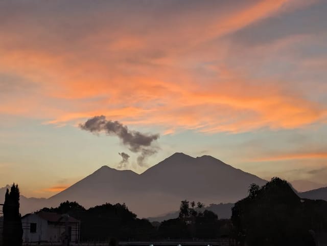
Guatemala’s 2026 drought story is not a prediction anymore. It is a posture. NOAA declared a full El Niño Advisory on June 11, 2026, and on the ground in Guatemala the response machinery is already running: INSIVUMEH puts the June-August El Niño probability at 92%, MAGA is monitoring 106 municipalities daily, and the United Nations launched a US$60 million corredor seco program on June 1, 2026.
This page pulls together what the official Guatemalan and humanitarian sources actually say about 2026 drought risk — INSIVUMEH, MAGA, CONRED, FEWS NET, and the UN System — and turns it into a set of numbers you can track. It does not claim the harvest has failed. As of mid-June 2026 this is a forecast-and-preparedness situation, and the decision point is the canícula window in July and August. What the data supports is a clear picture of where the risk concentrates and a short list of indicators to watch.
Quick summary: El Niño raises the odds of a damaging dry season in Guatemala’s corredor seco (Zacapa, Chiquimula, Jutiapa, El Progreso). INSIVUMEH puts the June-August 2026 El Niño probability at 92%, warns the canícula could run 30-40+ days (vs 2-3 weeks normal), and forecasts a rainfall deficit of up to 300 mm, with at least 18 of 22 departments exposed. MAGA classifies 123 municipalities as very-high water-deficit vulnerability and monitors 106 daily. FEWS NET projects 2.0-2.4 million people needing food aid in June-August 2026, with the Dry Corridor in IPC Crisis (Phase 3). The UN’s US$60M / 700,000-person / 38-municipality program started June 1, 2026. This is a “what to watch” story — the canícula is the decision point.
Explore the data: The Guatemala Weather Hub shows live rainfall accumulation for 22 departments versus the 30-year normal. During the canícula window, the single clearest signal is whether the corredor seco and the Pacific lowlands are running dry compared to a normal year — the accumulated-rainfall line going flat against the historical curve in late July and August is drought happening in real time.
The 2026 Outlook at a Glance
Every figure in this table traces to a named source. The probability number is the one that moved fastest: INSIVUMEH put the El Niño probability for Guatemala at 88% on May 5, 2026, and 92% by May 19 — a two-week jump that mirrors how quickly NOAA’s strength forecast firmed up globally.
| Indicator | Value | Source |
|---|---|---|
| El Niño probability, Jun-Aug 2026 | 92% (was 88% on May 5) | INSIVUMEH |
| Departments exposed to rainfall shortage | At least 18 of 22 | INSIVUMEH |
| Forecast rainfall deficit, corredor seco | Up to 300 mm | INSIVUMEH |
| Canícula length, severe El Niño years | 30-40+ days (vs 2-3 weeks normal) | INSIVUMEH |
| Municipalities, very-high water-deficit vulnerability | 123 | MAGA |
| Municipalities monitored daily (rainy season) | 106 | MAGA |
| People projected to need food aid, Jun-Aug 2026 | 2.0-2.4 million | FEWS NET (Feb 2026) |
A note on what is not in this table: there is no confirmed “rain is X% below normal as of today” figure. The 300 mm is a forecast deficit ceiling, not an observed-to-date measurement, and INSIVUMEH’s live rainfall-versus-normal bulletins were not available to cite here. The honest framing is that the risk is quantified; the realized deficit is still being written by the weather.
What INSIVUMEH Is Forecasting
INSIVUMEH, Guatemala’s national meteorological institute, is the authority for the country-specific drought signal, and its 2026 messaging has been consistent: this is a high-probability El Niño event that lands squarely on the canícula.
- El Niño probability: 92% for the June-August 2026 quarter. INSIVUMEH director Edwin Rojas had cited 88% on May 5; the figure rose to 92% by May 19.
- Rainfall deficit: Up to 300 mm in the corredor seco, per INSIVUMEH preliminary reports.
- Exposure: At least 18 of Guatemala’s 22 departments are exposed to rainfall shortage in this event.
- Canícula: Normally 2-3 weeks long, the canícula can stretch to 30-40 days in severe El Niño years. In 2014 the east reached 45 days without rain.
- Early rains: The 2026 rainy season started early — the second week of April in some regions, versus a normal May onset. An early start is not the same as a wet year; what matters is whether the rains hold through the canícula.
INSIVUMEH and Prensa Libre have also published a regional breakdown of how long the canícula is expected to run in 2026. The Pacific is the longest-exposed; the Caribbean and the Franja Transversal del Norte are the shortest.
Canícula 2026 Length by Region
| Region | Expected canícula length |
|---|---|
| Pacífico | 8-10 weeks |
| Occidente / Valles de Oriente / Bocacosta | 6-8 weeks |
| Petén / Altiplano Central | 5-7 weeks |
| Franja Transversal del Norte / Caribe | 4-6 weeks |
Source: INSIVUMEH via Prensa Libre.
On temperature, MAGA expects maximum temperatures in low-altitude areas of 30°C to 38°C (86-100°F), a deviation of 0.5 to 2°C above the historical average. That heat does not by itself cause crop failure, but it accelerates soil-moisture loss during exactly the weeks when rain-fed maize is most sensitive.
For the full mechanism of how El Niño lengthens and intensifies the mid-season dry spell, see our dedicated guide to the canícula in Guatemala 2026 — the canícula is the specific window through which a basin-wide El Niño turns into a Guatemalan drought.
Where It Bites: Mapping the Vulnerability
Drought in Guatemala is not uniform. The corredor seco core departments named in 2026 reporting are Zacapa, Chiquimula, Jutiapa, and El Progreso — a semi-arid strip that, per our El Niño flagship analysis, receives only about 500-800 mm of rain annually even in a normal year. When the canícula extends, this is where it does the most damage.
The government’s own vulnerability accounting puts hard numbers on the exposure. MAGA classifies the country’s municipalities into water-deficit vulnerability tiers, and CONRED’s extended-corridor estimate is even broader:
| Classification | Municipalities | Source |
|---|---|---|
| Very-high water-deficit vulnerability | 123 | MAGA |
| High vulnerability | 129 | MAGA |
| Medium vulnerability | 88 | MAGA |
| Daily rainy-season monitoring | 106 | MAGA |
| Could face critical conditions (extended corridor) | Up to 160 | CONRED |
Read together, these say the same thing from different agencies: well over 100 municipalities are squarely in the risk zone, and a worst-case extended corridor reaches 160. The CONRED figure comes from subsecretaria Ángela Leal’s May 2026 warning about the extended dry corridor.
Food Security: What FEWS NET Projects
The clearest humanitarian signal comes from the Famine Early Warning Systems Network (FEWS NET), whose February 2026 Guatemala outlook is the most recent sourced assessment available here.
- People needing food assistance: 2.0 to 2.4 million during June-August 2026, approaching 2.4 million by August.
- IPC phases (Feb 2026): The Dry Corridor, parts of the Altiplano, and Alta Verapaz were in Crisis (IPC Phase 3); the rest of the country was in Stressed (IPC Phase 2).
- Projection through September 2026: The Dry Corridor stays in Crisis (Phase 3); southern Alta Verapaz moves to Crisis from May to September; the poorest households in the Western Highlands reach Crisis from July to September.
- Early lean season: The lean season began prematurely — in February 2026 in the Dry Corridor — versus the typical June-August peak. An early lean season means household food stocks run out before the new harvest arrives.
On prices, FEWS NET reported that by January 2026 maize prices were down about 35% versus their mid-2024 peaks and bean prices down about 18%. But the outlook still projected wholesale maize running 10-15% above the five-year average through the period, with beans near the five-year average. There is no confirmed mid-2026 price-per-pound to report — the most recent specific staple prices in the sourced record (maize Q2.61/lb, beans Q8.84/lb) date to April 2024 and belong to the historical section below, not to a current-price claim. To watch staple-food cost pressure as 2026 develops, our canasta básica tracker is the right gauge.
The 2026 Anticipatory Response
What distinguishes 2026 from a passive forecast is that the response started before the canícula. This is the “anticipatory action” model — moving resources ahead of a predicted shock rather than after a confirmed disaster.
| Actor | Action | Figures | Source |
|---|---|---|---|
| UN System | Emergency program (Quiché, Alta Verapaz, Huehuetenango, Chiquimula) | US$60M · 700,000 people · 38 municipalities · 10 organizations · from Jun 1, 2026 | UN System / Prensa Libre |
| MAGA | Daily municipal monitoring | 106 municipalities (340-municipality extension network) | MAGA |
| MAGA | Rainwater-collection reservoirs | 4 (Jutiapa, Jalapa, Chiquimula) | MAGA / Emisoras Unidas |
| CONRED | Preparedness (May 2026) | 2,000 shelters · 8 strategic warehouses · 50 Immediate Response Brigades | CONRED |
The UN System program is the headline commitment: US$60 million to assist 700,000 people in 38 municipalities across Quiché, Alta Verapaz, Huehuetenango, and Chiquimula, delivered by 10 organizations (5 UN agencies plus 5 NGOs), starting June 1, 2026. MAGA’s extension network covers 340 municipalities nationwide and prioritizes maíz, frijol, café, caña, banano, melón, plátano, tabaco, cítricos, and pastos. CONRED, alongside its shelter and warehouse posture, reported 1,289 fires extinguished in 2026 with 13 active as of its early-May reporting — a reminder that drought risk and wildfire risk move together in a dry corredor seco.
Historical El Niño Drought Impacts
The reason these forecasts are taken seriously is that Guatemala has a recent, well-documented benchmark. Major El Niño drought years include 1982-83, 1997-98, 2014-2016, 2015-16, and 2018-2019 — and 2014 in particular is the disaster everyone is planning against.
| Event | Headline impact | Source |
|---|---|---|
| 2014 canícula | 236,000 families lost harvests; damage across 88 municipalities in 12 departments; up to 45 days without rain in the east | AGG / INSIVUMEH |
| 2014 crop loss | 68,298 ha partially + 26,229 ha totally lost; 1,890,559 quintals of maize + 661,695 quintals of beans lost; ~Q450.5M production value | AGG |
| 2023 El Niño | 72,612 ha of subsistence crops affected; 77 municipalities hit by drought; 4.1 million food-insecure (Apr 2024) | Prensa Libre |
2014: The Reference Disaster
The 2014 prolonged canícula left most of the territory without rain for 24-30 days, with the east and northeast going up to 45 days without rain. By September 2014, roughly 236,000 families had lost part or all of their maize and bean harvests, across 88 municipalities in 12 departments — the most vulnerable being Escuintla, Santa Rosa, Zacapa, and Chiquimula. Crop losses totaled 68,298 hectares partially damaged and 26,229 hectares totally lost, equivalent to 1,890,559 quintals of maize and 661,695 quintals of beans. The estimated production value lost was about Q450.5 million, and 126,501 children under five were placed at high risk of acute malnutrition.
What makes 2014 the cautionary tale is how little it took to trigger that cascade. INSIVUMEH has tied that year’s roughly 0.6°C temperature anomaly to losses exceeding 70% of basic grain crops in the affected zones. A fraction of a degree, landing on the canícula, in the wrong departments, was enough.
2023: The Most Recent El Niño
The 2023 El Niño is the closest analog to what 2026 may become. Agricultural drought affected 72,612 hectares of small-farmer crops, with 77 municipalities hit by drought (and 97 by excess rain — El Niño years are uneven). By April 2024, 4.1 million Guatemalans had minimal food consumption, up from a 3.1 million projection. Household reserves were thin: on the north and south coasts, families held about 1 quintal of maize (roughly 0.38 months); in the east and west, about 3 quintals (roughly 1.1 months); bean reserves ran from 15 days in the west, north, and south to about 1.7 months in the east.
What to Watch Through the 2026 Canícula
The forecast is not a verdict. Here is the short list of indicators that will tell you, in real time, whether 2026 turns into a damaging drought:
- Canícula length (July-August 2026). The single most important signal. Did the dry spell exceed 30-40 days across multiple corredor seco departments? Our canícula 2026 guide explains why this window decides the maize harvest.
- INSIVUMEH rainfall-vs-normal bulletins. Accumulated rain against the historical normal in the corredor seco. This is the figure to watch for an observed deficit — distinct from the 300 mm forecast ceiling.
- FEWS NET monthly Guatemala outlook. Watch for IPC phase movement in the Dry Corridor — whether more of the country slides from Stressed (Phase 2) into Crisis (Phase 3).
- MAGA crop-damage reports. Hectares of maize and frijol lost in the primera (first) cycle are the leading economic indicator.
- Reservoir and hydropower levels. Multi-month rainfall deficits pull down hydropower output. There is no current 2026 reservoir-level figure to cite, but it is a metric worth tracking as the dry season approaches.
- NOAA’s July 9, 2026 ENSO update. Whether the very-strong probability holds tells you how much of the dry season still has El Niño at its back.
The site’s Weather Hub pulls fresh rainfall accumulation versus the 30-year normal for all 22 departments, so the actual data — not predictions — is visible as the season unfolds.
Practical Implications
Agriculture
For corredor seco subsistence farmers (Zacapa, Chiquimula, Jutiapa, El Progreso), an extended canícula during the maize tasseling stage is the single biggest risk — the 2014 record shows it can mean losses above 70% of basic grains in affected zones. MAGA’s anticipatory measures (rainwater reservoirs in Jutiapa, Jalapa, and Chiquimula; drought-monitoring across its 340-municipality network) are aimed at exactly this. Households whose income depends on the primera harvest should treat the July-August window as the decision point.
Water and Wildfire
A dry corredor seco stresses municipal water systems and raises wildfire risk simultaneously — CONRED’s reporting of 1,289 fires extinguished in 2026 underlines that the two hazards arrive together. Dry-season water rationing, already common in normal years, tends to worsen when a drought year compounds it.
Food Prices and Remittances
The food-security pressure is concentrated in rural subsistence households, not the urban market shelf — but staple-grain cost pressure is the thing to watch as harvests come in. FEWS NET’s projection of maize running 10-15% above the five-year average is the sourced signal; the canasta básica tracker is where to follow it in Guatemalan prices. Historically, drought-loss years are also the years when remittances from family in the U.S. rise to fill the gap — a structural reason Guatemala’s economy treats remittances as climate insurance.
Travelers
For travelers, an El Niño-amplified canícula often means better weather in the highlands and along the volcanic corridor — drier afternoons, clearer volcano views, low-season hotel prices. The trade-off is a hotter, dustier dry season immediately after. The drought story is a humanitarian and agricultural story far more than a tourism one.
Related Reading
- El Niño Guatemala 2026 — the NOAA Advisory, the 63% very-strong forecast, and the full ENSO mechanism behind the drought risk.
- Canícula 2026 in Guatemala — the mid-season dry spell, when it hits, and how El Niño stretches it from 2 weeks to 6.
- Guatemala’s Corredor Seco — the dry corridor where this drought does the most damage, with the geography and food-security story.
- Corn and Bean Prices 2026 — how a drought year feeds through to the price of maize and black beans.
- Guatemala Rainy Season 2026 — month-by-month rainy-season guide, daily rain pattern, regional differences.
- Hurricane Season Guatemala 2026 — the El Niño suppression mechanism and why a drought year usually means fewer Atlantic storms.
- Canasta Básica Tracker — Guatemalan staple-food basket prices, the place to watch drought-driven cost pressure.
- Guatemala Weather Hub — live rainfall accumulation vs the 30-year normal for 22 departments, refreshed every 15-30 minutes.
Sources
- INSIVUMEH (92% probability, canícula 30-40 days, 2014 reference, 0.6°C / 70% loss, MAGA temperatures): Infobae, May 19, 2026.
- INSIVUMEH (88% probability, up to 300 mm deficit, 18 of 22 departments, CONRED preparedness): Infobae, May 5, 2026.
- MAGA (106 municipalities monitored, 123/129/88 vulnerability tiers, 340-municipality extension network): Infobae, June 22, 2026.
- INSIVUMEH (canícula length by region, early rainy-season start): Prensa Libre.
- UN System (US$60M / 700,000 people / 38 municipalities / 4 departments): Prensa Libre.
- CONRED (up to 160 municipalities), MAGA (4 reservoirs in Jutiapa/Jalapa/Chiquimula): Emisoras Unidas.
- FEWS NET (2.0-2.4M people, IPC phases, early lean season, price figures): FEWS NET Guatemala Food Security Outlook, February 2026.
- 2014 drought (236,000 families, 68,298 + 26,229 ha, quintals, 88 municipalities / 12 departments, Q450.5M, 126,501 children): AGG — Una sequía que golpea a los más pobres.
- 2023 El Niño (72,612 ha, 77 municipalities, 4.1M food-insecure, reserves, April 2024 prices): Prensa Libre.
This is a forecast-and-preparedness story, not a confirmed-disaster story. The probability is high (92% for June-August El Niño), the exposure is wide (18 of 22 departments), and the response is already moving (US$60M from June 1). But whether 2026 becomes a 2014-class drought will be decided in the canícula in late July and August. The right posture is informed attention — track the indicators above, and let the rainfall data, not the forecast, tell you what actually happened.