In the middle of Guatemala’s rainy season, the rain stops. For roughly two to three weeks, usually between late July and mid-August, afternoons turn sunny again, humidity drops, and the air gets noticeably hotter. Guatemalans call this break the canicula – or by its older folk name, the veranillo de San Juan.
For tourists, the canicula is a hidden travel window inside the wet season. For farmers in the corredor seco, it is the most dangerous stretch of the year – a yearly drought that, in a strong El Nino cycle, can wipe out an entire corn harvest. The 2026 canicula matters more than usual because NOAA’s Climate Prediction Center declared a full El Nino Advisory on June 11, 2026 — El Nino conditions are present, expected to strengthen, with a 63% chance of a very strong event at the November-January peak.
This guide breaks down what the canicula is, when it hits, where it bites hardest, and what 2026’s El Nino tilt means for travelers, residents, and Guatemala’s food security.
Quick summary: The canicula is a 10-20 day dry break inside Guatemala’s rainy season, typically late July to mid-August. It is driven by the northward shift of the subtropical high and the weakening of the Inter-Tropical Convergence Zone over Central America. It hits the corredor seco (eastern Guatemala) hardest – a zone of structural food insecurity. NOAA declared an El Nino Advisory on June 11, 2026 — El Nino conditions are present, with a 63% chance of a very strong event by November-January — which historically correlates with longer, drier canicula stretches. Expect more sun, more heat, and higher drought risk in the east than in a neutral year.
Explore the data: See live rainfall and forecast data for all 22 departments at the Guatemala Weather Hub. The hub tracks rainfall accumulation vs the 30-year normal, so you can watch the canicula appear in real time as the accumulated-rainfall line flattens against the historical curve during late July and early August. Filter by climate zone to see how the corredor seco diverges from the rest of the country.
What Is the Canicula?
The canicula is a meteorological pause inside the rainy season – a stretch of 10 to 20 days when afternoon thunderstorms become rare, humidity drops, and daytime temperatures climb. It is not a single weather event. It is a regional climate pattern that affects most of Mexico, Guatemala, El Salvador, Honduras, and Nicaragua during the same window each year.
In Guatemala, the canicula typically arrives in the last week of July and lasts into the second week of August. Some years it is barely noticeable – a few drier days, then back to rain. Other years it is a hard, three-week stretch of brown grass, dust, and dry wells.
The Meteorology in Plain Language
Three coupled atmospheric mechanisms produce the canicula:
- The subtropical high migrates north. During boreal summer, the Bermuda-Azores High strengthens and shifts west and north. As it does, its southern edge nudges into the Caribbean, increasing low-level pressure and suppressing the rising air that fuels convective rainfall over Central America.
- The Caribbean Low-Level Jet intensifies. Stronger trade winds blow more aggressively across the Caribbean. Counter-intuitively, this reduces rainfall over Guatemala because the winds rush moisture past Central America toward the eastern Pacific instead of allowing it to converge and rise over the isthmus.
- The Inter-Tropical Convergence Zone (ITCZ) shifts south. The band of equatorial convergence that drives the rainy season moves further from Guatemala, weakening the moisture supply for afternoon thunderstorms.
The combined effect: afternoons that were reliably wet in June and early July suddenly turn sunny, hot, and dry. The convective rain machine pauses. By mid-August, as the subtropical high weakens and the ITCZ shifts back north, the pattern resets and the wet season’s second half begins.
Canicula vs Veranillo de San Juan
The folk name veranillo de San Juan (“little summer of Saint John”) long predates modern meteorology. It comes from the feast of Saint John the Baptist on June 24 and the warm-dry interlude that often follows in late June and early July across parts of Spain and Spanish America.
In Guatemala specifically, the meteorological dry break peaks weeks later than San Juan – typically in late July and August. The name is technically misaligned with the calendar, but the term has stuck for centuries. “Canicula” (from Latin canicula, “little dog,” referring to the dog days under the star Sirius) became the more scientific term in the 20th century. Both names refer to the same phenomenon.
The 2026 Canicula Outlook: Why the El Nino Advisory Matters
NOAA’s Climate Prediction Center issued its most recent ENSO Diagnostic Discussion on June 11, 2026 (source). The headline:
- ENSO Alert System Status: El Nino Advisory (upgraded from the May Watch)
- Current state: El Nino conditions present (Nino-3.4 anomaly +0.7 C, coastal Nino-1+2 at +2.1 C)
- Forecast: strengthening into Northern Hemisphere winter 2026-27
- Peak strength: 63% chance of a VERY STRONG event during November-January — would rank among the largest since 1950
In plain language: El Nino is no longer a forecast — it is here, and it arrived during the run-up to Guatemala’s 2026 canicula. In May no strength category cleared 37%; one month later a single category (very strong) sits at 63%. The direction and now the magnitude both point the same way.
Why El Nino Amplifies the Canicula
El Nino is a coupled ocean-atmosphere mode where the central and eastern equatorial Pacific warms above normal. The atmospheric response is well-documented for Central America and consistent with what happened during the 2014-2016 and 2018-2019 El Nino events:
- Stronger subtropical high over the Caribbean
- Stronger Caribbean Low-Level Jet (more wind, less moisture convergence)
- Suppressed convection over the Central American isthmus
- Below-normal rainfall in the mid-summer rainy-season window
The canicula is essentially a brief annual version of the same atmospheric configuration that El Nino reinforces year-round. When El Nino emerges during the canicula window, the two reinforce each other. The result is typically:
- A longer canicula (20-25 days instead of 10-15)
- More intense heat (1-3 C above normal in the corredor seco)
- Deeper soil-moisture deficits
- Higher agricultural losses in rain-fed corn and bean crops
The June 11, 2026 NOAA El Nino Advisory does not guarantee a strong canicula – there is meaningful uncertainty in peak El Nino strength – but it shifts the probability distribution strongly toward “longer and drier” rather than “average.”
What This Means for 2026
Plan for a stronger-than-average canicula:
- Travelers: Late July through mid-August is likely to be a particularly good travel window in the highlands and on the volcanic shore. Expect more sun, fewer afternoon storms, and clearer mountain views. Hotel prices stay at rainy-season lows.
- Residents: Water-conservation behavior matters earlier than usual. Many municipal water systems already ration in August; an extended canicula stresses them further.
- Farmers: The corredor seco is on watch. The Ministry of Agriculture (MAGA) typically issues drought alerts during strong canicula years. Subsistence farmers in Chiquimula, Zacapa, El Progreso, and Baja Verapaz face the highest risk of corn-crop failure.
For real-time updates throughout the canicula window, the Weather Hub’s rainfall tracker compares 2026 accumulated rainfall against the 30-year normal for each department – the easiest single chart to see whether the canicula is normal, mild, or severe in real time.
Historical Canicula Patterns
The canicula is one of the most-studied climate features of Central America. Decades of research from regional meteorological agencies, NOAA, and the UN Food and Agriculture Organization (FAO) have documented its variability, but year-to-year intensity is influenced by ENSO state, sea-surface temperatures in the Caribbean, and the position of the Bermuda-Azores High.
The general pattern documented in scientific literature (Magana et al., 1999; regional meteorological assessments from INSIVUMEH and CRRH) is:
| ENSO State (Jul-Aug) | Typical Canicula Behavior in Guatemala |
|---|---|
| Strong La Nina | Often absent or barely noticeable; rainy season continues uninterrupted |
| Weak La Nina / Neutral | Short canicula (5-10 days), modest impact |
| Neutral / Weak El Nino | Average canicula (10-15 days) |
| Moderate El Nino | Pronounced canicula (15-20 days), agricultural alerts in corredor seco |
| Strong El Nino | Extended drought (20-30+ days), significant crop loss, water rationing |
The 2014-2016 El Nino, one of the strongest on record, produced consecutive years of extended canicula and severe drought in the Central American Dry Corridor, triggering large humanitarian responses (FAO Drought Response in the Dry Corridor). NOAA’s June 11, 2026 diagnostic puts the odds of a very strong event at 63% for November-January — a magnitude that would approach the 2014-2016 range — so the structural risk for 2026 is elevated, not just theoretical.
We will not invent specific date ranges or rainfall percentages for prior canicula years on this page – regional records are managed by INSIVUMEH and not consistently published as a public time series. Real-time data for 2026 lives at the Weather Hub.
Where the Canicula Hits Hardest
The canicula does not affect Guatemala uniformly. Some regions barely notice it. Others build their entire agricultural calendar around it.
The Corredor Seco (Dry Corridor)
The corredor seco is the band of structurally dry territory running along Guatemala’s eastern departments and across the country into Honduras and Nicaragua. Within Guatemala, the corridor includes:
- Zacapa – semi-arid, 500-800 mm annual rainfall, the driest department
- Chiquimula – mountainous dry corridor, subsistence corn farming
- El Progreso – Motagua valley, hot and dry
- Jalapa – transition between highlands and dry east
- Jutiapa – southeastern dry corridor near El Salvador
- Baja Verapaz (eastern portion) – Salama valley, semi-arid
These departments depend on rainy-season precipitation for rain-fed agriculture – mostly subsistence corn, beans, and sorghum. An extended canicula in this region is not an inconvenience. It is a livelihood threat. The FAO has classified the Central American Dry Corridor as one of the world’s most climate-vulnerable agricultural zones.
Regional Canicula Impact
| Region | Typical Canicula Impact | 2026 El Nino Risk |
|---|---|---|
| Corredor Seco (Zacapa, Chiquimula, El Progreso, Jalapa, Jutiapa) | Severe – crop failure risk | Elevated |
| Pacific Lowlands (Escuintla, Santa Rosa) | Moderate – sugar cane benefits from dry stretch before harvest | Moderate |
| Central Highlands (Guatemala City, Sacatepequez, Chimaltenango) | Mild – noticeable but not damaging | Low |
| Western Highlands (Quetzaltenango, Huehuetenango, San Marcos) | Mild – temperature warms slightly, rains pause briefly | Low |
| Caribbean Lowlands (Izabal) | Minimal – rain often continues uninterrupted | Very low |
| Peten | Variable – depends on year; usually mild | Low to moderate |
| Verapaces (cardamom, coffee zone) | Mild – moisture buffer from cloud forests | Low |
The dramatic regional split is what makes the canicula politically significant: a strong canicula triggers food-security crises in the east while travelers in Antigua experience it as a perfect-weather window.
Agricultural Impact: Corn, Beans, Cardamom, and Coffee
Guatemala’s agricultural calendar is built around the rainy season, and farmers have adapted to the canicula for generations. Understanding the canicula in agricultural terms explains why a strong El Nino year matters far beyond tourism.
Corn (Maiz)
Subsistence corn farmers in the corredor seco plant in May with the first rains. The crop’s most water-sensitive growth stage – tasseling and silking – often falls in late July and August. A strong canicula during tasseling can cause near-total crop failure. This is the single most consequential canicula impact in Guatemala. The FAO and World Food Programme have documented repeated food-security emergencies in eastern Guatemala during strong El Nino canicula years.
Beans (Frijol)
Beans share the same calendar problem – planted in May, vulnerable in August. The Guatemalan diet’s other staple, alongside corn, faces the same risk in the same departments. Farmers sometimes shift to a second planting cycle (siembra de postrera) in August-September to recover, but this requires the post-canicula rains to actually arrive.
Cardamom
Guatemala is the world’s largest cardamom exporter, with most production in Alta Verapaz. Cardamom prefers consistent moisture and cooler temperatures. The canicula is mild in the Verapaces because of the region’s cloud-forest microclimate. El Nino impact on cardamom is typically modest.
Coffee
Coffee is grown across the central and western highlands at 1,200-2,000 meters. The canicula typically falls during the green-cherry stage. A short, mild canicula is actually beneficial for coffee – it concentrates flavor and helps cherries develop properly. A strong, extended canicula stresses coffee trees, especially at lower elevations, and can reduce yields. Coffee is more resilient than corn but not immune.
Sugar Cane
Guatemala’s Pacific lowland sugar industry actually benefits from a strong canicula. Sugar cane is harvested during the dry season (November-April), and a drier mid-rainy-season stretch helps the cane mature with higher sugar content. Strong canicula years can be favorable for sugar yields.
What Farmers Do
Subsistence farmers in the corredor seco use a range of adaptation strategies:
- Drought-tolerant maize varieties – promoted by MAGA and international NGOs
- Soil-moisture conservation – mulching, contour planting, agroforestry
- Postrera planting – a second cycle in August-September if the canicula breaks
- Off-farm income – remittances from family members in the US are often the actual buffer that gets families through bad canicula years
Remittances and the canicula are economically linked: years with strong canicula crop losses are often the same years when family members in the US send extra money home. This is one of the structural reasons remittances are so central to Guatemala’s economy – they function as climate insurance.
Practical Implications for Visitors and Residents
For Travelers
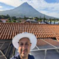
The canicula is one of the best-kept travel secrets in Guatemala. If you can target your trip for late July or the first two weeks of August in an El Nino year like 2026, you get:
- Mostly dry afternoons during what is officially the rainy season
- Rainy-season hotel prices (20-40% below dry season)
- Lighter tourist crowds than the December-March peak
- Lush green landscapes carried over from June rains
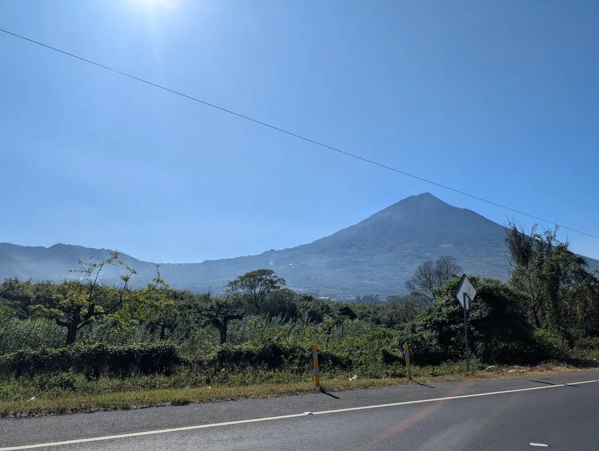
- Clear volcano views in the highlands (Fuego, Acatenango, Atitlan)
What to pack: Light rain jacket (just in case), sun protection (UV index spikes during canicula), reusable water bottle, sunglasses. Highland nights still get cool.
Best regions during canicula: Antigua, Lake Atitlan, the Western Highlands, Tikal. The Caribbean coast (Livingston, Rio Dulce) stays wet regardless.
For Residents
Guatemala City residents experience the canicula mostly as better weather and dustier streets. A few practical points:
- Water rationing in some zones intensifies during canicula
- Wildfire risk increases, especially in pine forests near Guatemala City and Sacatepequez
- Air quality degrades as dust and biomass smoke accumulate without rain to wash them out – the Weather Hub’s AQI tracker shows this clearly
- Volcanic ash from Fuego is harder to clear when there is no afternoon rain; ashfall affects Antigua and surrounding municipalities more during canicula
Residents in the corredor seco should watch CONRED and MAGA drought alerts. Strong El Nino years (like 2014-2016) triggered formal drought emergencies and food-assistance programs.
The Veranillo de San Juan: The Folk Name
Long before satellites and the ITCZ, Guatemalans noticed the same pattern. The folk name veranillo de San Juan – “little summer of Saint John” – ties the dry break to the feast of Saint John the Baptist on June 24.
The phrase comes from Spain and the broader Spanish-speaking Atlantic. In peninsular Spain, the weeks after San Juan often bring a warm-dry stretch before late summer rains. Spanish colonization carried the name and concept to the Americas, where it was applied to a regional phenomenon that does not actually peak around San Juan – the Guatemalan canicula proper happens five to seven weeks after the feast.
The mismatch did not stop the name from sticking. Older Guatemalan farmers still call the August dry break the veranillo. Urban Guatemalans more often say canicula. Scientific Spanish-language meteorology has standardized on canicula or sequia intra-estival (“intra-summer drought”). All three terms refer to the same phenomenon.
The etymology of canicula itself comes from Latin canicula – “little dog” – a reference to the star Sirius (the Dog Star) being prominent in the summer sky during what the Romans called the dies caniculares, the “dog days of summer.” The Mediterranean dog days are not meteorologically related to the Central American canicula, but the name was borrowed because the timing roughly matches.
How to Track the 2026 Canicula in Real Time
The canicula is invisible until rainfall stops appearing on the daily forecast. The fastest way to see it happening:
- Weather Hub rainfall tracker – compares 2026 accumulated rainfall vs the 30-year normal for each department. A flat line in late July through mid-August is the canicula in real time. Refreshed every 15-30 minutes.
- Departamento-level forecasts – watch for consecutive dry days in Zacapa, Chiquimula, and the eastern departments
- Fuego ash drift – ash deposition patterns shift when there is no afternoon rain to clear the air
- INSIVUMEH bulletins – official seasonal forecasts and drought alerts
- MAGA agricultural alerts – corredor seco crop status updates
- CONRED situation reports – emergencies, drought declarations, water rationing
Practical Summary
| Detail | Information |
|---|---|
| Canicula typical dates | Late July to mid-August (10-20 days) |
| 2026 outlook | Likely longer/drier than average (El Nino Advisory declared Jun 11; 63% chance very strong by Nov-Jan) |
| Hardest-hit region | Corredor seco (Zacapa, Chiquimula, El Progreso, Jalapa, Jutiapa) |
| Best-positioned region | Caribbean lowlands (Izabal) – rains often continue |
| Best for travelers | Antigua, Lake Atitlan, Western Highlands, Tikal |
| Main agricultural risk | Rain-fed corn and beans (tasseling stage coincides with canicula) |
| Coffee impact | Modest; lower elevations more vulnerable |
| Sugar cane impact | Often beneficial for yield |
| Folk name | Veranillo de San Juan |
| Scientific name (Spanish) | Canicula or sequia intra-estival |
| Authority for forecasts | INSIVUMEH (Guatemala), NOAA CPC (ENSO state) |
The canicula is one of the most predictable features of Guatemala’s climate, and also one of the most consequential. Plan around it – as a traveler chasing the best weather window of the rainy season, as a resident managing water and air quality, or as a citizen tracking how a stronger El Nino canicula will affect food security in eastern Guatemala.
Related Reading
- Guatemala Rainy Season 2026: Monthly Rain Guide – the full rainy-season context the canicula sits inside.
- El Nino and La Nina in Guatemala 2026 – the ENSO cycle, what NOAA’s forecast means for Guatemala, and a deeper dive on the 2026 outlook.
- Drought in Guatemala 2026 – when the canicula stretches and deepens into agricultural drought, this is what to watch.
- Guatemala’s Corredor Seco – the dry corridor where an extended canicula does the most damage to corn and beans.
- Hurricane Season Guatemala 2026 – the August-October risk that follows the canicula as the rainy season reasserts itself.
- Guatemala Weather Hub – live data for all 22 departments, rainy-season tracker vs 30-year normal, Fuego ash, UV, AQI.
- Safety Data – drought, flood, and landslide risk by department.