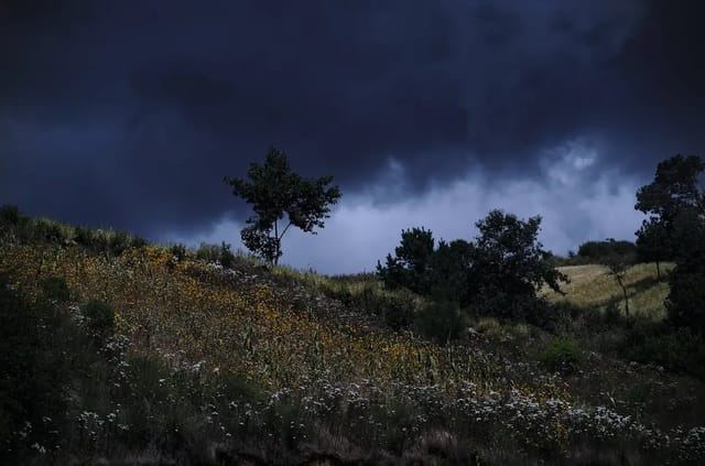
Between November and February, Guatemala’s weather flips into its mirror image: the rainy season ends, and instead, every week or two a polar air mass slides down across the Gulf of Mexico and pushes into Central America — a cold front, or norte. For the highlands it means frosty dawns and crystal skies; for Izabal and the Verapaces, days of grey drizzle; for the Cuchumatanes plateau, frost thick enough to pass for snow.
TL;DR: Season: November-February (coldest in December-January), typically 8-12 fronts reach Guatemala per season per INSIVUMEH’s outlooks. Regional effects: western highlands = dry cold and frost (Xela can dip below 0°C), Caribbean slope = persistent rain and wind, Pacific coast = barely notices. It’s the exact mirror of the canícula — the two phenomena that quarter Guatemala’s climate calendar.
What a Cold Front Does Here
A dense, cold air mass pushed down from the Arctic crosses the Gulf of Mexico and slams into Central America’s tropical air. When it reaches Guatemala:
- Winds swing to the north and accelerate — the famous nortes that churn the Caribbean, suspending lancha traffic on the Golfete and Amatique Bay.
- Caribbean moisture piles against the mountains — the Sierra de las Minas, the Verapaces and the Cuchumatanes wring out persistent drizzle (the temporal del norte) on the windward side.
- The Pacific side gets descending dry air — cloudless skies, low humidity, and the coldest dawns of the year through nighttime radiative cooling.
A front passes in 2-4 days; the coldest morning comes 1-2 days behind it, then the pattern relaxes until the next one.
Effects by Region
| Region | Typical effect | Risk |
|---|---|---|
| Western highlands (Xela, Totonicapán, Cuchumatanes) | Lows of 0 to -5°C in high valleys, frost | Crop-killing frost; hypothermia risk for vulnerable communities |
| Guatemala City / Antigua / Atitlán | Lows of 8-12°C, windy, brilliant skies | Low — pack layers |
| Verapaces / northern Huehue & Quiché | Persistent drizzle, fog | Muddy rural roads |
| Izabal / Caribbean | Rain, strong north wind, rough seas | Boat traffic suspended; wet days in Río Dulce/Livingston |
| Petén | Grey, cool days, light drizzle | Low |
| Pacific coast | Almost unchanged (lows 18-20°C), some wind | Minimal |
Frost: the Season’s Real Hazard
Guatemala’s cold makes news not for thermometers but for what it burns: in the high valleys of Quetzaltenango, Totonicapán and Huehuetenango, the clear dawn after a front produces frost that kills potato and vegetable crops — hitting the same subsistence-farming communities the canícula hits in August. CONRED activates its annual cold season plan (shelters, monitoring of vulnerable populations), and MINEDUC occasionally adjusts school schedules in the coldest municipalities.
On the Cuchumatanes plateau (3,300-3,800 m), a strong January front occasionally delivers sleet or thick rime frost — the “snow in Guatemala” photos that circulate every couple of years. Almost never true snow, but the white landscape is real, and gone by mid-morning.
For Travelers: the Best Season, with One Asterisk
November-February is high season for a reason — the cold front is the only thing that interrupts weeks of perfect sky.
- Antigua–Atitlán–Xela circuit: sunny 20-24°C days, cold nights. December-January volcano views are the year’s best. Pack real layers — the classic mistake is a 4°C night in Xela with only a hoodie.
- Acatenango overnight: the dry window is ideal — but an active front means -5 to -10°C wind chill at the summit with north winds. Check the Weather Hub forecast before committing.
- Izabal / Río Dulce / Livingston: the asterisk. If your dates coincide with an incoming front, expect 2-3 grey, wet days and suspended lanchas. Shift the visit a few days if you can.
- Tikal: cool and grey under an active front, perfect otherwise.
Following the Season
- Weather Hub — department-level forecasts and live temperatures
- INSIVUMEH — official cold front and temperature-drop advisories
- Canícula 2026 — the mid-rainy-season mirror phenomenon
- Rainy Season 2026 — the full climate calendar
- Guatemala Right Now — live storms, volcano and seismic status in one place