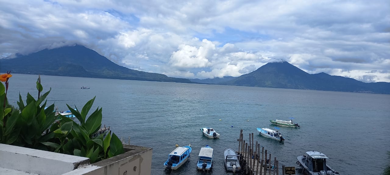
Lake Atitlan is surrounded by volcanoes, cliffs, and forested ridges that create some of the best hiking in Guatemala. The trails range from 20-minute walks to viewpoints to full-day volcanic ascents, and many of them are free. For an overview of all the lakeside towns and where to base yourself, read our dedicated guide.
I have hiked every trail on this list, some of them multiple times. Here is what you actually need to know – no filler, just trail data and honest assessments.
TL;DR: Lake Atitlan has 6 great hikes ranging from free lakeside trails to the Q200 ($26) San Pedro Volcano climb. Indian Nose is the classic sunrise hike at Q100 ($13, 45 minutes up). Three of the best trails – including the Santa Cruz to Jaibalito lakeside walk – are completely free.
Quick Comparison Table
| Hike | Difficulty (1-5) | Duration | Cost (GTQ) | Cost (USD) | Sunrise? | Views Rating |
|---|---|---|---|---|---|---|
| Indian Nose | 2/5 | 45 min up | Q100 (entry+guide) | $13 | Yes (classic) | 10/10 |
| San Pedro Volcano | 4/5 | 5-6 hrs RT | Q200 (entry+guide) | $26 | Possible | 9/10 |
| Mirador Kaqasiiwaan | 1/5 | 20 min up | FREE | FREE | Good for sunset | 8/10 |
| Santa Cruz - Jaibalito | 2/5 | 2-3 hrs | FREE | FREE | N/A | 8/10 |
| Cerro de Oro | 3/5 | 3-4 hrs RT | Q25 | $3.25 | Morning best | 7/10 |
| Rostro Maya | 1/5 | 30 min walk | FREE | FREE | Anytime | 6/10 |
Exchange rate: Q7.7 = $1 USD
Prices verified February 2026. See our exchange rates page for today’s USD/GTQ rate. For the best rates on sending money to Guatemala, compare providers before your trip.
Indian Nose (Nariz del Indio): The Iconic Sunrise
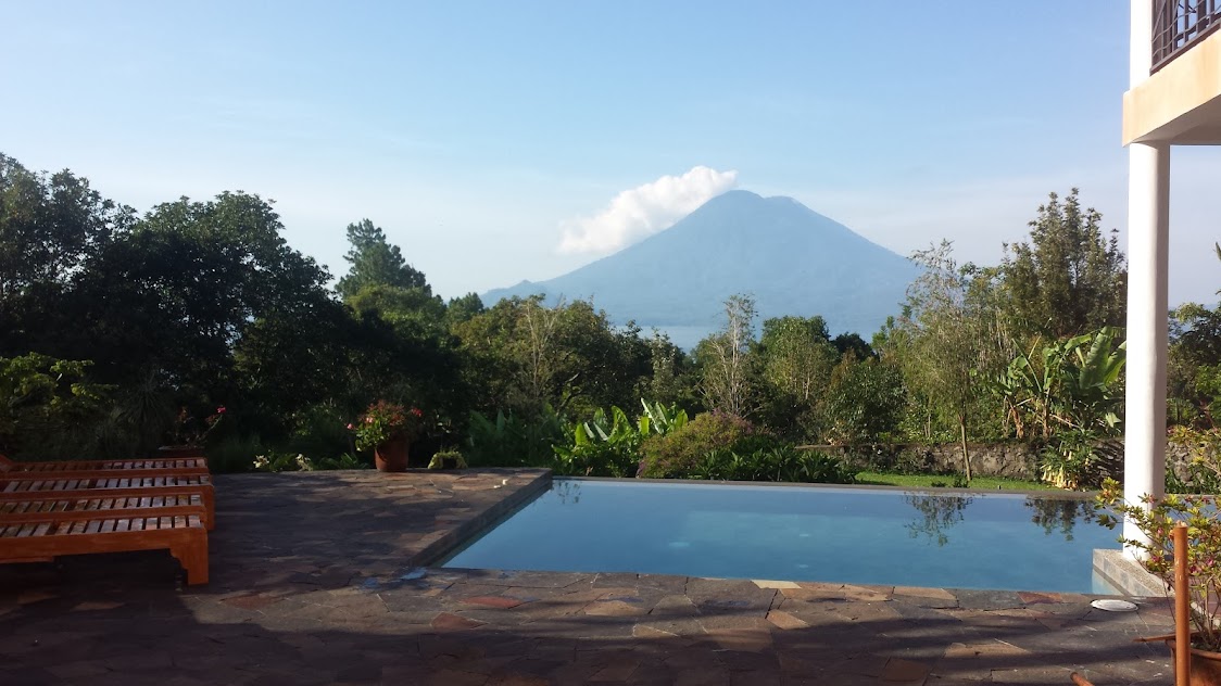
Indian Nose is the most popular hike at Lake Atitlan and one of the most photographed sunrise spots in Guatemala. The viewpoint sits on a ridge above San Juan La Laguna at about 2,600 meters, overlooking the entire lake with San Pedro, Toliman, and Atitlan volcanoes framed perfectly.
The Trail
The standard route starts from a parking area above San Juan La Laguna. It is a 45-minute climb on a well-maintained trail with some steep sections near the top. The path is clear and does not require any scrambling. At the summit, there is a flat area where dozens of people gather for sunrise.
Logistics
| Item | Cost | Notes |
|---|---|---|
| Entrance fee | Q50 ($6.50) | Collected at the trailhead |
| Guide fee | Q50 ($6.50) | Mandatory for pre-dawn starts |
| Tour from Pana/San Pedro | Q100-200 ($13-26) | Includes boat + transport + guide |
| Departure time | 4:00-4:30 AM | To catch sunrise around 6:00-6:15 AM |
Tips
- Book the night before from your hotel in San Pedro or Panajachel. Tours include boat transfers and pickup.
- Bring a headlamp. The first 30 minutes are in complete darkness.
- Dress warm. It is cold at 2,600 meters before dawn. Bring a fleece or jacket.
- Arrive early for a good spot. On weekends and holidays, 30-50 people may be at the summit.
San Pedro Volcano: The Big One
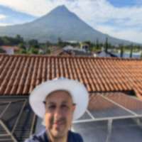
San Pedro Volcano (Volcan San Pedro) rises to 3,020 meters directly above the town of San Pedro La Laguna. It is the most challenging hike at the lake and the most rewarding on a clear day, offering aerial views of the entire lake basin.
The Trail
The trail starts from the edge of San Pedro town. The first hour climbs through farmland and coffee plantations. After that, you enter cloud forest that becomes increasingly steep and dense. The final hour is a scramble through exposed volcanic rock and stunted trees.
Total elevation gain is about 1,200 meters over roughly 5 kilometers. It is relentless – no flat sections.
Logistics
| Item | Cost | Notes |
|---|---|---|
| Park entrance | Q100 ($13) | Paid at the trailhead gate |
| Guide (mandatory) | Q100 ($13) | Local guides wait at the gate |
| Total | Q200 ($26) | Per person |
| Duration | 5-6 hours RT | 3-3.5 hrs up, 1.5-2 hrs down |
Tips
- Start by 6 AM at the latest. Clouds roll in by 10-11 AM and the view disappears.
- Bring 3 liters of water. There is no water on the trail and the climb is sweaty.
- The descent is harder than you think. Steep, loose soil destroys your knees. Trekking poles help enormously.
- Fitness required. This is a legitimate mountain hike, not a tourist walk. If you are not comfortable hiking for 3+ hours uphill, consider Indian Nose instead. For bigger volcanic challenges, see our volcano hiking guide covering Acatenango, Tajumulco, and more.
Mirador Kaqasiiwaan: Best Free Viewpoint
This overlooked mirador above San Juan La Laguna offers stunning lake views for zero cost. The 20-minute walk from the main road takes you to a cleared viewpoint with benches and a basic shelter.
Why It Is Special
Unlike Indian Nose (which requires an entrance fee and guide), Kaqasiiwaan is free, less crowded, and arguably has better sunset views. The angle looks directly across the lake toward San Pedro volcano and the southern shore.
How to Find It
From the main road in San Juan La Laguna, follow signs for “Mirador Kaqasiiwaan.” The trail is marked with painted stones. Walk uphill for about 20 minutes on a clear path. No guide needed.
Best time: Late afternoon for sunset. Bring a snack and arrive 30 minutes before golden hour.
Santa Cruz to Jaibalito: The Lakeside Trail
This is my favorite walk at Atitlan. A footpath follows the northern lakeshore from Santa Cruz La Laguna to Jaibalito, passing through tropical vegetation with multiple swimming spots accessible from the trail.
The Trail
Take a boat from Panajachel to Santa Cruz (Q25, 15 minutes). From the Santa Cruz dock, the trail heads west along the lakeshore. The path rises and falls over several ridges, passing through forest and along cliff edges with lake views.
About halfway, there are accessible rocky beaches where you can swim in the lake. The water is clean and refreshing. Pack a towel. Getting to the trailhead is easy – lanchas connect all lakeside towns for Q25-35 per person.
The trail ends in Jaibalito, where you catch a boat back to Panajachel or continue to San Marcos (another 1-2 hours of walking).
| Segment | Duration | Difficulty | Cost |
|---|---|---|---|
| Santa Cruz to Jaibalito | 2-3 hours | Easy-moderate | FREE |
| Jaibalito to San Marcos | 1-2 hours | Moderate | FREE |
| Full trail (Santa Cruz to San Marcos) | 3-5 hours | Moderate | FREE |
| Boat to/from trailheads | – | – | Q25-35 each way |
Tips
- Bring water and snacks. There are no shops between towns.
- Wear sturdy shoes. The trail has rocky and uneven sections.
- Start in the morning when the lake is calm and light is beautiful.
- Watch for cliff edges – some sections are narrow with steep drops to the lake.
Cerro de Oro: The Underrated Climb
Cerro de Oro is a small volcanic peak (1,892m) on the southern shore of the lake near the town of Santiago Atitlan. The name means “Hill of Gold” and the hike offers different perspectives of the lake than the more popular northern-shore trails.
The Trail
From the village of Cerro de Oro (accessible by boat from Santiago or Panajachel), the trail climbs through forest for about 1.5-2 hours. The summit gives views of Santiago, the lake, and the three main volcanoes.
| Item | Cost | Notes |
|---|---|---|
| Entrance fee | Q25 ($3.25) | Paid to the community |
| Guide | Q50-100 ($6-13) | Optional but recommended |
| Boat from Pana | Q25 ($3.25) | Via Santiago |
Rostro Maya: The Carved Rock Face
Near San Juan La Laguna, a natural rock formation resembles a Maya face in profile. It is a short 30-minute walk from town along a marked trail. The formation is interesting rather than spectacular, but the walk is pleasant and free.
Cost: Free. The trail starts near the main dock in San Juan.
Free vs Paid: Summary
| Category | Hikes | Total Cost |
|---|---|---|
| FREE | Kaqasiiwaan mirador, Santa Cruz-Jaibalito trail, Rostro Maya | Q0 (plus boat Q25-35) |
| Budget (under Q50) | Cerro de Oro | Q25-75 |
| Mid-range | Indian Nose | Q100-200 |
| Investment | San Pedro Volcano | Q200+ |
Practical Tips for All Hikes
Weather windows: Morning is always best. Clouds build from 10 AM and afternoon rain is common May-October. Plan sunrise hikes or start by 6 AM for volcano climbs.
What to wear: Light hiking shoes or trail runners are fine for most trails. Only San Pedro volcano needs proper hiking boots. Layers for early morning starts.
Water: The #1 mistake. Bring at least 2 liters for any hike over 1 hour. Dehydration at altitude compounds quickly. Read our water safety guide for tips on staying hydrated safely.
Sun protection: UV intensity at 1,500-3,000 meters is much stronger than at sea level. Sunscreen, hat, and sunglasses are not optional.
Explore all Lake Atitlan towns on the map to plan your base for hiking.
Related Guides
- Lake Atitlan Towns Guide – choose where to base yourself around the lake
- Hiking Volcanoes in Guatemala – for more serious volcanic ascents beyond Atitlan
- Adventure Sports in Guatemala – kayaking, paragliding, and more at the lake
- Is Guatemala Safe? – safety data for the Solola department
![Hiking Guatemala Volcanoes: 7 Trails Ranked [2026]](/images/photos/fuega-and-acatenango-sunset.jpg)