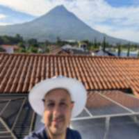
Every postcard of Antigua Guatemala – the colonial rooftops, the church domes, the volcano rising behind – is shot from Cerro de la Cruz. It’s the city’s defining viewpoint, and reaching it takes nothing more than a 15-30 minute walk uphill from the central plaza. If you do only one thing in Antigua, this should be it.
The cross at the top has stood on this hill for centuries, marking the northern boundary of the old colonial city. The Spanish built it as a religious landmark. Today it serves as the best free viewpoint in one of Central America’s most beautiful cities.
Quick Facts
| Detail | Info |
|---|---|
| Elevation | ~1,600m (5,250 ft) – about 80m above Antigua’s center |
| Duration | 15-30 minutes walk from central Antigua |
| Difficulty | Very Easy |
| Cost | Free |
| Tourist Police | POLITUR officers present during daylight hours |
| Best Times | Sunrise (golden hour) and late afternoon (4-5 PM) |
| Accessibility | Partially – lower viewpoint reachable by vehicle |
The View
From the stone platform at the base of the cross, you look directly south over the entire colonial grid of Antigua Guatemala. The view is the reason this spot exists in every guidebook and Instagram feed, and it genuinely delivers:
What you see:
- The full colonial city grid – cobblestone streets in a perfect north-south, east-west pattern laid out by the Spanish in the 1500s
- Church towers and domes – the Catedral, La Merced (its yellow facade is easy to spot), San Francisco, and several others
- Colorful rooftops – terra cotta, painted concrete, and the occasional bougainvillea-covered terrace
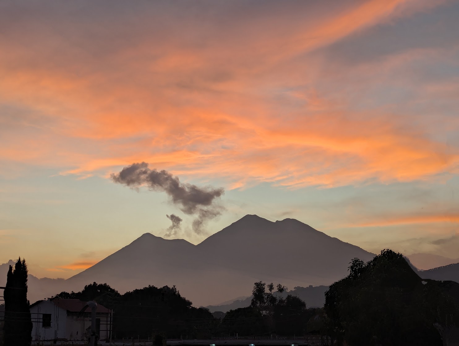
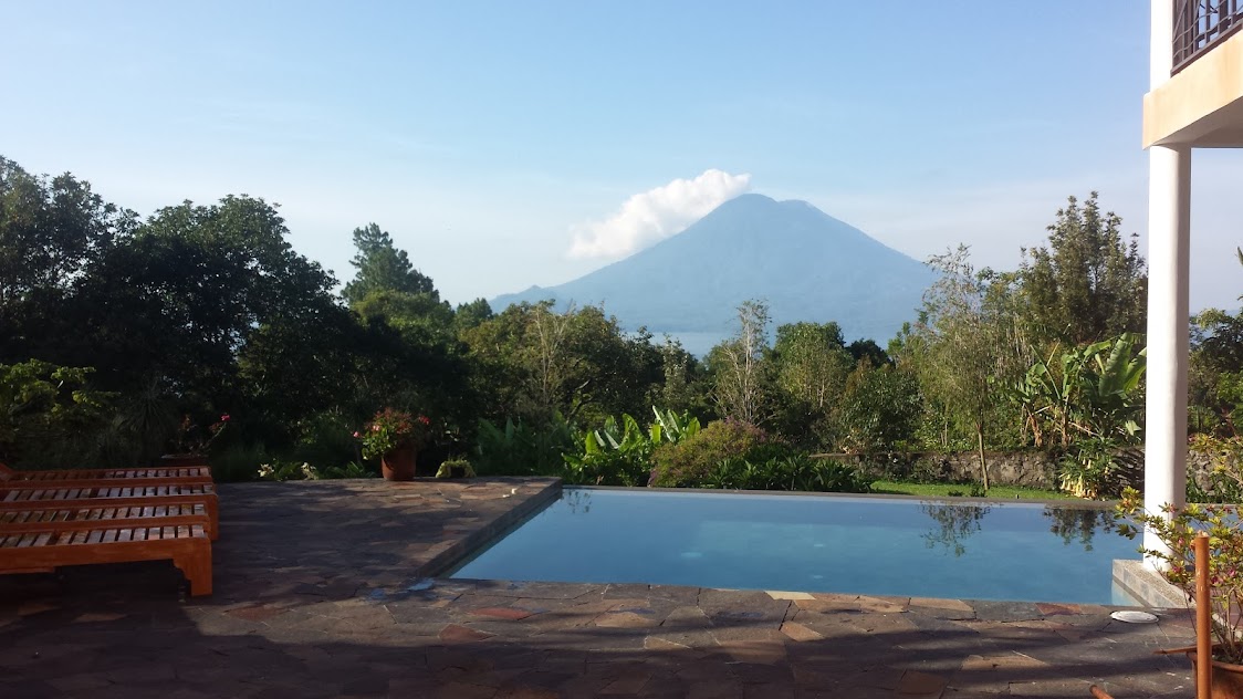
- Volcan de Agua (3,766m) rising directly behind the city like a painted backdrop. The symmetrical cone fills the southern horizon.
- On clear days, Volcan de Fuego (3,763m) is visible to the southwest. If Fuego is active, you may see steam or ash plumes from here.
The composition is remarkable because everything lines up – the cross in the foreground, the city in the middle ground, and the massive volcano behind. It’s one of those views that looks almost too perfect to be real.
History of the Cross
The original cross was erected during the colonial period as a station of prayer and a boundary marker for the city. Over the centuries it has been rebuilt and replaced multiple times after earthquake damage – Antigua sits in one of the most seismically active zones in Central America.
The current concrete cross and stone platform were built in the 20th century. The surrounding park area has been improved several times, most recently with better paths, railings, and the permanent POLITUR (tourist police) presence that has made the site safe for visitors.
The name is straightforward: “cerro” means hill, “de la cruz” means of the cross. Locals simply call it “la cruz” when giving directions.
Safety
This is the section that matters most to cautious travelers, because Cerro de la Cruz has a complicated safety history.
The past: Through the 1990s and 2000s, the path to Cerro de la Cruz had a reputation for robberies. The walk passed through a quiet residential area with limited foot traffic, and muggers would target tourists walking alone. Multiple guidebooks warned against going.
The present: Since the early 2010s, the Guatemalan government has stationed POLITUR (tourist police) officers along the path and at the viewpoint during daylight hours. The improvement has been dramatic. The route is now well-traveled, the police presence is consistent, and incidents are rare.
Practical advice:
- Walk during daylight hours only – POLITUR officers are present roughly from 7 AM to 6 PM
- The path is busiest (and safest) between 8 AM and 4 PM
- Going in a group is always better than alone, though solo walkers are common during peak hours
- Don’t bring excessive valuables – leave your laptop at the hotel, but your phone and camera are fine
- If you want to go at sunrise, go with a group or hire a guide (Q50-100)
The safety transformation at Cerro de la Cruz is one of Antigua’s success stories. It’s a genuinely pleasant walk now, and the police officers are friendly and happy to chat.
Walking Route
The standard route starts from the northern edge of Antigua’s center and heads uphill. Here’s the step-by-step:
-
Start at the Central Park (Parque Central) and walk north on 1a Avenida Norte – the street that runs along the east side of the park.
-
Continue north past La Merced church – you’ll see its distinctive yellow baroque facade on your left. This is one of Antigua’s most recognizable landmarks and worth a stop on the way.
-
Keep going north as the street becomes more residential. The pavement transitions from cobblestone to concrete. You’ll start to see signs pointing toward “Cerro de la Cruz.”
-
Follow the signed path as it curves uphill through a neighborhood. POLITUR officers are usually visible along this stretch. The incline is gentle at first and gets steeper for the last 5 minutes.
-
Final approach – a short steep section with steps leads up to the viewpoint platform at the base of the cross.
Total distance from the Central Park is about 1-1.2 kilometers. Walking at a normal pace takes 15-20 minutes. At a leisurely pace with stops, 25-30 minutes.
The path is paved or has good footing the entire way. No hiking shoes needed – sandals or any comfortable walking shoes work fine.
Photography Tips
Cerro de la Cruz is one of the most photographed spots in Guatemala, so here are tips for getting shots that stand out:
Best light – sunrise (6:00-6:30 AM): The golden hour light hits the east-facing church facades and creates long shadows across the grid. Volcan de Agua catches the first light on its peak. This is the classic shot, but you’ll need to arrange access before POLITUR’s regular shift. Some hotels can connect you with a guide for early morning visits.
Best light – late afternoon (4:00-5:00 PM): The sun drops to the west and side-lights the city with warm tones. Agua volcano goes into a blue-purple silhouette. Less classic than sunrise but easier to arrange and often less crowded.
Midday (11 AM - 2 PM): Harsh overhead light, flat shadows. Views are still impressive but photos tend to look washed out. Worst time for photography, best time for crowd-free visits.
Lens recommendations:
- Wide angle (16-35mm): Gets the full panorama – cross, city, and volcano in one frame
- Standard zoom (24-70mm): Most versatile. Wide enough for the panorama, zoomed enough for details
- Telephoto (70-200mm): Compresses the volcano behind the city, making Agua look impossibly close. Some of the most striking Cerro de la Cruz images use this compression effect.
Composition ideas:
- Include the cross in the foreground for scale and context
- Frame the city between the cross and surrounding trees
- Use the grid pattern of streets as leading lines toward the volcano
- On days when Fuego is erupting, include both volcanoes in a wide shot
Getting There by Vehicle
If walking uphill isn’t an option, you can reach a viewpoint near Cerro de la Cruz by vehicle:
- Tuk-tuk: Q15-20 ($2-3) from central Antigua. Ask for “Cerro de la Cruz” and the driver will take you up the road as far as vehicles can go. You’ll still need to walk 3-5 minutes to the actual cross.
- Driving: Follow signs north from the center. There’s limited parking near the top on a small side street. The road is narrow and steep – not recommended for large rental vehicles.
- Taxi: Q30-50 ($4-7) from anywhere in Antigua.
The vehicle route does not go to the exact viewpoint – you’ll park or be dropped off on the road below and walk the final short section uphill.
Combine With
Cerro de la Cruz works naturally as part of a walking day in Antigua. Here’s a suggested route:
Morning option (2-3 hours): Central Park – La Merced church – walk to Cerro de la Cruz – viewpoint – walk back via a different street – stop at a cafe on 5a Avenida Norte
Afternoon option (3-4 hours): Lunch on the central plaza – walk north to Cerro de la Cruz for 4-5 PM light – walk back – explore the Calle del Arco area (Santa Catalina Arch) – dinner
Full-day pairing: Morning at Hobbitenango for the mountain-top perspective – afternoon at Cerro de la Cruz for the street-level perspective. You see Antigua from above and from the edge, two completely different angles.
Other nearby walks:
- Stroll through the ruins of the old Cathedral (free from outside, Q10 to enter)
- Walk to the San Felipe de Jesus church in the Jocotenango neighborhood (20 minutes)
- Visit the Cerro de San Cristobal viewpoint on the road toward Hobbitenango for a different angle
Costs
| Item | GTQ | USD (approx) |
|---|---|---|
| Viewpoint entry | Free | Free |
| Tuk-tuk (if not walking) | Q15-20 | $2-3 |
| Early morning guide (optional) | Q50-100 | $7-13 |
| Coffee on the walk back | Q15-25 | $2-3 |
See current exchange rates for up-to-date GTQ/USD conversion.
Practical Notes
- No facilities at the top – no bathrooms, no water, no food vendors at the viewpoint itself. Use facilities in town before walking up.
- Wind – the hilltop can be breezy, especially in the morning. Bring a light layer if going at sunrise.
- Dogs – a few friendly stray dogs frequent the path. They’re harmless but if you’re uncomfortable around dogs, just keep walking.
- Rain – the path gets slippery when wet. In rainy season (June-October), go in the morning before afternoon showers.
- Duration at the top – most visitors spend 15-30 minutes at the viewpoint. There’s not much to do besides enjoy the view and take photos, so factor that into your planning.
Cerro de la Cruz is the simplest outdoor activity in Antigua and one of the most rewarding. It takes almost no time, costs nothing, requires no special gear, and gives you the single most iconic view in one of Central America’s most beautiful cities. There’s no reason not to do it.
For a longer hike near Antigua with volcano views, see Hobbitenango. Browse all trails in our hiking directory or check current exchange rates for cost planning.