Tajumulco is Central America’s highest point. At 4,220 meters – 13,845 feet – it stands above everything between Mexico and Colombia. That simple fact draws a certain type of hiker: the kind who wants to stand on the roof of a region, plant a Guatemalan flag, and say they reached the top.
But Tajumulco offers more than bragging rights. This is a genuinely remote, uncrowded, beautiful mountain in Guatemala’s western highlands. On a clear summit morning, you see the volcanic chain stretching southeast toward Antigua, the Mexican border to the north, and the Pacific coast glimmering 4,000 meters below. There are no tour buses here, no marshmallows, no Instagram crowds. Just you, the cold, and the highest ground in Central America.
Quick Facts
| Detail | Info |
|---|---|
| Elevation | 4,220m (13,845 ft) |
| Duration | 2 days / 1 night |
| Difficulty | Hard |
| Elevation Gain | ~1,400m from trailhead |
| Guide Fee | Q100-200 ($13-26 USD) |
| Park Entry | Q20-50 (varies, paid locally) |
| Best Months | November - March (dry season) |
| Trailhead | Tuichan village (above San Marcos) |
| Nearest City | Quetzaltenango / Xela (2-3 hours) |
Getting to the Trailhead
Tajumulco is in the San Marcos department, Guatemala’s western highlands near the Mexican border. It is significantly more remote than the Antigua volcanoes, and getting there is part of the adventure.
From Quetzaltenango (Xela):
-
Take a bus from Xela’s Terminal Minerva to San Marcos city. Buses leave regularly throughout the morning. The ride takes about 2-2.5 hours on winding mountain roads. Cost: Q15-25 ($2-3 USD).
-
From San Marcos, take a local bus or pickup truck to the village of Tuichan (also spelled Tuichan or sometimes referenced as “the Tajumulco trailhead”). This is a smaller, less frequent service – ask around at the San Marcos terminal. The ride takes about 1 hour. Cost: Q10-15 ($1.30-2 USD).
-
In Tuichan, you register for the hike and connect with local guides. The village sits at roughly 2,800m, so you are already well above the altitude of Antigua.
From Guatemala City: Take a Pullman bus to Xela (4-5 hours, Q80-150), then follow the route above. You can also bus directly to San Marcos from Guatemala City, but schedules are less convenient.
By private vehicle: Drivable to Tuichan on mostly paved roads, though the final stretch from San Marcos is rough in places. 4WD is helpful but not essential in dry season.
The Trail
Day 1 – Tuichan to Camp (4-5 hours)
The trail leaves Tuichan through agricultural fields – potatoes, broccoli, and other cool-weather crops that grow at this altitude. The Mam-speaking communities here have farmed these slopes for centuries, and you will likely pass farmers working their land as you ascend.
Within an hour, you leave the farmland and enter cloud forest – dense, moss-covered trees, bromeliads, and ferns. The trail is well-established but not formally maintained. It is a mountain path, sometimes muddy, sometimes rocky, always going up.
The gradient is steady rather than brutal. Unlike Acatenango’s infamous scree sections or Agua’s relentless steepness, Tajumulco’s trail climbs at a more measured pace. This is deceptive – the altitude makes even moderate grades feel taxing. Above 3,500m, you start noticing your breathing. Above 3,800m, every steep section requires rest stops.
Most hikers camp at a relatively flat area around 3,800-4,000m, just below the tree line. This is where the handful of established campsites sit – flat clearings with fire rings from previous groups, sometimes with basic stone wind shelters. There are no facilities, no shelters to rent, and no water source at camp (carry everything you need).
Day 2 – Summit Push and Descent (4-6 hours)
Wake early – 4 AM at the latest – for the summit push. The final 200-400 meters of elevation (depending on where you camped) cross open alpine terrain: tussock grass, volcanic rock, and exposure to wind from every direction.
The trail to the summit is not technical. No ropes, no scrambling, no exposed ridges. But the altitude hits hard. At 4,000m+, the air has about 60% of the oxygen available at sea level. Move slowly, breathe deliberately, and do not push through dizziness or nausea – those are altitude sickness symptoms that demand stopping.
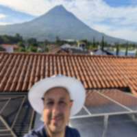
The summit itself is a rocky plateau with a small concrete marker and often a Guatemalan flag left by previous hikers. On a clear morning, the 360-degree view is extraordinary:
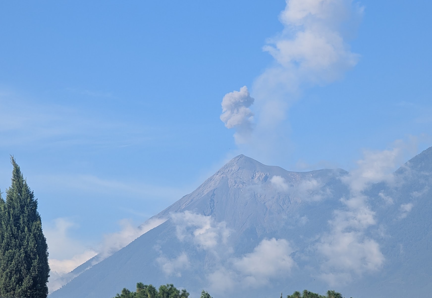
- Southeast: The full volcanic chain – Santiaguito steaming, Santa Maria’s cone, and on the clearest days, Fuego and Acatenango 200+ kilometers away
- North: The Cuchumatanes mountain range and the Mexican border
- South: The Pacific slope dropping 4,000 meters to the coastal plain
- West: The highlands of San Marcos stretching toward Mexico
Descend the same trail to camp, pack up, and continue down to Tuichan. The full descent takes 3-4 hours. Most groups reach the village by midday and catch afternoon transport back to San Marcos or Xela.
Altitude and Cold – The Real Challenge
Tajumulco’s difficulty is not in the terrain – it is in the altitude and temperature. This deserves its own section because these two factors cause the most problems for unprepared hikers.
Altitude Sickness
At 4,220m, you are in the zone where altitude sickness is a real risk. Symptoms include headache, nausea, dizziness, loss of appetite, and difficulty sleeping. In rare cases, it can progress to dangerous conditions like pulmonary or cerebral edema.
How to minimize risk:
- Spend at least 2-3 days at 2,000m+ before attempting Tajumulco. Xela (2,333m) is ideal for acclimatization.
- If coming from sea level, spend a minimum of 3-4 days acclimatizing. Consider spending time in Antigua (1,530m) first, then Xela.
- Hydrate aggressively – 3-4 liters per day in the days before and during the hike
- Ascend slowly. The camp at 3,800-4,000m gives your body a night to adjust before the final push.
- Diamox (acetazolamide) is available at Guatemalan pharmacies without prescription. Consult a doctor before using it, but many high-altitude hikers take 125mg twice daily starting 1-2 days before the ascent.
Extreme Cold
Summit temperatures regularly drop to -10C (14F) at night, and wind chill can make it feel much colder. Frost, ice, and occasionally snow are not unusual near the summit, even in the dry season. This is genuinely cold – colder than most hikers from Guatemala’s lowlands or from warm countries have ever experienced.
Required cold weather gear:
- 4-season sleeping bag rated to -15C (do not gamble on a -5C bag at this altitude)
- Thermal base layers (top and bottom)
- Insulating mid-layer (fleece or down jacket)
- Windproof outer layer
- Warm gloves, beanie, and balaclava or buff
- Warm socks (bring extra dry pair for sleeping)
What to Bring
Essential gear:
- 4-season sleeping bag (-15C rated)
- Tent with good wind resistance
- Sleeping pad (insulated – the ground is cold)
- 4+ liters of water (there is no water above Tuichan)
- Food for 3 meals (dinner, breakfast, lunch) plus snacks
- Stove and fuel if you want hot food or drinks (highly recommended – hot tea at camp makes a big difference)
- Complete cold weather layering system (see above)
- Headlamp with spare batteries
- Sunscreen, sunglasses, lip balm with SPF
- First aid kit with altitude sickness medication
- Cash for guide, transport, and entry fee
Optional but recommended:
- Trekking poles
- Hand and toe warmers
- Thermos for hot drinks on summit push
- Guatemalan flag for the summit photo
Guides
Local guides from Tuichan typically charge Q100-200 ($13-26 USD) for the 2-day trek. They know the trail intimately, can help with camping logistics, and some can provide basic gear like tents.
Arranging a guide in advance is not easy – Tuichan does not have tour operator offices with websites. Options:
-
Ask in Tuichan when you arrive. The community is small and accustomed to hikers. Someone at the registration point or a local tienda can connect you with a guide. This works but carries the risk of no one being available on short notice.
-
Arrange through a Xela-based tour operator. Several agencies in Quetzaltenango organize Tajumulco trips with transport, guide, and sometimes gear included. Prices range from Q400-800 ($52-104 USD) per person for the full package. This is the easiest option.
-
Ask your hostel in Xela. Most hostels catering to travelers can arrange Tajumulco guides or group trips.
Costs Breakdown
| Item | GTQ | USD (approx) |
|---|---|---|
| Bus: Xela to San Marcos | Q15-25 | $2-3.25 |
| Transport: San Marcos to Tuichan | Q10-15 | $1.30-2 |
| Park entry / registration | Q20-50 | $2.60-6.50 |
| Local guide (2 days) | Q100-200 | $13-26 |
| Return transport to Xela | Q25-40 | $3.25-5 |
| Food and water | Q50-80 | $6.50-10.50 |
| Total (independent, budget) | Q220-410 | $29-54 |
| Total (organized tour from Xela) | Q400-800 | $52-104 |
Prices verified March 2026. See current exchange rates for exact USD conversion.
Tajumulco vs Acatenango
These are Guatemala’s two premier overnight volcano hikes, but they offer very different experiences:
| Tajumulco | Acatenango | |
|---|---|---|
| Elevation | 4,220m | 3,976m |
| Main draw | Highest point in Central America | Watching Fuego erupt |
| Crowds | 5-20 hikers on busy days | 100-200+ on weekends |
| Infrastructure | None – fully self-supported | Established campsites, shelters |
| Tour availability | Limited, mostly Xela-based | Dozens of operators in Antigua |
| Cold severity | Extreme (-10C common) | Very cold (-5C common) |
| Access | Remote (3-4 hours from Xela) | Convenient (1 hour from Antigua) |
Do Acatenango if: you want the classic Guatemala volcano experience, convenient booking, and the spectacle of Fuego erupting.
Do Tajumulco if: you want to stand on the highest point in Central America, prefer solitude over crowds, and are prepared for more extreme conditions.
Tips
-
Do not rush this hike. With a camp at 3,800-4,000m, you have time to acclimatize overnight before the summit push. Trying to speed-run Tajumulco in a single day from Tuichan is possible but significantly increases altitude sickness risk.
-
Dry season only. November through March gives the best weather. During rainy season (June-October), the trail is muddy, visibility is often zero at the summit, and cold rain at altitude is miserable and potentially dangerous.
-
Bring more warm gear than you think. Seriously. People who have hiked Acatenango and think they know what cold feels like are often shocked by Tajumulco. It is 250 meters higher, more exposed to wind, and more remote – there is no heated shelter to retreat to.
-
Tell someone your plan. Tajumulco is remote. Cell service is spotty to nonexistent above Tuichan. Leave your itinerary with your hostel in Xela and give a realistic expected return time.
-
Respect the Mam communities. Tuichan and surrounding villages are indigenous Mam communities. Be respectful, ask before photographing people, buy snacks or food locally if possible, and remember you are a guest on their land.
Related Pages
- All Guatemala Hiking Trails – Complete trail directory
- Santa Maria Volcano – Another major hike near Xela
- Acatenango Volcano – Guatemala’s most popular overnight hike
- Quetzaltenango (Xela) – Base city for western highland hikes
- Exchange Rates – Current GTQ/USD conversion
![Hiking Guatemala Volcanoes: 7 Trails Ranked [2026]](/images/photos/fuega-and-acatenango-sunset.jpg)